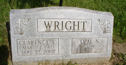
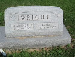
Clarence Edward Wright
| Birth | : | 24 Mar 1910 Missouri, USA |
| Death | : | 27 Sep 2002 Elkader, Clayton County, Iowa, USA |
| Burial | : | St. Mary's Churchyard, Saxlingham Nethergate, South Norfolk District, England |
| Coordinate | : | 52.5268910, 1.2880390 |
| Description | : | Son of Edward Arthur Wright and Maude May Smith. He m1. Elma Irene Cousins; she died in 1957. He m2. Opal Neoma Ortmann in 1959. During the Depression, Clarence helped feed his family by working with the Civilian Conservation Corp (CCC). He built liberty ships during World War II and worked in the construction industry all his life. Clarence was a carpenter, builder of bridges, culverts, dams and flood control along the Mississippi and Cedar rivers. Clarence and Opal lived in Mederville, for 26 years. There's a second stone for him at Pleasant Hill Cemetery in Cincinnati, Appanoose County, Iowa with his first... Read More |
frequently asked questions (FAQ):
-
Where is Clarence Edward Wright's memorial?
Clarence Edward Wright's memorial is located at: St. Mary's Churchyard, Saxlingham Nethergate, South Norfolk District, England.
-
When did Clarence Edward Wright death?
Clarence Edward Wright death on 27 Sep 2002 in Elkader, Clayton County, Iowa, USA
-
Where are the coordinates of the Clarence Edward Wright's memorial?
Latitude: 52.5268910
Longitude: 1.2880390
Family Members:
Spouse
Flowers:
Nearby Cemetories:
1. St Mary Churchyard
Shotesham, South Norfolk District, England
Coordinate: 52.5411110, 1.2985880
2. St Mary's Churchyard
Newton Flotman, South Norfolk District, England
Coordinate: 52.5393520, 1.2617220
3. All Saints Church
Shotesham, South Norfolk District, England
Coordinate: 52.5428610, 1.3120560
4. St Margaret Churchyard
Hempnall, South Norfolk District, England
Coordinate: 52.5018500, 1.3004810
5. St Catherine Churchyard
Fritton, Great Yarmouth Borough, England
Coordinate: 52.4919750, 1.2796600
6. St Michael And All Saint's
Flordon, South Norfolk District, England
Coordinate: 52.5294700, 1.2261400
7. Saint John the Baptist Churchyard
Morningthorpe, South Norfolk District, England
Coordinate: 52.4859170, 1.2654150
8. St Remigius Churchyard
Dunston, South Norfolk District, England
Coordinate: 52.5722420, 1.2872510
9. St Mary Churchyard
Howe, South Norfolk District, England
Coordinate: 52.5497970, 1.3541770
10. St. Mary Magdalen Churchyard
Mulbarton, South Norfolk District, England
Coordinate: 52.5638930, 1.2360530
11. St. Margaret Churchyard
Hapton, South Norfolk District, England
Coordinate: 52.5244110, 1.2066410
12. St Nicholas Churchyard
Bracon Ash, South Norfolk District, England
Coordinate: 52.5559000, 1.2137000
13. All Saints Churchyard
Poringland, South Norfolk District, England
Coordinate: 52.5657160, 1.3496310
14. St Mary's Churchyard
Long Stratton, South Norfolk District, England
Coordinate: 52.4840800, 1.2339000
15. Saint Edmund Churchyard
Caistor St Edmund, South Norfolk District, England
Coordinate: 52.5826350, 1.2936850
16. St. Mary's Churchyard
Shelton, South Norfolk District, England
Coordinate: 52.4720940, 1.2686120
17. Long Stratton Congregational Churchyard
Long Stratton, South Norfolk District, England
Coordinate: 52.4818890, 1.2324460
18. St Margaret's Churchyard
Kirstead, South Norfolk District, England
Coordinate: 52.5358860, 1.3840860
19. Saint Andrews Churchyard
Bedingham, South Norfolk District, England
Coordinate: 52.4902500, 1.3643180
20. St Peters Churchyard
Brooke, South Norfolk District, England
Coordinate: 52.5452560, 1.3814930
21. All Saints Churchyard
Hethel, South Norfolk District, England
Coordinate: 52.5578530, 1.2014560
22. St Mary Churchyard
East Carleton, South Norfolk District, England
Coordinate: 52.5726700, 1.2153470
23. Saint Margaret's Churchyard
Hardwick, South Norfolk District, England
Coordinate: 52.4632800, 1.2712440
24. St Andrew Churchyard
Framingham Earl, South Norfolk District, England
Coordinate: 52.5748560, 1.3596480


