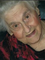
| Birth | : | 5 Apr 1935 Formoso, Jewell County, Kansas, USA |
| Death | : | 9 Sep 2007 Omaha, Douglas County, Nebraska, USA |
| Burial | : | Edgar Cemetery, Edgar, Clay County, USA |
| Coordinate | : | 40.3587200, -97.9700200 |
| Plot | : | Block 31, Lot |
| Description | : | Claude William "Bill" Marcotte, 72, was born to Fred and Nellie Marcotte April 5, 1935 in Formoso. He was the youngest of 12 children. He died Sunday at the VA Hospital in Omaha. Bill attended country school near Webber. He served in the U. S. Army from 1953 until 1956. He married Lana Gunn Sept. 1,1956, and later divorced. Bill and his family lived in Burbank, Calif., from 1961-1969. He was employed by Bock underground telephone in Los Angeles. He and his family moved to Nebraska in the summer of 1969 where he was employed by Beck's Farm Equipment. Bill owned and operated a... Read More |
frequently asked questions (FAQ):
-
Where is Claude William “Bill” Marcotte's memorial?
Claude William “Bill” Marcotte's memorial is located at: Edgar Cemetery, Edgar, Clay County, USA.
-
When did Claude William “Bill” Marcotte death?
Claude William “Bill” Marcotte death on 9 Sep 2007 in Omaha, Douglas County, Nebraska, USA
-
Where are the coordinates of the Claude William “Bill” Marcotte's memorial?
Latitude: 40.3587200
Longitude: -97.9700200
Family Members:
Parent
Siblings
Flowers:
Nearby Cemetories:
1. Edgar Cemetery
Edgar, Clay County, USA
Coordinate: 40.3587200, -97.9700200
2. Prairieview Cemetery
Ong, Clay County, USA
Coordinate: 40.4235100, -97.9093400
3. Smith Cemetery
Nelson, Nuckolls County, USA
Coordinate: 40.3078003, -98.0567017
4. Phil R Landon Gravesite
Angus, Nuckolls County, USA
Coordinate: 40.2703200, -97.9553200
5. Fairfield Cemetery
Fairfield, Clay County, USA
Coordinate: 40.4094009, -98.0982971
6. Oxbow Cemetery
Nelson, Nuckolls County, USA
Coordinate: 40.2560997, -98.0280991
7. Ong Cemetery
Ong, Clay County, USA
Coordinate: 40.4077988, -97.8367004
8. Assumption Church Cemetery
Deweese, Clay County, USA
Coordinate: 40.3507000, -98.1324000
9. Saint Aloysius Cemetery
Deweese, Clay County, USA
Coordinate: 40.3932991, -98.1278000
10. Union Cemetery
Nuckolls County, USA
Coordinate: 40.3146706, -98.1236877
11. Chapel Grove Cemetery
Clay County, USA
Coordinate: 40.4660988, -97.8816986
12. Marshall Union Evergreen Cemetery
Clay Center, Clay County, USA
Coordinate: 40.4880300, -97.9573000
13. Davenport Cemetery
Davenport, Thayer County, USA
Coordinate: 40.3208313, -97.8009949
14. Eller Cemetery
Clay Center, Clay County, USA
Coordinate: 40.4956700, -98.0145700
15. Oak Grove Cemetery
Oak, Nuckolls County, USA
Coordinate: 40.2326889, -97.8739471
16. Stockholm Lutheran Cemetery
Fillmore County, USA
Coordinate: 40.4091988, -97.7767029
17. Hannum Graves
Lawrence, Nuckolls County, USA
Coordinate: 40.3456500, -98.1766800
18. Fairview Cemetery
Fillmore County, USA
Coordinate: 40.4817009, -97.8133011
19. Saint Martin-Loucky Cemetery
Deweese, Clay County, USA
Coordinate: 40.3652496, -98.1948624
20. Nelson Cemetery
Nelson, Nuckolls County, USA
Coordinate: 40.2056084, -98.0791702
21. Liberty Creek Cemetery
Nuckolls County, USA
Coordinate: 40.3361015, -98.2035980
22. Clay Center Cemetery
Clay Center, Clay County, USA
Coordinate: 40.5325012, -98.0500031
23. Mount Zion Cemetery
Nuckolls County, USA
Coordinate: 40.1974983, -97.8397522
24. Bethel Church of the Brethren Cemetery
Carleton, Thayer County, USA
Coordinate: 40.3499800, -97.7069800


