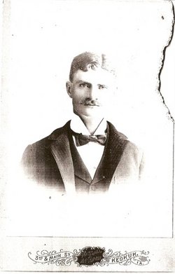
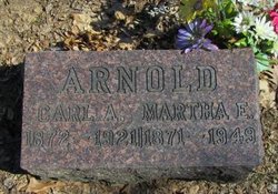
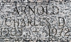
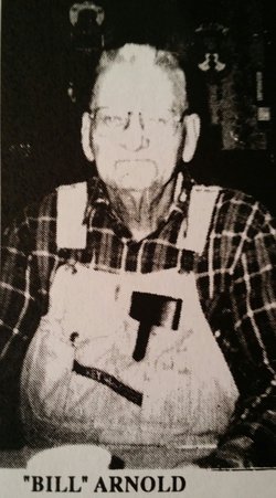
| Birth | : | 30 Jul 1911 Scotland County, Missouri, USA |
| Death | : | 21 Oct 2005 Mount Pleasant, Henry County, Iowa, USA |
| Burial | : | Bethel Cemetery, Job, Randolph County, USA |
| Coordinate | : | 38.8734500, -79.5602860 |
| Plot | : | Block 1B Lot 327 |
| Description | : | Clayton A. "Slim" Arnold, 94, of Mt. Pleasant, IA, died October 21, 2005, at Arbor Court in Mt. Pleasant, IA. Clayton August "Slim" Arnold was born July 30, 1911, in Gorin, Scotland County, MO, the son of Carl August "Gus" and Martha (Dye) Arnold. On August 8, 1932, in Memphis, MO, Slim was united in marriage to Edna Fay Osbon. Mrs. Arnold died September 24, 1987, in Burlington, IA. Slim farmed in Missouri during the Great Depression. In 1943, he moved to Burlington, IA, to work in the railroad shop. He returned to farming when he moved southwest of Mt. Pleasant, IA. Clayton... Read More |
frequently asked questions (FAQ):
-
Where is Clayton A. “Slim” Arnold's memorial?
Clayton A. “Slim” Arnold's memorial is located at: Bethel Cemetery, Job, Randolph County, USA.
-
When did Clayton A. “Slim” Arnold death?
Clayton A. “Slim” Arnold death on 21 Oct 2005 in Mount Pleasant, Henry County, Iowa, USA
-
Where are the coordinates of the Clayton A. “Slim” Arnold's memorial?
Latitude: 38.8734500
Longitude: -79.5602860
Family Members:
Parent
Spouse
Siblings
Children
Flowers:
Nearby Cemetories:
1. Bethel Cemetery
Job, Randolph County, USA
Coordinate: 38.8734500, -79.5602860
2. Bennett Cemetery
Job, Randolph County, USA
Coordinate: 38.8689200, -79.5586800
3. White Cemetery Lower Dam
Job, Randolph County, USA
Coordinate: 38.8869600, -79.5578000
4. Mullennex Cemetery
Job, Randolph County, USA
Coordinate: 38.8317580, -79.5729120
5. Cooper Cemetery
Harman, Randolph County, USA
Coordinate: 38.9180630, -79.5327650
6. Armentrout Cemetery
Randolph County, USA
Coordinate: 38.8211800, -79.5583390
7. Yokum Cemetery
Harman, Randolph County, USA
Coordinate: 38.9071050, -79.5084140
8. Harman Church of the Brethren Cemetery
Harman, Randolph County, USA
Coordinate: 38.9142810, -79.5098070
9. Cooper-Summerfield Cemetery
Harman, Randolph County, USA
Coordinate: 38.9225230, -79.5206370
10. Cooper-Mauzy Cemetery
Harman, Randolph County, USA
Coordinate: 38.9225230, -79.5205040
11. Cooper-Dove Cemetery
Harman, Randolph County, USA
Coordinate: 38.9278860, -79.5266020
12. Blizzard Cemetery
Harman, Randolph County, USA
Coordinate: 38.9247490, -79.5136000
13. Bennett Cemetery
Harman, Randolph County, USA
Coordinate: 38.9292120, -79.5192660
14. Vandevender Cemetery
Harman, Randolph County, USA
Coordinate: 38.9341240, -79.5237940
15. Judy Cemetery
Harman, Randolph County, USA
Coordinate: 38.9368480, -79.5170200
16. Jessie Kay Grasser Grave Site
Alpena, Randolph County, USA
Coordinate: 38.9292700, -79.6206100
17. Jacob C. Harper Family Cemetery
Harman, Randolph County, USA
Coordinate: 38.9059520, -79.4731850
18. Alpena Cemetery
Alpena, Randolph County, USA
Coordinate: 38.9109280, -79.6512930
19. Mick Family Cemetery
Harman, Randolph County, USA
Coordinate: 38.9463470, -79.5053720
20. Pennington Cemetery
Harman, Randolph County, USA
Coordinate: 38.9463760, -79.5049300
21. Laban Smith Family Cemetery
Randolph County, USA
Coordinate: 38.9587080, -79.5259120
22. Schmidlen Family Cemetery
Alpena, Randolph County, USA
Coordinate: 38.9531900, -79.6187500
23. Peter Shaver Roadside Gravesite
Glady, Randolph County, USA
Coordinate: 38.8588219, -79.6914673
24. Turner Cemetery
Dryfork, Randolph County, USA
Coordinate: 38.9687195, -79.5028305


