
| Memorials | : | 0 |
| Location | : | Glady, Randolph County, USA |
| Coordinate | : | 38.8588219, -79.6914673 |
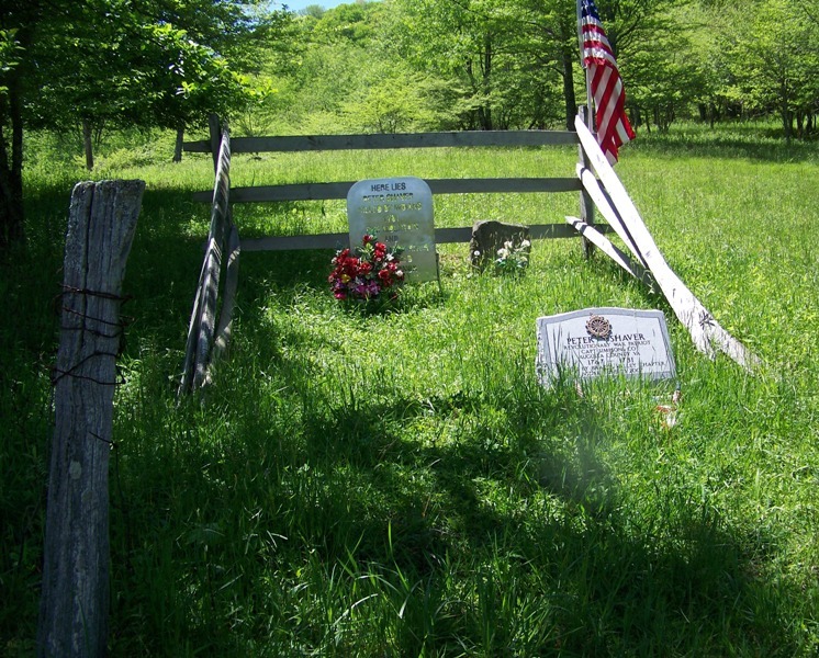
| Description | : | From US Highway 33, turn south at Alpena onto County Road 27. This is a paved road and if you stay on it, it will lead to you to the small, but historical, communities of Glady and Bemis. The grave site is located about halfway between Alpena and Glady. The grave is immediately adjacent to the road and very visible on the right hand side. Just prior to reaching the grave, there is a red gate on the left side of the road. When Peter Shaver was killed this area was still a part of Viginia. West Virginia was not separated... Read More |
frequently asked questions (FAQ):
-
Where is Peter Shaver Roadside Gravesite?
Peter Shaver Roadside Gravesite is located at Glady, Randolph County ,West Virginia ,USA.
-
Peter Shaver Roadside Gravesite cemetery's updated grave count on graveviews.com?
0 memorials
-
Where are the coordinates of the Peter Shaver Roadside Gravesite?
Latitude: 38.8588219
Longitude: -79.6914673
Nearby Cemetories:
1. Taylor Cemetery
Bowden, Randolph County, USA
Coordinate: 38.9110500, -79.7130200
2. Alpena Cemetery
Alpena, Randolph County, USA
Coordinate: 38.9109280, -79.6512930
3. Bemis Cemetery
Bemis, Randolph County, USA
Coordinate: 38.8080040, -79.7386820
4. Glady Cemetery
Glady, Randolph County, USA
Coordinate: 38.7901600, -79.7241750
5. Bell Family Cemetery
Randolph County, USA
Coordinate: 38.8981480, -79.7708890
6. Shrader Cemetery #1
Franklin, Pendleton County, USA
Coordinate: 38.8235000, -79.7740500
7. Hammer Cemetery #6
Pendleton County, USA
Coordinate: 38.9277500, -79.7253300
8. Kelly Mountain Cemetery
Elkins, Randolph County, USA
Coordinate: 38.9013930, -79.7789460
9. Waybright Cemetery #05
Franklin, Pendleton County, USA
Coordinate: 38.8646300, -79.7964600
10. Harper Cemetery
Pendleton County, USA
Coordinate: 38.8646300, -79.7964600
11. Jessie Kay Grasser Grave Site
Alpena, Randolph County, USA
Coordinate: 38.9292700, -79.6206100
12. Mullennex Cemetery
Job, Randolph County, USA
Coordinate: 38.8317580, -79.5729120
13. Bethel Cemetery
Job, Randolph County, USA
Coordinate: 38.8734500, -79.5602860
14. Bennett Cemetery
Job, Randolph County, USA
Coordinate: 38.8689200, -79.5586800
15. Mount Zion Church Cemetery
Elkins, Randolph County, USA
Coordinate: 38.9438400, -79.7733700
16. White Cemetery Lower Dam
Job, Randolph County, USA
Coordinate: 38.8869600, -79.5578000
17. Schmidlen Family Cemetery
Alpena, Randolph County, USA
Coordinate: 38.9531900, -79.6187500
18. Armentrout Cemetery
Randolph County, USA
Coordinate: 38.8211800, -79.5583390
19. Chenoweth Hill Cemetery
Elkins, Randolph County, USA
Coordinate: 38.8792590, -79.8357770
20. Park Cemetery
Beverly, Randolph County, USA
Coordinate: 38.8407560, -79.8369520
21. Baxter Wilmoth Cemetery
Elkins, Randolph County, USA
Coordinate: 38.9573850, -79.7766400
22. Wilmoth-Isner Cemetery
Elkins, Randolph County, USA
Coordinate: 38.9573970, -79.7767230
23. Elkins Memorial Gardens
Elkins, Randolph County, USA
Coordinate: 38.8838997, -79.8469009
24. Saint Brendan Catholic Cemetery
Elkins, Randolph County, USA
Coordinate: 38.9002991, -79.8442001