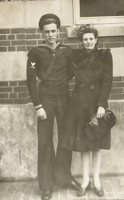
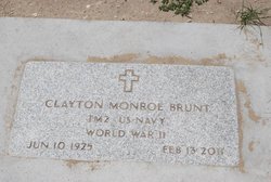
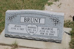
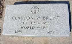
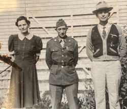
Clayton Monroe “Moe” Brunt
| Birth | : | 10 Jun 1925 Lewellen, Garden County, Nebraska, USA |
| Death | : | 13 Feb 2011 Garden County, Nebraska, USA |
| Burial | : | Woodman Cemetery, Durham, Strafford County, USA |
| Coordinate | : | 43.1501750, -70.9413870 |
| Plot | : | Block 7, Lot 25 |
| Description | : | Garden County News (Oshkosh, Nebraska), Feb. 17, 2011, Page 5 Clayton Monroe "Moe" Brunt, 85, of Lewellen, died Sunday, February 13, 2011, from injuries received in a train-pickup accident west of Lewellen. Funeral services will be held at 10:30 a.m., Thursday, February 17, 2011, at the United Methodist Church in Lewellen with Pastor Ray Weinerman officiating. Interment will be in the Ash Hollow Cemetery near Lewellen with military honors by the United States Navy Honor Guard. Visitation will be on Wednesday from 1 p.m. to 7 p.m. at the Holechek Funeral Home in Oshkosh. Memorials may be made to the Lewellen... Read More |
frequently asked questions (FAQ):
-
Where is Clayton Monroe “Moe” Brunt's memorial?
Clayton Monroe “Moe” Brunt's memorial is located at: Woodman Cemetery, Durham, Strafford County, USA.
-
When did Clayton Monroe “Moe” Brunt death?
Clayton Monroe “Moe” Brunt death on 13 Feb 2011 in Garden County, Nebraska, USA
-
Where are the coordinates of the Clayton Monroe “Moe” Brunt's memorial?
Latitude: 43.1501750
Longitude: -70.9413870
Family Members:
Parent
Spouse
Flowers:
Nearby Cemetories:
1. Woodman Cemetery
Durham, Strafford County, USA
Coordinate: 43.1501750, -70.9413870
2. Woodman Cemetery
Durham, Strafford County, USA
Coordinate: 43.1501700, -70.9413700
3. Stevens Cemetery
Durham, Strafford County, USA
Coordinate: 43.1452780, -70.9430560
4. Demeritt Cemetery
Durham, Strafford County, USA
Coordinate: 43.1479000, -70.9517000
5. White Cemetery
Durham, Strafford County, USA
Coordinate: 43.1400210, -70.9410600
6. Page Cemetery
Durham, Strafford County, USA
Coordinate: 43.1396344, -70.9383405
7. Miles Cemetery
Madbury, Strafford County, USA
Coordinate: 43.1613190, -70.9315910
8. Demeritt Cemetery
Durham, Strafford County, USA
Coordinate: 43.1427780, -70.9572220
9. Durham Cemetery
Durham, Strafford County, USA
Coordinate: 43.1474991, -70.9614029
10. Emerson Cemetery
Durham, Strafford County, USA
Coordinate: 43.1431964, -70.9211684
11. Town Hall Cemetery
Madbury, Strafford County, USA
Coordinate: 43.1672910, -70.9422020
12. Demeritt Town Hall Road Cemetery
Madbury, Strafford County, USA
Coordinate: 43.1673040, -70.9431620
13. Madbury Memorial Cemetery
Madbury, Strafford County, USA
Coordinate: 43.1677000, -70.9483300
14. Demeritt Cemetery
Lee, Strafford County, USA
Coordinate: 43.1563890, -70.9655560
15. Griffin Cemetery
Durham, Strafford County, USA
Coordinate: 43.1377850, -70.9205550
16. Woodman Cemetery
Durham, Strafford County, USA
Coordinate: 43.1377850, -70.9205370
17. Emerson-Buzzell Family Graveyard
Lee, Strafford County, USA
Coordinate: 43.1591518, -70.9667262
18. Community Church of Durham Memorial Garden
Durham, Strafford County, USA
Coordinate: 43.1316000, -70.9210900
19. Young Cemetery
Durham, Strafford County, USA
Coordinate: 43.1339680, -70.9168160
20. School House Lane Cemetery
Durham, Strafford County, USA
Coordinate: 43.1328735, -70.9181442
21. Hoitt Cemetery
Lee, Strafford County, USA
Coordinate: 43.1412770, -70.9726820
22. Demerritt Family Cemetery
Lee, Strafford County, USA
Coordinate: 43.1513890, -70.9750000
23. Foss Family Cemetery
Durham, Strafford County, USA
Coordinate: 43.1452914, -70.9077409
24. Hamilton Smith Chapel Cemetery
Durham, Strafford County, USA
Coordinate: 43.1276990, -70.9243530

