
| Birth | : | 11 Oct 1913 Bono Township, Lawrence County, Indiana, USA |
| Death | : | 8 Sep 2007 Bedford, Lawrence County, Indiana, USA |
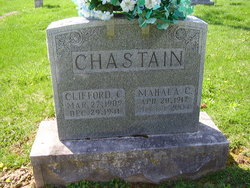
| Burial | : | Manukau Memorial Gardens, Manukau, Auckland Council, New Zealand |
| Coordinate | : | -36.9944380, 174.8397300 |
| Description | : | Clyde Chastain, 93, Bedford, passed away at 4:25 p.m. Saturday September 8, 2007 at Westview Nursing and Rehabilitation Center in Bedford. Born Oct. 11, 1913, in Lawrence County, he was the son of Curtis and Effie (Enochs) Chastain. He grew up in the Bono area, working on farms as a boy and young man. He always preferred to work with mules rather than horses. He was an avid gardener and loved to give away his produce. He retired from GM Powertrain in 1975 and was a member of UAW Local 440. He was a member of... Read More |
frequently asked questions (FAQ):
-
Where is Clyde Chastain's memorial?
Clyde Chastain's memorial is located at: Manukau Memorial Gardens, Manukau, Auckland Council, New Zealand.
-
When did Clyde Chastain death?
Clyde Chastain death on 8 Sep 2007 in Bedford, Lawrence County, Indiana, USA
-
Where are the coordinates of the Clyde Chastain's memorial?
Latitude: -36.9944380
Longitude: 174.8397300
Family Members:
Parent

Spouse
Siblings
Children
Flowers:


Nearby Cemetories:
1. Manukau Memorial Gardens
Manukau, Auckland Council, New Zealand
Coordinate: -36.9944380, 174.8397300
2. Papatoetoe Cemetery
Papatoetoe, Auckland Council, New Zealand
Coordinate: -36.9893110, 174.8373530
3. St. John's Presbyterian Church Cemetery
Papatoetoe, Auckland Council, New Zealand
Coordinate: -36.9674185, 174.8598178
4. Woodside Methodist Cemetery
Manukau, Auckland Council, New Zealand
Coordinate: -36.9929680, 174.8837860
5. St. David's Anglican Churchyard
Wiri, Auckland Council, New Zealand
Coordinate: -37.0025400, 174.8886150
6. Mangere Presbyterian Cemetery
Mangere, Auckland Council, New Zealand
Coordinate: -36.9750197, 174.7924783
7. Nixon Memorial
Ōtāhūhū, Auckland Council, New Zealand
Coordinate: -36.9499366, 174.8449909
8. St. Joseph and St. Joachim Catholic Cemetery
Ōtāhūhū, Auckland Council, New Zealand
Coordinate: -36.9436100, 174.8490100
9. Laurie-Gibbons Memorial Park
Weymouth, Auckland Council, New Zealand
Coordinate: -37.0440600, 174.8586790
10. Mangere Lawn Cemetery
Mangere, Auckland Council, New Zealand
Coordinate: -36.9626150, 174.7857000
11. Otahuhu Public Cemetery
Ōtāhūhū, Auckland Council, New Zealand
Coordinate: -36.9377500, 174.8432390
12. Holy Trinity Memorial Park
Ōtāhūhū, Auckland Council, New Zealand
Coordinate: -36.9374510, 174.8448580
13. St. John's Church Cemetery
East Tamaki, Auckland Council, New Zealand
Coordinate: -36.9522250, 174.8964540
14. St. Paul's Anglican Cemetery
East Tamaki, Auckland Council, New Zealand
Coordinate: -36.9615200, 174.9082000
15. Flat Bush Cemetery
East Tamaki, Auckland Council, New Zealand
Coordinate: -36.9563500, 174.9097100
16. Mangere Piriti Urupā St. James Churchyard
Mangere, Auckland Council, New Zealand
Coordinate: -36.9418970, 174.7835260
17. Waikaraka Cemetery
Ōnehunga, Auckland Council, New Zealand
Coordinate: -36.9297140, 174.7967170
18. Onehunga Catholic Cemetery
Ōnehunga, Auckland Council, New Zealand
Coordinate: -36.9224360, 174.7884560
19. Our Lady of the Assumption Catholic Church
Ōnehunga, Auckland Council, New Zealand
Coordinate: -36.9223690, 174.7884530
20. St. Peter's Anglican Cemetery
Ōnehunga, Auckland Council, New Zealand
Coordinate: -36.9227113, 174.7847550
21. Alfriston Cemetery
Auckland Council, New Zealand
Coordinate: -37.0133660, 174.9479400
22. St Matthias Churchyard
Panmure, Auckland Council, New Zealand
Coordinate: -36.9053300, 174.8577200
23. St. Patrick's Roman Catholic Church Cemetery
Panmure, Auckland Council, New Zealand
Coordinate: -36.9029680, 174.8564960
24. Pakuranga Methodist Cemetery
Pakuranga, Auckland Council, New Zealand
Coordinate: -36.9054000, 174.8914900