
| Birth | : | 29 Apr 1929 Mount Orab, Brown County, Ohio, USA |
| Death | : | 3 Jun 2005 Hillsboro, Highland County, Ohio, USA |
| Burial | : | Twiston Quaker Burial Ground, Clitheroe, Ribble Valley Borough, England |
| Coordinate | : | 53.8854210, -2.2838840 |
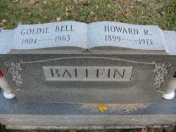
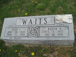
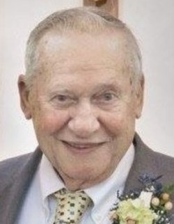
| Description | : | Clyde Ballein, 76, of Hillsboro, died Friday, June 3, 2005 in Hillsboro. He was born April 29, 1929 in Brown County, the son of the late Howard and Goldie Miller Ballein. He was also preceded in death by one sister, Ruth Waits. Mr. Ballein is survived by two brothers; two sisters; and several nieces and nephews. |
frequently asked questions (FAQ):
-
Where is Clyde Elton Ballein's memorial?
Clyde Elton Ballein's memorial is located at: Twiston Quaker Burial Ground, Clitheroe, Ribble Valley Borough, England.
-
When did Clyde Elton Ballein death?
Clyde Elton Ballein death on 3 Jun 2005 in Hillsboro, Highland County, Ohio, USA
-
Where are the coordinates of the Clyde Elton Ballein's memorial?
Latitude: 53.8854210
Longitude: -2.2838840
Family Members:
Parent

Siblings
Flowers:


Nearby Cemetories:
1. Twiston Quaker Burial Ground
Clitheroe, Ribble Valley Borough, England
Coordinate: 53.8854210, -2.2838840
2. Salem Congregational Chapel Martin Top
Rimington, Ribble Valley Borough, England
Coordinate: 53.9072484, -2.2740463
3. St. Leonard's Churchyard
Downham, Ribble Valley Borough, England
Coordinate: 53.8944340, -2.3294250
4. St. Mary's Churchyard
Newchurch in Pendle, Pendle Borough, England
Coordinate: 53.8504181, -2.2706807
5. Christ Churchyard
Chatburn, Ribble Valley Borough, England
Coordinate: 53.8940690, -2.3515030
6. Sawley Abbey
Sawley, Ribble Valley Borough, England
Coordinate: 53.9131920, -2.3417080
7. All Souls Cemetery
Barrowford, Pendle Borough, England
Coordinate: 53.8462900, -2.2355600
8. Wheatley Lane Inghamite Church Churchyard
Wheatley Lane, Pendle Borough, England
Coordinate: 53.8412800, -2.2457100
9. St. Thomas Churchyard
Barrowford, Pendle Borough, England
Coordinate: 53.8513900, -2.2196600
10. St Ambrose Churchyard
Grindleton, Ribble Valley Borough, England
Coordinate: 53.9061710, -2.3633270
11. St. Mary the Virgin Churchyard
Gisburn, Ribble Valley Borough, England
Coordinate: 53.9356080, -2.2605210
12. Wheatley Lane Methodist Churchyard
Fence, Pendle Borough, England
Coordinate: 53.8341457, -2.2596202
13. Barrowford Cemetery
Nelson, Pendle Borough, England
Coordinate: 53.8521100, -2.2130300
14. Grindleton Methodist Cemetery
Grindleton, Ribble Valley Borough, England
Coordinate: 53.9080420, -2.3684420
15. St. Anne Churchyard
Fence, Pendle Borough, England
Coordinate: 53.8304372, -2.2679552
16. Saint Nicholas Parish Churchyard
Sabden, Ribble Valley Borough, England
Coordinate: 53.8346503, -2.3332764
17. St Peter and St Paul Churchyard
Bolton-by-Bowland, Ribble Valley Borough, England
Coordinate: 53.9399800, -2.3270300
18. St John Churchyard
Higham, Pendle Borough, England
Coordinate: 53.8251420, -2.2898120
19. St Mary Magdalene Churchyard
Clitheroe, Ribble Valley Borough, England
Coordinate: 53.8740980, -2.3903420
20. Saint Michael's Church
Bracewell, Pendle Borough, England
Coordinate: 53.9322400, -2.2099730
21. St. Joseph's Roman Catholic Cemetery
Clitheroe, Ribble Valley Borough, England
Coordinate: 53.8770700, -2.3960000
22. St James Churchyard
Clitheroe, Ribble Valley Borough, England
Coordinate: 53.8659600, -2.3922700
23. Nelson Cemetery
Nelson, Pendle Borough, England
Coordinate: 53.8420330, -2.1972230
24. Trinity Methodist Churchyard
Clitheroe, Ribble Valley Borough, England
Coordinate: 53.8709060, -2.3954550