
| Birth | : | 20 Jan 1911 Montgomery County, Iowa, USA |
| Death | : | 26 Jan 1994 Scranton, Greene County, Iowa, USA |
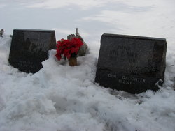
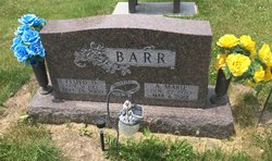
| Burial | : | Scranton Township Cemetery, Scranton, Greene County, USA |
| Coordinate | : | 42.0306015, -94.5783005 |
| Description | : | Clyde William Barr was born January 20, 1911 in Pilot Grove, Montgomery County, Iowa to Carl Martin Barr and Laura Bell Givan. He died January 26, 1994 in Scranton, Greene County, Iowa and is buried in the Scranton Township Cemetery. Note: Clyde attended Barber School, he lived at Scaranton, Iowa where he was a barber. On September 16, 1934 at Falls City, Nebraska, Clyde William Barr married Helen Velma Bashaw. After a brief tenure on the family farm near Elliot, Clyde and Helen moved to Des Moines where Clyde attended barber college. Upon his graduation in 1936, they moved to... Read More |
frequently asked questions (FAQ):
-
Where is Clyde William Barr's memorial?
Clyde William Barr's memorial is located at: Scranton Township Cemetery, Scranton, Greene County, USA.
-
When did Clyde William Barr death?
Clyde William Barr death on 26 Jan 1994 in Scranton, Greene County, Iowa, USA
-
Where are the coordinates of the Clyde William Barr's memorial?
Latitude: 42.0306015
Longitude: -94.5783005
Family Members:
Parent

Spouse
Siblings
Flowers:


Nearby Cemetories:
1. Dillavou Cemetery
Kendrick Township, Greene County, USA
Coordinate: 42.0802994, -94.6138992
2. Gibson-Fleck-Thompson Cemetery
Scranton, Greene County, USA
Coordinate: 42.0428870, -94.4988800
3. Wright Cemetery
Jefferson, Greene County, USA
Coordinate: 42.0228004, -94.4477997
4. Fair Oaks Cemetery
Scranton, Greene County, USA
Coordinate: 42.0355988, -94.4460983
5. Headley Cemetery
Jefferson, Greene County, USA
Coordinate: 42.0041504, -94.4335815
6. Dickson Cemetery
Glidden Township, Carroll County, USA
Coordinate: 42.1074982, -94.6939011
7. North Coon Cemetery
Carroll County, USA
Coordinate: 42.1260986, -94.6716995
8. Willow Cemetery
Greene County, USA
Coordinate: 41.9067001, -94.5730972
9. West Lawn Cemetery
Glidden, Carroll County, USA
Coordinate: 42.0649986, -94.7406006
10. Saint Patricks Cemetery
Churdan, Greene County, USA
Coordinate: 42.1605988, -94.5511017
11. Highland Township Cemetery
Churdan, Greene County, USA
Coordinate: 42.1518310, -94.4699120
12. Saint Joseph Cemetery
Jefferson, Greene County, USA
Coordinate: 42.0289001, -94.3818970
13. Union Township Cemetery
Coon Rapids, Carroll County, USA
Coordinate: 41.8781013, -94.6389008
14. Old Cedar Cemetery
Adaza, Greene County, USA
Coordinate: 42.1874821, -94.5419194
15. Old Carrollton Cemetery
Carrollton, Carroll County, USA
Coordinate: 41.9233017, -94.7403030
16. Jefferson Cemetery
Jefferson, Greene County, USA
Coordinate: 42.0133018, -94.3591995
17. Oak Hill Cemetery
Coon Rapids, Carroll County, USA
Coordinate: 41.9053001, -94.7200012
18. McCurdy Cemetery
Carroll County, USA
Coordinate: 41.9403000, -94.7649994
19. Coon Rapids Cemetery
Coon Rapids, Carroll County, USA
Coordinate: 41.8778000, -94.6678009
20. Greenbrier Cemetery
Cooper, Greene County, USA
Coordinate: 41.9063988, -94.4218979
21. Holy Family Cemetery
Lidderdale, Carroll County, USA
Coordinate: 42.1178017, -94.7839966
22. Lanesboro Cemetery
Lanesboro, Carroll County, USA
Coordinate: 42.1810989, -94.7230988
23. Saint Marys Catholic Cemetery
Willey, Carroll County, USA
Coordinate: 41.9783363, -94.8212204
24. East Liberty Cemetery
Lidderdale, Carroll County, USA
Coordinate: 42.1591988, -94.7636032