
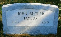
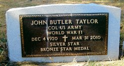
Col John Butler “J.B.” Taylor
| Birth | : | 14 Dec 1920 Maryville, Nodaway County, Missouri, USA |
| Death | : | 31 Mar 2010 USA |
| Burial | : | Oak Ridge Cemetery, Arcadia, DeSoto County, USA |
| Coordinate | : | 27.2264004, -81.8694000 |
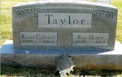
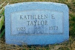
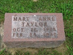
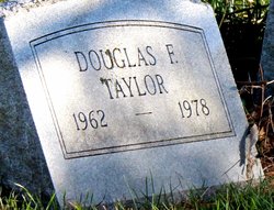
| Description | : | Col. John Butler (J.B.) Taylor, 89, Maryville, MO. died Wednesday, March 31, 2010. Col. Taylor was born Dec. 14, 1920 in Maryville, MO., the son of Ray Henry and Katie Calvert Taylor. He married Kathleen Elizabeth Farnan Taylor October 4, 1947 in Conception Junction, Mo.; Bettie J. Vanice, Sept. 22, 1977 and Kathryn V. Pfeifer, April 25, 1987. They all preceded him in death. Also preceding him in death were his parents; a son; Douglas F. Taylor; and grandson, Matthew J. Taylor. Survivors include sons; Steve (Debbie) Taylor, Olathe, Kansas, Russ Taylor, Maryville, and Ron... Read More |
frequently asked questions (FAQ):
-
Where is Col John Butler “J.B.” Taylor's memorial?
Col John Butler “J.B.” Taylor's memorial is located at: Oak Ridge Cemetery, Arcadia, DeSoto County, USA.
-
When did Col John Butler “J.B.” Taylor death?
Col John Butler “J.B.” Taylor death on 31 Mar 2010 in USA
-
Where are the coordinates of the Col John Butler “J.B.” Taylor's memorial?
Latitude: 27.2264004
Longitude: -81.8694000
Family Members:
Parent

Spouse
Siblings
Children

Flowers:


Nearby Cemetories:
1. Oak Ridge Cemetery
Arcadia, DeSoto County, USA
Coordinate: 27.2264004, -81.8694000
2. Saint Edmund Episcopal Church Columbarium
Arcadia, DeSoto County, USA
Coordinate: 27.2176980, -81.8640790
3. Trinity United Methodist Columbarium
Arcadia, DeSoto County, USA
Coordinate: 27.2168390, -81.8640150
4. Oak Hill Cemetery
Arcadia, DeSoto County, USA
Coordinate: 27.2457730, -81.8991580
5. Kabrich Cemetery
Nocatee, DeSoto County, USA
Coordinate: 27.1698100, -81.8597000
6. Peace River Mennonite Cemetery
Arcadia, DeSoto County, USA
Coordinate: 27.2000650, -81.9284800
7. Owens Cemetery
Arcadia, DeSoto County, USA
Coordinate: 27.1833000, -81.9233017
8. Mount Olive Cemetery
Nocatee, DeSoto County, USA
Coordinate: 27.1615700, -81.8885000
9. Joshua Creek Cemetery
Arcadia, DeSoto County, USA
Coordinate: 27.1825008, -81.8028030
10. Indian Mound Cemetery
Arcadia, DeSoto County, USA
Coordinate: 27.2520220, -81.9843050
11. Pine Level Camp Grounds Cemetery
Pine Level, DeSoto County, USA
Coordinate: 27.2650394, -81.9986930
12. Coker Cemetery
Limestone, Hardee County, USA
Coordinate: 27.3514004, -81.8510971
13. Hull Cemetery
Arcadia, DeSoto County, USA
Coordinate: 27.1152992, -81.9494019
14. Gardner Cemetery
Zolfo Springs, Hardee County, USA
Coordinate: 27.3480000, -81.8029010
15. King Cemetery
Fort Ogden, DeSoto County, USA
Coordinate: 27.0869500, -81.9563100
16. Lily Cemetery
Lily, Hardee County, USA
Coordinate: 27.3643980, -81.9773480
17. Fort Ogden Cemetery
Fort Ogden, DeSoto County, USA
Coordinate: 27.0795612, -81.9651031
18. Jernigan Family Plot
Arcadia, DeSoto County, USA
Coordinate: 27.1030800, -82.0080700
19. Locklar Cemetery
Zolfo Springs, Hardee County, USA
Coordinate: 27.4012990, -81.7026930
20. Sweetwater Cemetery
Sweetwater, Hardee County, USA
Coordinate: 27.4055784, -81.7002807
21. Friendship Methodist Cemetery
Zolfo Springs, Hardee County, USA
Coordinate: 27.4553697, -81.7752567
22. Oak Grove Community Cemetery
Hardee County, USA
Coordinate: 27.4710999, -81.8600006
23. Zolfo Springs Baptist Church Cemetery
Zolfo Springs, Hardee County, USA
Coordinate: 27.4888990, -81.7914080
24. Huckeby Cemetery
Cleveland, Charlotte County, USA
Coordinate: 26.9718136, -81.9824299