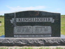
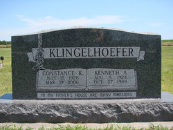
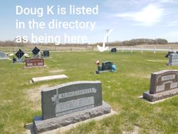
Constance Kathleen “Connie” McMahon Klingelhoefer
| Birth | : | 17 Jul 1928 |
| Death | : | 19 Mar 2006 |
| Burial | : | Custer Cemetery, Custer, Custer County, USA |
| Coordinate | : | 43.7781181, -103.6159592 |
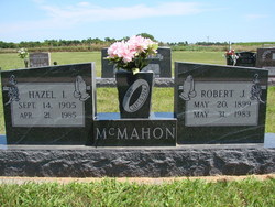
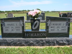
| Description | : | KLINGELHOEFER, Constance "Connie" Kathleen, 77, of Amherst died Sunday, March 19, 2006, at Mother Hull Home in Kearney Services: Saturday, St. James Catholic Church in Kearney Burial: Stanley Cemetery in Amherst Mortuary: Horner-Lieske-Horner in Kearney Memorials: St. John Capistran Altar Society or the Amherst Volunteer Fire Department Born July 17, 1928, in Kearney Parents: Robert and Hazel (Kenney) McMahon Graduated from Amherst High School, 1945 Married: Aug. 3, 1948, to Kenneth Klingelhoefer in Eddyville. He died Oct. 27, 1989 With husband, farmed in the Amherst area; continued to run the farming operation after his death Activities: member of St. John... Read More |
frequently asked questions (FAQ):
-
Where is Constance Kathleen “Connie” McMahon Klingelhoefer's memorial?
Constance Kathleen “Connie” McMahon Klingelhoefer's memorial is located at: Custer Cemetery, Custer, Custer County, USA.
-
When did Constance Kathleen “Connie” McMahon Klingelhoefer death?
Constance Kathleen “Connie” McMahon Klingelhoefer death on 19 Mar 2006 in
-
Where are the coordinates of the Constance Kathleen “Connie” McMahon Klingelhoefer's memorial?
Latitude: 43.7781181
Longitude: -103.6159592
Family Members:
Parent
Spouse
Siblings
Children
Flowers:
Nearby Cemetories:
1. Custer Cemetery
Custer, Custer County, USA
Coordinate: 43.7781181, -103.6159592
2. Thunderhead Mountain
Custer, Custer County, USA
Coordinate: 43.8346510, -103.6221890
3. McGillycuddy Monument
Pennington County, USA
Coordinate: 43.8865110, -103.5670850
4. Major James Whitehead Burial Site
Custer County, USA
Coordinate: 43.7169500, -103.4535500
5. Hill City Cemetery
Hill City, Pennington County, USA
Coordinate: 43.9366270, -103.5789730
6. Pringle Cemetery
Pringle, Custer County, USA
Coordinate: 43.6086006, -103.6042023
7. Cold Springs Cemetery
Custer County, USA
Coordinate: 43.6232700, -103.5075000
8. Keystone Cemetery
Keystone, Pennington County, USA
Coordinate: 43.8835983, -103.4147034
9. Harney City Cemetery
Harney, Pennington County, USA
Coordinate: 43.8908000, -103.3887800
10. Hayward Cemetery
Pennington County, USA
Coordinate: 43.8879500, -103.3511800
11. Wind Cave National Park Cemetery
Pringle, Custer County, USA
Coordinate: 43.5579400, -103.4793600
12. Rockerville Cemetery
Rockerville, Pennington County, USA
Coordinate: 43.9681015, -103.3572006
13. Cornelius Donahue Burial Site
Custer County, USA
Coordinate: 43.6079380, -103.2996950
14. Highland Park Cemetery
Hermosa, Custer County, USA
Coordinate: 43.8386750, -103.2044510
15. Fairburn Cemetery
Fairburn, Custer County, USA
Coordinate: 43.6871986, -103.1956024
16. Reynolds Ranch Cemetery
Rochford, Pennington County, USA
Coordinate: 44.0875667, -103.8027265
17. Minnekahta Valley Cemetery
Minnekahta, Fall River County, USA
Coordinate: 43.4402800, -103.6133300
18. Evergreen Cemetery
Hot Springs, Fall River County, USA
Coordinate: 43.4458008, -103.4843979
19. Bell Park Cemetery
Rochford, Pennington County, USA
Coordinate: 44.1116982, -103.7466965
20. State Veterans Home Cemetery
Hot Springs, Fall River County, USA
Coordinate: 43.4362020, -103.5007810
21. Hot Springs National Cemetery
Hot Springs, Fall River County, USA
Coordinate: 43.4394684, -103.4722214
22. Boot Hill Cemetery
Buffalo Gap, Custer County, USA
Coordinate: 43.4874600, -103.3205660
23. Pine Lawn Memorial Park
Rapid City, Pennington County, USA
Coordinate: 44.0410995, -103.2472000
24. Buffalo Gap Cemetery
Fall River County, USA
Coordinate: 43.4747009, -103.3131027

