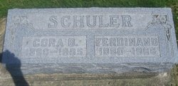
Cora Anna Beckwith Schuler
| Birth | : | 27 Aug 1890 Marshalltown, Marshall County, Iowa, USA |
| Death | : | 17 Dec 1985 Union, Hardin County, Iowa, USA |
| Burial | : | Prairie Lake Baptist Church Cemetery, Jefferson County, USA |
| Coordinate | : | 34.2466680, -91.9162990 |
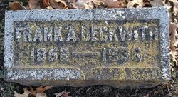
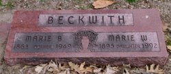
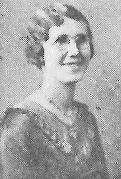
| Description | : | Hardin County Index, December 20, 1985 Funeral services at the Union Community Church for Cora Schuler, 95, who died at her home in Union. Rev. Dean Messerly officiating, interment in the Union Cemetery. Cora was born on August 27, 1890, in Marshalltown the daughter of Frank and Mary Beckwith. She was raised and educated in Marshalltown, graduating with the Class of 1909. She taught school in Marshalltown and the surrounding area. She married Ferdinand Schuler on January 15, 1913, in Marshalltown. They farmed near Clemons after their marriage, moving to Union in 1928 where she had... Read More |
frequently asked questions (FAQ):
-
Where is Cora Anna Beckwith Schuler's memorial?
Cora Anna Beckwith Schuler's memorial is located at: Prairie Lake Baptist Church Cemetery, Jefferson County, USA.
-
When did Cora Anna Beckwith Schuler death?
Cora Anna Beckwith Schuler death on 17 Dec 1985 in Union, Hardin County, Iowa, USA
-
Where are the coordinates of the Cora Anna Beckwith Schuler's memorial?
Latitude: 34.2466680
Longitude: -91.9162990
Family Members:
Parent
Spouse
Siblings
Children
Flowers:
Nearby Cemetories:
1. Prairie Lake Baptist Church Cemetery
Jefferson County, USA
Coordinate: 34.2466680, -91.9162990
2. Fairfield Cemetery
Jefferson County, USA
Coordinate: 34.2322006, -91.9094009
3. Prayer Lake Cemetery
Jefferson County, USA
Coordinate: 34.2593994, -91.9274979
4. Saint Andrews Church Cemetery
Altheimer, Jefferson County, USA
Coordinate: 34.2682930, -91.8668570
5. Atkins Cemetery
Jefferson County, USA
Coordinate: 34.2078018, -91.8792038
6. Bryson Cemetery
Jefferson County, USA
Coordinate: 34.2792015, -91.8683014
7. Cottonwood Cemetery
Plum Bayou Township, Jefferson County, USA
Coordinate: 34.2999800, -91.9098800
8. Smith Chapel Cemetery
Jefferson County, USA
Coordinate: 34.1963997, -91.9428024
9. Damascus Cemetery
Jefferson County, USA
Coordinate: 34.2825012, -91.8566971
10. Nebraska Street Grave
Pine Bluff, Jefferson County, USA
Coordinate: 34.2214670, -91.9884220
11. Stewart Chapel Cemetery
Jefferson County, USA
Coordinate: 34.1795120, -91.9126810
12. Madding
Madding, Jefferson County, USA
Coordinate: 34.2255105, -91.8374802
13. Bethany Chapel
Pine Bluff, Jefferson County, USA
Coordinate: 34.1815700, -91.9465360
14. Saint Ruth Cemetery
Jefferson County, USA
Coordinate: 34.2092018, -91.8447037
15. Taylor Cemetery
Pine Bluff, Jefferson County, USA
Coordinate: 34.1953011, -91.9794006
16. County Courthouse Grounds
Pine Bluff, Jefferson County, USA
Coordinate: 34.2295540, -92.0032880
17. Patterson Cemetery
Jefferson County, USA
Coordinate: 34.1800003, -91.8775024
18. Rice Cemetery
Jefferson County, USA
Coordinate: 34.3203011, -91.9297028
19. Cottondale Cemetery
Jefferson County, USA
Coordinate: 34.1878014, -91.8597031
20. New Saint Hurricane MBC Cemetery
Pine Bluff, Jefferson County, USA
Coordinate: 34.1948200, -91.9890300
21. Trinity Episcopal Church Columbarium
Pine Bluff, Jefferson County, USA
Coordinate: 34.2276980, -92.0100680
22. Reynolds Cemetery
Sherrill, Jefferson County, USA
Coordinate: 34.3236090, -91.9447870
23. Saint Marys Cemetery
Pine Bluff, Jefferson County, USA
Coordinate: 34.3244019, -91.9424973
24. Highline Cemetery
Pine Bluff, Jefferson County, USA
Coordinate: 34.1856200, -91.9802000

