| Birth | : | 21 Jan 1858 Tipton, Cedar County, Iowa, USA |
| Death | : | 19 Oct 1944 Los Angeles, Los Angeles County, California, USA |
| Burial | : | Ådala Kyrkogård, Bettna, Flens kommun, Sweden |
| Coordinate | : | 58.9939522, 16.8291178 |
| Plot | : | Plot: Block 1, plot 55 |
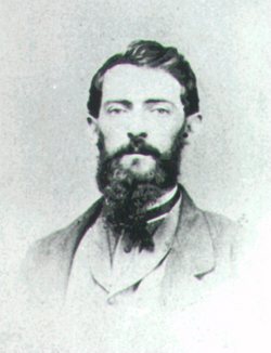
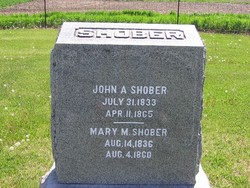
| Description | : | Cora was the daughter of John A. Shober & Mary McLeod and sister to Howard Clayton Shober (1859-1956). She was the first woman School Superintendent in Hyde County, South Dakota as well as in all of the Dakota territory. Cora and Charles Benton Ambrose were married in Clarence, Iowa (1889). They were the parents of Winifred Cora (Ambrose) Mumper and Genevieve Shober (Ambrose) Oldfield. Cora was the grandmother of Norris McAllister, Charles Ambrose & Richard Hewlings MUMPER. |
frequently asked questions (FAQ):
-
Where is Cora Mary Shober Ambrose's memorial?
Cora Mary Shober Ambrose's memorial is located at: Ådala Kyrkogård, Bettna, Flens kommun, Sweden.
-
When did Cora Mary Shober Ambrose death?
Cora Mary Shober Ambrose death on 19 Oct 1944 in Los Angeles, Los Angeles County, California, USA
-
Where are the coordinates of the Cora Mary Shober Ambrose's memorial?
Latitude: 58.9939522
Longitude: 16.8291178
Family Members:
Parent
Spouse
Siblings
Children
Flowers:
Nearby Cemetories:
1. Ådala Kyrkogård
Bettna, Flens kommun, Sweden
Coordinate: 58.9939522, 16.8291178
2. Husby-Oppunda kyrkogård
Vrena, Nyköpings kommun, Sweden
Coordinate: 58.9087626, 16.8041195
3. Blacksta Church Cemetery
Blacksta, Gnesta kommun, Sweden
Coordinate: 58.9582100, 16.6340809
4. Vadsbro Kyrka
Vadsbro, Flens kommun, Sweden
Coordinate: 58.9773068, 16.5663294
5. Lilla Malma gamla kyrkogård
Malmkoping, Flens kommun, Sweden
Coordinate: 59.1349594, 16.7263983
6. Halla kyrkogård
Vrena, Nyköpings kommun, Sweden
Coordinate: 58.8593901, 16.6252792
7. Dunker Church Cemetery
Dunker, Flens kommun, Sweden
Coordinate: 59.1663160, 16.7819595
8. Mellösa Kyrkogård
Mellosa, Flens kommun, Sweden
Coordinate: 59.1000073, 16.5500845
9. Mellösa Församling Kvarter 3
Halleforsnas, Flens kommun, Sweden
Coordinate: 59.1518570, 16.4938092
10. Frustuna Kyrkogård
Gnesta kommun, Sweden
Coordinate: 59.0584170, 17.3080670
11. Kattnäs Kyrkogård
Gnesta kommun, Sweden
Coordinate: 59.0801860, 17.2956540
12. Vårdinge kyrkogård
Molnbo, Södertälje kommun, Sweden
Coordinate: 59.0291550, 17.3580770
13. Länna kyrkogård
Strängnäs, Strängnäs kommun, Sweden
Coordinate: 59.2814570, 16.9839330
14. Skogskyrkogården
Katrineholms kommun, Sweden
Coordinate: 58.9816400, 16.2290490
15. Katrineholm Kyrkogård
Katrineholm, Katrineholms kommun, Sweden
Coordinate: 58.9919670, 16.1948670
16. Västerljungs kyrkogård
Vasterljung, Trosa kommun, Sweden
Coordinate: 58.9222220, 17.4486110
17. Mariefreds kyrkogård
Mariefred, Strängnäs kommun, Sweden
Coordinate: 59.2629490, 17.2273330
18. Tunabergs Kyrkogård
Navekvarn, Nyköpings kommun, Sweden
Coordinate: 58.6444254, 16.9026768
19. Holo Gamla Kyrkogård
Holo, Södertälje kommun, Sweden
Coordinate: 59.0167124, 17.5331466
20. Turinge kyrkogård
Nykvarns kommun, Sweden
Coordinate: 59.1963950, 17.4414160
21. Strängnäs södra kyrkogård
Strängnäs, Strängnäs kommun, Sweden
Coordinate: 59.3556780, 17.0148080
22. Husby-Rekarne kyrkogård
Eskilstuna kommun, Sweden
Coordinate: 59.3142240, 16.4520100
23. Härads kyrkogård
Strängnäs kommun, Sweden
Coordinate: 59.3599625, 17.0169271
24. Trosa Kyrka
Trosa kommun, Sweden
Coordinate: 58.8979857, 17.5441491


