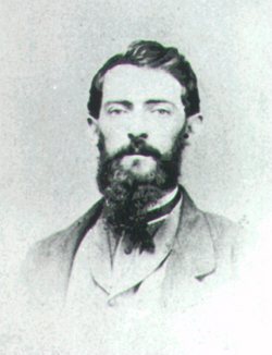
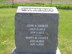
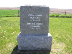
John A. Shober
| Birth | : | 30 Jul 1833 |
| Death | : | 12 Apr 1865 |
| Burial | : | Ådala Kyrkogård, Bettna, Flens kommun, Sweden |
| Coordinate | : | 58.9939522, 16.8291178 |
| Description | : | John was the son of Jacob (1786-1838) & Mary (1791-1844) Shober. John was the husband of Mary McLeod (1836-1860). John & Mary were the parents of Cora Mary (Shober) Ambrose (1858-1944) and Howard Clayton Shober (1859-1856). |
frequently asked questions (FAQ):
-
Where is John A. Shober's memorial?
John A. Shober's memorial is located at: Ådala Kyrkogård, Bettna, Flens kommun, Sweden.
-
When did John A. Shober death?
John A. Shober death on 12 Apr 1865 in
-
Where are the coordinates of the John A. Shober's memorial?
Latitude: 58.9939522
Longitude: 16.8291178
Family Members:
Spouse
Children
Flowers:
Nearby Cemetories:
1. Ådala Kyrkogård
Bettna, Flens kommun, Sweden
Coordinate: 58.9939522, 16.8291178
2. Husby-Oppunda kyrkogård
Vrena, Nyköpings kommun, Sweden
Coordinate: 58.9087626, 16.8041195
3. Blacksta Church Cemetery
Blacksta, Gnesta kommun, Sweden
Coordinate: 58.9582100, 16.6340809
4. Vadsbro Kyrka
Vadsbro, Flens kommun, Sweden
Coordinate: 58.9773068, 16.5663294
5. Lilla Malma gamla kyrkogård
Malmkoping, Flens kommun, Sweden
Coordinate: 59.1349594, 16.7263983
6. Halla kyrkogård
Vrena, Nyköpings kommun, Sweden
Coordinate: 58.8593901, 16.6252792
7. Dunker Church Cemetery
Dunker, Flens kommun, Sweden
Coordinate: 59.1663160, 16.7819595
8. Mellösa Kyrkogård
Mellosa, Flens kommun, Sweden
Coordinate: 59.1000073, 16.5500845
9. Mellösa Församling Kvarter 3
Halleforsnas, Flens kommun, Sweden
Coordinate: 59.1518570, 16.4938092
10. Frustuna Kyrkogård
Gnesta kommun, Sweden
Coordinate: 59.0584170, 17.3080670
11. Kattnäs Kyrkogård
Gnesta kommun, Sweden
Coordinate: 59.0801860, 17.2956540
12. Vårdinge kyrkogård
Molnbo, Södertälje kommun, Sweden
Coordinate: 59.0291550, 17.3580770
13. Länna kyrkogård
Strängnäs, Strängnäs kommun, Sweden
Coordinate: 59.2814570, 16.9839330
14. Skogskyrkogården
Katrineholms kommun, Sweden
Coordinate: 58.9816400, 16.2290490
15. Katrineholm Kyrkogård
Katrineholm, Katrineholms kommun, Sweden
Coordinate: 58.9919670, 16.1948670
16. Västerljungs kyrkogård
Vasterljung, Trosa kommun, Sweden
Coordinate: 58.9222220, 17.4486110
17. Mariefreds kyrkogård
Mariefred, Strängnäs kommun, Sweden
Coordinate: 59.2629490, 17.2273330
18. Tunabergs Kyrkogård
Navekvarn, Nyköpings kommun, Sweden
Coordinate: 58.6444254, 16.9026768
19. Holo Gamla Kyrkogård
Holo, Södertälje kommun, Sweden
Coordinate: 59.0167124, 17.5331466
20. Turinge kyrkogård
Nykvarns kommun, Sweden
Coordinate: 59.1963950, 17.4414160
21. Strängnäs södra kyrkogård
Strängnäs, Strängnäs kommun, Sweden
Coordinate: 59.3556780, 17.0148080
22. Husby-Rekarne kyrkogård
Eskilstuna kommun, Sweden
Coordinate: 59.3142240, 16.4520100
23. Härads kyrkogård
Strängnäs kommun, Sweden
Coordinate: 59.3599625, 17.0169271
24. Trosa Kyrka
Trosa kommun, Sweden
Coordinate: 58.8979857, 17.5441491


