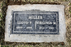
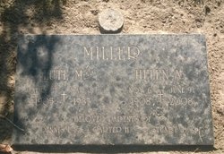
| Birth | : | 3 May 1915 Imperial, Chase County, Nebraska, USA |
| Death | : | 5 Nov 2005 Billings, Yellowstone County, Montana, USA |
| Burial | : | Tracy Public Cemetery, Tracy, San Joaquin County, USA |
| Coordinate | : | 37.7251358, -121.4189453 |
| Plot | : | crematorium crypt North East corner -C4 & D4 |
| Description | : | Obit:Coryelle M. Roe Coryelle Miller Roe, longtime Billings resident, died peacefully in her sleep on Nov. 26, 2005, at age 90. Death at the Big Sky Hospice followed a personal decision to end years of kidney dialysis. She is survived by six children, five of whom live in Montana, plus 21 grandchildren, 23 great-grandchildren and three great-great-grandchildren. The body was cremated by Smith Funeral Home and its ashes placed in Terrace Gardens alongside those of her husband, Wallace H. Roe, who died in 1977. There was no formal ceremony following her death, but family will hold an appropriate event of... Read More |
frequently asked questions (FAQ):
-
Where is Coryelle Elva Miller Roe's memorial?
Coryelle Elva Miller Roe's memorial is located at: Tracy Public Cemetery, Tracy, San Joaquin County, USA.
-
When did Coryelle Elva Miller Roe death?
Coryelle Elva Miller Roe death on 5 Nov 2005 in Billings, Yellowstone County, Montana, USA
-
Where are the coordinates of the Coryelle Elva Miller Roe's memorial?
Latitude: 37.7251358
Longitude: -121.4189453
Family Members:
Parent
Spouse
Siblings
Children
Flowers:
Nearby Cemetories:
1. Tracy Public Cemetery
Tracy, San Joaquin County, USA
Coordinate: 37.7251358, -121.4189453
2. Tracy Mausoleum
Tracy, San Joaquin County, USA
Coordinate: 37.7250214, -121.4150696
3. Valpico Memorial Park
Tracy, San Joaquin County, USA
Coordinate: 37.7113260, -121.4656510
4. Brichetto Tomb
San Joaquin County, USA
Coordinate: 37.6272011, -121.3871994
5. East Union Cemetery
Manteca, San Joaquin County, USA
Coordinate: 37.8114014, -121.2350006
6. Congregation of Ahavas Achim Cemetery
French Camp, San Joaquin County, USA
Coordinate: 37.8778419, -121.2753067
7. Chinese Cemetery
French Camp, San Joaquin County, USA
Coordinate: 37.8819962, -121.2805862
8. Congregation Adas Yeshuran of Stockton Cemetery
French Camp, San Joaquin County, USA
Coordinate: 37.8784065, -121.2740784
9. Park View Cemetery
Manteca, San Joaquin County, USA
Coordinate: 37.8617249, -121.2238312
10. Five Pillars Farm Cemetery
Livermore, Alameda County, USA
Coordinate: 37.7262764, -121.7105789
11. Ripon Cemetery
Ripon, San Joaquin County, USA
Coordinate: 37.7420311, -121.1238708
12. Atlanta Cemetery
Five Corners, San Joaquin County, USA
Coordinate: 37.8270035, -121.1420135
13. Grayson Cemetery
Grayson, Stanislaus County, USA
Coordinate: 37.5594559, -121.1802826
14. Thomas Lindsay Gravesite
San Joaquin County, USA
Coordinate: 37.9573110, -121.2918430
15. David Kelsey Gravesite
Stockton, San Joaquin County, USA
Coordinate: 37.9573110, -121.2918430
16. Citizens Cemetery
Stockton, San Joaquin County, USA
Coordinate: 37.9559410, -121.2769120
17. Union Cemetery
Brentwood, Contra Costa County, USA
Coordinate: 37.9103012, -121.6477966
18. Temple Israel Cemetery
Stockton, San Joaquin County, USA
Coordinate: 37.9640541, -121.2784348
19. Stockton State Hospital Cemetery
Stockton, San Joaquin County, USA
Coordinate: 37.9663110, -121.2846850
20. Saint Michaels Cemetery
Livermore, Alameda County, USA
Coordinate: 37.6797790, -121.7519150
21. San Joaquin Catholic Cemetery
Stockton, San Joaquin County, USA
Coordinate: 37.9707830, -121.2850190
22. IOOF Memory Gardens Cemetery
Livermore, Alameda County, USA
Coordinate: 37.6797850, -121.7526100
23. Casa Bonita Mausoleum
Stockton, San Joaquin County, USA
Coordinate: 37.9752340, -121.2877800
24. Stockton Woodland Mausoleum
Stockton, San Joaquin County, USA
Coordinate: 37.9762400, -121.2878000


