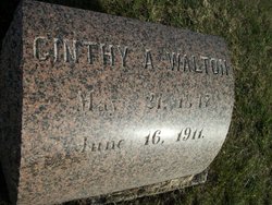
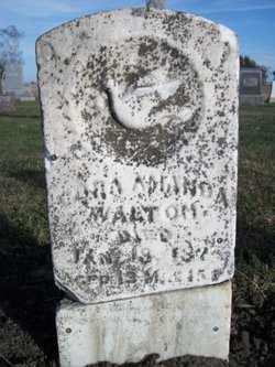
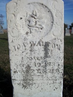
Cynthia Ann “Cinthy” McNeil Walton
| Birth | : | 21 May 1847 Jefferson County, Pennsylvania, USA |
| Death | : | 16 Jun 1911 Fort Dodge, Webster County, Iowa, USA |
| Burial | : | Greenfield Cemetery, Knierim, Calhoun County, USA |
| Coordinate | : | 42.4495000, -94.4565000 |
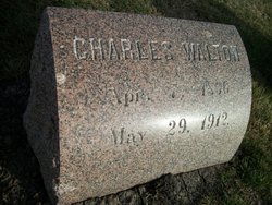
| Description | : | Cynthia Ann "Cinthy" McNeil was born May 21, 1847 in Eldred Twp., Jefferson Co., PA She died Jun 16, 1911 in Fort Dodge, Webster Co., IA On Jan. 19, 1865 she married Charles Walton [Find A Grave # 23660209] in Davenport, Scott Co., IA They had 11 children, one who died in infancy and one who died as a child. Her parents were Christopher and Eliza Jane Daugherty McNeil. |
frequently asked questions (FAQ):
-
Where is Cynthia Ann “Cinthy” McNeil Walton's memorial?
Cynthia Ann “Cinthy” McNeil Walton's memorial is located at: Greenfield Cemetery, Knierim, Calhoun County, USA.
-
When did Cynthia Ann “Cinthy” McNeil Walton death?
Cynthia Ann “Cinthy” McNeil Walton death on 16 Jun 1911 in Fort Dodge, Webster County, Iowa, USA
-
Where are the coordinates of the Cynthia Ann “Cinthy” McNeil Walton's memorial?
Latitude: 42.4495000
Longitude: -94.4565000
Family Members:
Parent
Spouse
Siblings
Children
Flowers:
Nearby Cemetories:
1. Greenfield Cemetery
Knierim, Calhoun County, USA
Coordinate: 42.4495000, -94.4565000
2. Trinity Cemetery
Calhoun County, USA
Coordinate: 42.4747200, -94.4555588
3. Calvary Presbyterian Cemetery
Barnum, Webster County, USA
Coordinate: 42.4742810, -94.3835020
4. Hope Cemetery
Manson, Calhoun County, USA
Coordinate: 42.4994011, -94.5199966
5. Fulton Lutheran Cemetery
Roelyn, Webster County, USA
Coordinate: 42.4263992, -94.3688965
6. Rose Hill Cemetery
Manson, Calhoun County, USA
Coordinate: 42.5228004, -94.5243988
7. Saint Josephs Cemetery
Barnum, Webster County, USA
Coordinate: 42.5172000, -94.3769000
8. Leith Cemetery
Manson, Calhoun County, USA
Coordinate: 42.4878006, -94.5667038
9. Mizpah Cemetery
Webster County, USA
Coordinate: 42.3835983, -94.3707962
10. Saint Thomas Cemetery
Manson, Calhoun County, USA
Coordinate: 42.5208500, -94.5365000
11. Roland Township Cemetery
Slifer, Webster County, USA
Coordinate: 42.3685989, -94.3685989
12. Cedar Cemetery
Rinard, Calhoun County, USA
Coordinate: 42.3456001, -94.4644012
13. Fulton Township Cemetery
Moorland, Webster County, USA
Coordinate: 42.4272000, -94.3159000
14. Logan Township Cemetery
Logan Township, Calhoun County, USA
Coordinate: 42.3539009, -94.5330963
15. Our Lady of Good Counsel Cemetery
Moorland, Webster County, USA
Coordinate: 42.4427986, -94.3043976
16. Reformatory Cemetery
Rockwell City, Calhoun County, USA
Coordinate: 42.3952570, -94.6038660
17. Saint Francis Cemetery
Rockwell City, Calhoun County, USA
Coordinate: 42.4055000, -94.6127000
18. Rosehill Cemetery
Rockwell City, Calhoun County, USA
Coordinate: 42.4042015, -94.6128006
19. Saint Paul Lutheran Cemetery
Pocahontas County, USA
Coordinate: 42.5610000, -94.5392000
20. Old Lizard Cemetery
Webster County, USA
Coordinate: 42.5249720, -94.3141340
21. Saint James Cemetery
Clare, Webster County, USA
Coordinate: 42.5691986, -94.3644028
22. Memorial Park Cemetery
Calhoun County, USA
Coordinate: 42.5189018, -94.6194000
23. Lizard Cemetery
Palmer, Pocahontas County, USA
Coordinate: 42.5875015, -94.4796982
24. Swedish Cemetery
Manson, Calhoun County, USA
Coordinate: 42.5426295, -94.5992013

