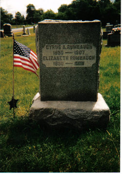
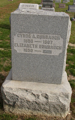
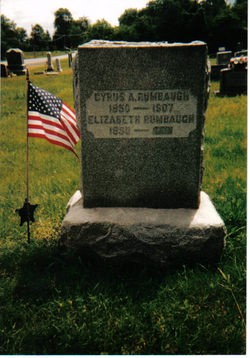
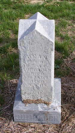
Cyrus A. Rumbaugh
| Birth | : | 1850 Allen County, Ohio, USA |
| Death | : | 21 Feb 1907 Whistler, Mobile County, Alabama, USA |
| Burial | : | St Mary the Virgin and All Saints Churchyard, Boxley, Maidstone Borough, England |
| Coordinate | : | 51.3019050, 0.5448300 |
| Plot | : | Section A-2, Row 13 |
| Description | : | Son of Morris & Mary (Hanson) Rumbaugh. Husband of Elizabeth Protsman Rumbaugh From the Lima Times Democrat Sat. 2/23/1907 IN THE SOUTH Occurred the death of C.A.Rumbaugh C.A.Rumbaugh,a former Allen County resident, died at Whistler, Alabama,details of the death being unknown at this time to relatives here.The remains are expected to reach this city tonight at 9:30 o'clock and the body will be taken to the home of Frank Wheeler, 613 Harrison Ave., funeral arrangements to be announced later. From The Times Democrat Mon. 2/25/1907 VETERAN SHOP MAN Will Be Laid To Rest In Bluelick Cemetery Tomorrow Morning The remains of C.A.Rumbaugh, note of whose death was made... Read More |
frequently asked questions (FAQ):
-
Where is Cyrus A. Rumbaugh's memorial?
Cyrus A. Rumbaugh's memorial is located at: St Mary the Virgin and All Saints Churchyard, Boxley, Maidstone Borough, England.
-
When did Cyrus A. Rumbaugh death?
Cyrus A. Rumbaugh death on 21 Feb 1907 in Whistler, Mobile County, Alabama, USA
-
Where are the coordinates of the Cyrus A. Rumbaugh's memorial?
Latitude: 51.3019050
Longitude: 0.5448300
Family Members:
Parent
Spouse
Siblings
Children
Flowers:
Nearby Cemetories:
1. St Mary the Virgin and All Saints Churchyard
Boxley, Maidstone Borough, England
Coordinate: 51.3019050, 0.5448300
2. Boxley Parish War Memorial
Boxley, Maidstone Borough, England
Coordinate: 51.3020400, 0.5440300
3. St. Martin of Tours Churchyard
Detling, Maidstone Borough, England
Coordinate: 51.2943460, 0.5687340
4. Vinters Park Crematorium
Maidstone, Maidstone Borough, England
Coordinate: 51.2833100, 0.5506470
5. St Mary the Virgin Church
Thurnham, Maidstone Borough, England
Coordinate: 51.2891730, 0.5858830
6. St Faith Churchyard
Maidstone, Maidstone Borough, England
Coordinate: 51.2764210, 0.5211100
7. Holy Trinity Church
Maidstone, Maidstone Borough, England
Coordinate: 51.2749390, 0.5252620
8. Maidstone Baptist Church
Maidstone, Maidstone Borough, England
Coordinate: 51.2704370, 0.5230740
9. All Saints Churchyard
Maidstone, Maidstone Borough, England
Coordinate: 51.2706920, 0.5215980
10. St Peter Churchyard
Bredhurst, Maidstone Borough, England
Coordinate: 51.3297870, 0.5808540
11. Medway Crematorium
Chatham, Medway Unitary Authority, England
Coordinate: 51.3331340, 0.5107590
12. St Peter and St Paul Churchyard
Aylesford, Tonbridge and Malling Borough, England
Coordinate: 51.3040630, 0.4793870
13. St Stephens Churchyard
Tovil, Maidstone Borough, England
Coordinate: 51.2642700, 0.5110600
14. Aylesford Cemetery
Aylesford, Tonbridge and Malling Borough, England
Coordinate: 51.3001000, 0.4752090
15. Eccles War Memorial
Aylesford, Tonbridge and Malling Borough, England
Coordinate: 51.3178120, 0.4788630
16. Royal British Legion Village Memorial
Aylesford, Tonbridge and Malling Borough, England
Coordinate: 51.2964380, 0.4744810
17. Aylesford Priory
Aylesford, Tonbridge and Malling Borough, England
Coordinate: 51.3030586, 0.4724390
18. Maidstone Cemetery
Maidstone, Maidstone Borough, England
Coordinate: 51.2554700, 0.5323500
19. Tovil Anabaptist Burial Ground
Tovil, Maidstone Borough, England
Coordinate: 51.2602944, 0.5082881
20. Burham War Memorial
Burham, Tonbridge and Malling Borough, England
Coordinate: 51.3327530, 0.4785610
21. St Peter ad vincula Churchyard
Ditton, Tonbridge and Malling Borough, England
Coordinate: 51.2958810, 0.4510820
22. St Mary Old Churchyard
Burham, Tonbridge and Malling Borough, England
Coordinate: 51.3312262, 0.4619326
23. East Farleigh Parish Churchyard
East Farleigh, Maidstone Borough, England
Coordinate: 51.2526270, 0.4835740
24. Holy Trinity Churchyard
Larkfield, Tonbridge and Malling Borough, England
Coordinate: 51.3062210, 0.4441090


