
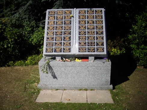
| Memorials | : | 200 |
| Location | : | Chatham, Medway Unitary Authority, England |
| Phone | : | 01634 861639 |
| Coordinate | : | 51.3331340, 0.5107590 |
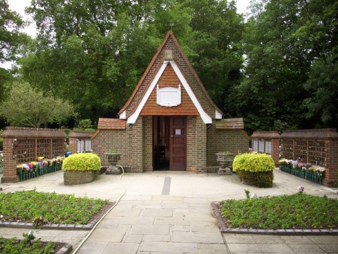
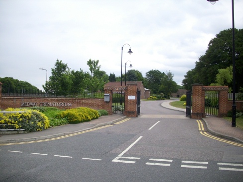
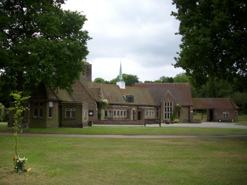
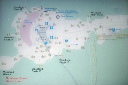
| Description | : | Medway Crematorium was opened in 1959 and is owned and managed by Medway Council. The crematorium covers 14 acres and is a mix of woodland, shrub beds, formal planting and grass beneath large and stately trees.The crematorium is situated between Chatham and Maidstone in Blue Bell Hill village. Travelling time from junction 3 of the M2 is about three minutes and from junction 6 of the M20 about 10 minutes. |
frequently asked questions (FAQ):
-
Where is Medway Crematorium?
Medway Crematorium is located at Robin Hood Lane,Blue Bell Hill Chatham, Medway Unitary Authority ,Kent , ME5 9QUEngland.
-
Medway Crematorium cemetery's updated grave count on graveviews.com?
0 memorials
-
Where are the coordinates of the Medway Crematorium?
Latitude: 51.3331340
Longitude: 0.5107590


Nearby Cemetories:
1. Burham War Memorial
Burham, Tonbridge and Malling Borough, England
Coordinate: 51.3327530, 0.4785610
2. Eccles War Memorial
Aylesford, Tonbridge and Malling Borough, England
Coordinate: 51.3178120, 0.4788630
3. St Mary Old Churchyard
Burham, Tonbridge and Malling Borough, England
Coordinate: 51.3312262, 0.4619326
4. St Peter and St Paul Churchyard
Aylesford, Tonbridge and Malling Borough, England
Coordinate: 51.3040630, 0.4793870
5. Chatham Palmerston Road Cemetery
Chatham, Medway Unitary Authority, England
Coordinate: 51.3678600, 0.5267300
6. Boxley Parish War Memorial
Boxley, Maidstone Borough, England
Coordinate: 51.3020400, 0.5440300
7. St Mary the Virgin and All Saints Churchyard
Boxley, Maidstone Borough, England
Coordinate: 51.3019050, 0.5448300
8. Chatham Maidstone Road Cemetery
Chatham, Medway Unitary Authority, England
Coordinate: 51.3703300, 0.5227600
9. All Saints Churchyard
Snodland, Tonbridge and Malling Borough, England
Coordinate: 51.3299000, 0.4496900
10. All Saints Churchyard
Wouldham, Tonbridge and Malling Borough, England
Coordinate: 51.3528130, 0.4580580
11. Aylesford Priory
Aylesford, Tonbridge and Malling Borough, England
Coordinate: 51.3030586, 0.4724390
12. Aylesford Cemetery
Aylesford, Tonbridge and Malling Borough, England
Coordinate: 51.3001000, 0.4752090
13. St John the Baptist Churchyard
Halling, Medway Unitary Authority, England
Coordinate: 51.3484993, 0.4468510
14. Royal British Legion Village Memorial
Aylesford, Tonbridge and Malling Borough, England
Coordinate: 51.2964380, 0.4744810
15. St Matthew Churchyard
Borstal, Medway Unitary Authority, England
Coordinate: 51.3736150, 0.4868020
16. Fort Pitt Military Cemetery
Rochester, Medway Unitary Authority, England
Coordinate: 51.3769790, 0.5114570
17. St Peter Churchyard
Bredhurst, Maidstone Borough, England
Coordinate: 51.3297870, 0.5808540
18. Christ Church Cemetery
Chatham, Medway Unitary Authority, England
Coordinate: 51.3716730, 0.5462690
19. Halling Church Cemetery
Halling, Medway Unitary Authority, England
Coordinate: 51.3499140, 0.4447960
20. All Saints with Christchurch Churchyard
Snodland, Tonbridge and Malling Borough, England
Coordinate: 51.3246110, 0.4406010
21. St. Margaret's Cemetery
Rochester, Medway Unitary Authority, England
Coordinate: 51.3777000, 0.5011600
22. St. Nicholas's Cemetery
Rochester, Medway Unitary Authority, England
Coordinate: 51.3780081, 0.5021076
23. Halling War Memorial
Halling, Medway Unitary Authority, England
Coordinate: 51.3519630, 0.4439060
24. St. Augustine's Church
Gillingham, Medway Unitary Authority, England
Coordinate: 51.3745050, 0.5474930