
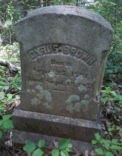
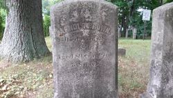
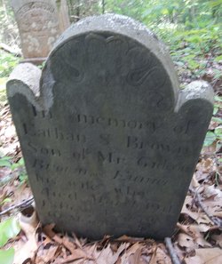
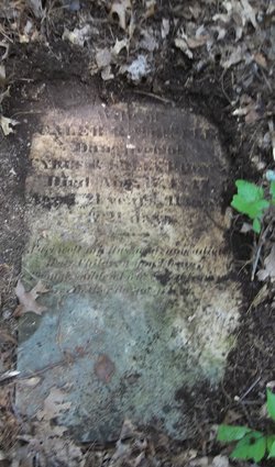
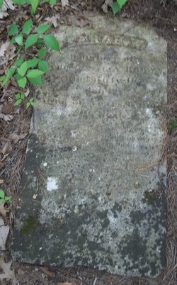
Cyrus Brown Sr.
| Birth | : | 25 Sep 1791 |
| Death | : | 13 Sep 1871 |
| Burial | : | Our Saviors Lutheran Cemetery, Kenaston, Ward County, USA |
| Coordinate | : | 48.5604477, -102.1352158 |
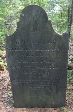
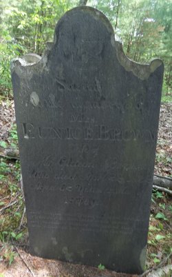
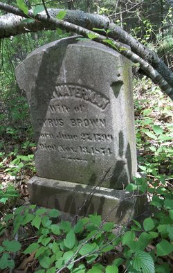
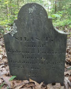
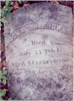
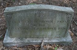
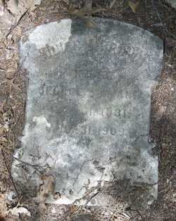
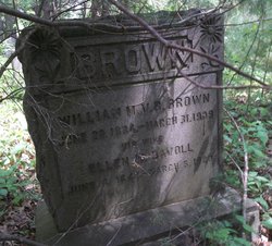
| Description | : | Parents: . Gideon Brown (1767 - 1841) . Eunice Thornton (1769 - 1832) Marriage: . Sally Waterman, 19 Sep 1819 Children: 1. Cyrus Brown Jr. [1829-1909] + sp: Harriet Amelia Thurber [1837-1926] |
frequently asked questions (FAQ):
-
Where is Cyrus Brown Sr.'s memorial?
Cyrus Brown Sr.'s memorial is located at: Our Saviors Lutheran Cemetery, Kenaston, Ward County, USA.
-
When did Cyrus Brown Sr. death?
Cyrus Brown Sr. death on 13 Sep 1871 in
-
Where are the coordinates of the Cyrus Brown Sr.'s memorial?
Latitude: 48.5604477
Longitude: -102.1352158
Family Members:
Parent
Spouse
Siblings

Children


Nearby Cemetories:
1. Our Saviors Lutheran Cemetery
Kenaston, Ward County, USA
Coordinate: 48.5604477, -102.1352158
2. Bethlehem Lutheran Cemetery
Coulee, Mountrail County, USA
Coordinate: 48.5301895, -102.1457291
3. Baden Cemetery
Baden, Ward County, USA
Coordinate: 48.5610700, -102.0823000
4. Spring Valley Mennonite Cemetery
Kenaston, Ward County, USA
Coordinate: 48.5904617, -102.0805817
5. Coulee Cemetery
Coulee, Mountrail County, USA
Coordinate: 48.5462723, -102.0065536
6. Zion Lutheran Cemetery
Coulee, Mountrail County, USA
Coordinate: 48.4882300, -102.2240500
7. Lakeview Cemetery
Kenmare, Ward County, USA
Coordinate: 48.6627998, -102.1016998
8. Saint Agnes Catholic Cemetery
Kenmare, Ward County, USA
Coordinate: 48.6804500, -102.0737200
9. Rose Hill Cemetery
Kenmare, Ward County, USA
Coordinate: 48.6804600, -102.0723200
10. Elmdale Lutheran Cemetery
Niobe, Ward County, USA
Coordinate: 48.6988983, -102.2127991
11. Peters Family Cemetery
Donnybrook, Ward County, USA
Coordinate: 48.4968290, -101.9170010
12. Hide and Stone Cemetery
Vanville, Burke County, USA
Coordinate: 48.5788000, -102.3792600
13. Nolen Family Cemetery
Aurelia, Ward County, USA
Coordinate: 48.4808884, -101.9191360
14. Saint Lukes Lutheran Cemetery
Coulee, Mountrail County, USA
Coordinate: 48.4152908, -102.0166931
15. Holbrook Cemetery
Donnybrook, Ward County, USA
Coordinate: 48.5119019, -101.8944016
16. Donnybrook Community Cemetery
Donnybrook, Ward County, USA
Coordinate: 48.5171165, -101.8895264
17. Aurelia Community Cemetery
Aurelia, Ward County, USA
Coordinate: 48.4593773, -101.9290924
18. Power Cemetery
Donnybrook, Ward County, USA
Coordinate: 48.5051627, -101.8884413
19. Nasareth Cemetery
Vanville, Burke County, USA
Coordinate: 48.6180992, -102.3861008
20. Bethany Lutheran Cemetery
Burke County, USA
Coordinate: 48.7349080, -102.1683880
21. Trinity Lutheran Cemetery
Kenmare, Ward County, USA
Coordinate: 48.7335590, -102.0646290
22. Greenfield Cemetery
Ward County, USA
Coordinate: 48.5974998, -101.8653030
23. Saint Anthonys Cemetery
Donnybrook, Ward County, USA
Coordinate: 48.4996986, -101.8731003
24. Little Butte Cemetery
Bowbells, Burke County, USA
Coordinate: 48.7197310, -102.2769000