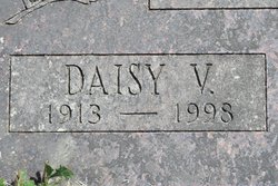
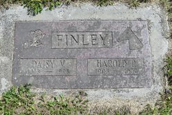
Daisy V Howe Finley
| Birth | : | 5 Mar 1913 |
| Death | : | 27 Oct 1998 |
| Burial | : | East View Cemetery, Salem, Salem County, USA |
| Coordinate | : | 39.5627480, -75.4561081 |
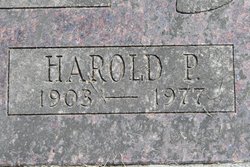
| Description | : | Daisy V. Finley, 85, of Oroville died on Tuesday, Oct. 27, 1998 at the North Valley Nursing Home in Tonasket. She was born on March 5, 1913 in Sprague to Hally and Ada Howe. She was the middle child of nine children. At an early age the family moved to Wauconda. She attended school there through the 8th grade. She worked at various jobs in the northern end of Okanogan County. On June 25, 1935, Daisy married Harold P. Finley. Together they lived in Grand Coulee while Harold worked on the construction of Grand Coulee Dam. After that, the family... Read More |
frequently asked questions (FAQ):
-
Where is Daisy V Howe Finley's memorial?
Daisy V Howe Finley's memorial is located at: East View Cemetery, Salem, Salem County, USA.
-
When did Daisy V Howe Finley death?
Daisy V Howe Finley death on 27 Oct 1998 in
-
Where are the coordinates of the Daisy V Howe Finley's memorial?
Latitude: 39.5627480
Longitude: -75.4561081
Family Members:
Flowers:
Nearby Cemetories:
1. East View Cemetery
Salem, Salem County, USA
Coordinate: 39.5627480, -75.4561081
2. Baptist Cemetery
Salem, Salem County, USA
Coordinate: 39.5621681, -75.4611053
3. Mount Hope United Methodist Church Cemetery
Salem, Salem County, USA
Coordinate: 39.5660667, -75.4606781
4. Saint Mary's Roman Catholic Cemetery
Salem, Salem County, USA
Coordinate: 39.5637856, -75.4684753
5. First United Methodist Church Cemetery
Salem, Salem County, USA
Coordinate: 39.5695496, -75.4670868
6. Mount Pisgah AME Cemetery
Salem County, USA
Coordinate: 39.5549700, -75.4663900
7. Evergreen Cemetery
Salem, Salem County, USA
Coordinate: 39.5540000, -75.4652000
8. First Presbyterian Cemetery
Salem, Salem County, USA
Coordinate: 39.5736351, -75.4648819
9. Saint John's Episcopal Churchyard
Salem, Salem County, USA
Coordinate: 39.5744705, -75.4655151
10. Salem Friends Burial Ground
Salem, Salem County, USA
Coordinate: 39.5732307, -75.4705963
11. Mill Hollow Cemetery
Quinton, Salem County, USA
Coordinate: 39.5563120, -75.4305770
12. Alloway Creek Old Quaker Burial Ground
Lower Alloways Creek Township, Salem County, USA
Coordinate: 39.5202900, -75.4597000
13. Hancocks Bridge United Methodist Church Cemetery
Harmersville, Salem County, USA
Coordinate: 39.5023537, -75.4411850
14. Cedar Hill Friends Cemetery
Harmersville, Salem County, USA
Coordinate: 39.5014720, -75.4387800
15. Alloway Baptist Church Cemetery
Alloway, Salem County, USA
Coordinate: 39.5606308, -75.3655090
16. Battle of Quintons Bridge Graveyard
Quinton, Salem County, USA
Coordinate: 39.5130650, -75.3884040
17. Dunham Family Cemetery
Pennsville, Salem County, USA
Coordinate: 39.6138890, -75.5268330
18. Alloway United Methodist Church Cemetery
Alloway, Salem County, USA
Coordinate: 39.5623207, -75.3586273
19. Little Bethel A.M.E Church Cemetery
Marshalltown, Salem County, USA
Coordinate: 39.6381190, -75.4537830
20. Berrys Chapel Cemetery
Quinton, Salem County, USA
Coordinate: 39.5137900, -75.3779510
21. Old Alloway Cemetery
Alloway, Salem County, USA
Coordinate: 39.5619545, -75.3549957
22. Mount Zion AUMP Church Cemetery
Marshalltown, Salem County, USA
Coordinate: 39.6410060, -75.4554070
23. Lower Penns Neck Methodist Episcopal Cemetery
Pennsville, Salem County, USA
Coordinate: 39.6383120, -75.5164490
24. Canton Baptist Church Cemetery
Canton, Salem County, USA
Coordinate: 39.4799385, -75.4120789


