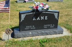
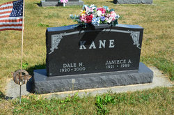
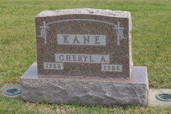
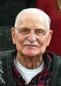
Dale Harold Kane
| Birth | : | 16 Mar 1920 Webster County, Iowa, USA |
| Death | : | 1 Dec 2000 Boone, Boone County, Iowa, USA |
| Burial | : | Greenleaf Memorial Park, Trent Woods, Craven County, USA |
| Coordinate | : | 35.0866699, -77.1172180 |
| Description | : | Daily Freeman Journal Webster City, Iowa December 4, 2000 Dale Kane, 80, Stratford Dale Kane, 80, Stratford, died Friday, Dec. 1, 2000 at the Boone County Hospital in Boone. Funeral services will be held Wednesday at 10 a.m. at the Stratford Lutheran Church in Stratford with Rev. Joe Lambert officiating. Burial will be in Oakwood Cemetery north of Stratford, with flag folding services to be conducted by American Legion Frederick Sonksen Post No. 576. Friends may call at the Stark-Welin Funeral Home in Stratford Tuesday from 7-9 p.m. with the family present from 7-8 p.m. Visitation will continue at the church after 8:30 a.m.... Read More |
frequently asked questions (FAQ):
-
Where is Dale Harold Kane's memorial?
Dale Harold Kane's memorial is located at: Greenleaf Memorial Park, Trent Woods, Craven County, USA.
-
When did Dale Harold Kane death?
Dale Harold Kane death on 1 Dec 2000 in Boone, Boone County, Iowa, USA
-
Where are the coordinates of the Dale Harold Kane's memorial?
Latitude: 35.0866699
Longitude: -77.1172180
Family Members:
Parent
Spouse
Siblings
Children
Flowers:
Nearby Cemetories:
1. Greenleaf Memorial Park
Trent Woods, Craven County, USA
Coordinate: 35.0866699, -77.1172180
2. Tabernacle Missionary Baptist Church Cemetery
New Bern, Craven County, USA
Coordinate: 35.0932600, -77.1313900
3. New Bern Memorial Cemetery
New Bern, Craven County, USA
Coordinate: 35.0905991, -77.0935974
4. Richardson Cemetery
New Bern, Craven County, USA
Coordinate: 35.0911500, -77.1455600
5. Rocky Run Church Cemetery
New Bern, Craven County, USA
Coordinate: 35.0907150, -77.1466180
6. Garber United Methodist Church
New Bern, Craven County, USA
Coordinate: 35.0754880, -77.0880260
7. Saint Josephs Cemetery
New Bern, Craven County, USA
Coordinate: 35.0800000, -77.0700000
8. Perrytown Community Cemetery
New Bern, Craven County, USA
Coordinate: 35.0520080, -77.0788750
9. Saint Andrew Lutheran Church Memorial Garden
New Bern, Craven County, USA
Coordinate: 35.1094927, -77.0614065
10. Clermont Estate Cemetery
New Bern, Craven County, USA
Coordinate: 35.0721940, -77.0549700
11. Rhems United Methodist Church Cemetery
New Bern, Craven County, USA
Coordinate: 35.0712100, -77.1817630
12. Evergreen Cemetery
New Bern, Craven County, USA
Coordinate: 35.1196976, -77.0620575
13. Bryan-Fordham Cemetery
New Bern, Craven County, USA
Coordinate: 35.1072290, -77.0509060
14. Macedonia Missionary Baptist Church Cemetery
New Bern, Craven County, USA
Coordinate: 35.1480400, -77.1137600
15. Dawson Family Cemetery
New Bern, Craven County, USA
Coordinate: 35.1484800, -77.1138000
16. Bryan Cemetery
James City, Craven County, USA
Coordinate: 35.0799700, -77.0409700
17. Brooks Family Cemetery
New Bern, Craven County, USA
Coordinate: 35.0885800, -77.0398000
18. Greenwood Cemetery
New Bern, Craven County, USA
Coordinate: 35.1166992, -77.0483017
19. DeBruhl Cemetery
Tenmile Fork, Jones County, USA
Coordinate: 35.0606400, -77.1888700
20. Bern Cemetery
New Bern, Craven County, USA
Coordinate: 35.1130981, -77.0453033
21. United Hebrews of New Bern Cemetery
New Bern, Craven County, USA
Coordinate: 35.1236100, -77.0515600
22. New Bern National Cemetery
New Bern, Craven County, USA
Coordinate: 35.1248398, -77.0524216
23. Harriet Koonce Cemetery
Pollocksville, Jones County, USA
Coordinate: 35.0604300, -77.1904400
24. Cedar Grove Cemetery
New Bern, Craven County, USA
Coordinate: 35.1130981, -77.0436020

