Dale Stanton Florea
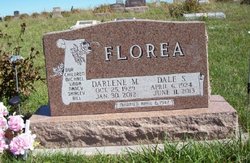
| Birth | : | 6 Apr 1924 Nodaway County, Missouri, USA |
| Death | : | 11 Jun 2013 Nodaway County, Missouri, USA |
| Burial | : | Long Branch Cemetery, Gaynor, Nodaway County, USA |
| Coordinate | : | 40.4872017, -94.7177963 |
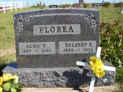
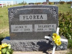
| Description | : | DALE S. FLOREA 1924-2013 MARYVILLE, MO. Dale Stanton Floria, 89, of Maryville, passed away peacefully Tuesday, June 11, 2013, following a lengthy illness. Dale was born on April 6, 1924, in Nodaway County, near Pickering, Mo., to Delbert and Alma (Massie) Florea. He worked in construction and was a licensed electrician and plumber. He was employed by the City of Maryville as the building inspector until he retired. He volunteered for several years with the Maryville Fire Department and as a volunteer for Nodaway County Ambulance in the early 1970's. In WWII, Dale proudly served his country in the US Army. He was wounded... Read More |
frequently asked questions (FAQ):
-
Where is Dale Stanton Florea's memorial?
Dale Stanton Florea's memorial is located at: Long Branch Cemetery, Gaynor, Nodaway County, USA.
-
When did Dale Stanton Florea death?
Dale Stanton Florea death on 11 Jun 2013 in Nodaway County, Missouri, USA
-
Where are the coordinates of the Dale Stanton Florea's memorial?
Latitude: 40.4872017
Longitude: -94.7177963
Family Members:
Parent
Spouse
Siblings
Children
Flowers:
Nearby Cemetories:
1. Daugherty Cemetery
Gaynor, Nodaway County, USA
Coordinate: 40.4927600, -94.7266800
2. Washburn Cemetery
Hopkins, Nodaway County, USA
Coordinate: 40.5127983, -94.7568970
3. McLaughlin Cemetery
Nodaway County, USA
Coordinate: 40.4850006, -94.6464005
4. Brethren Cemetery
Nodaway County, USA
Coordinate: 40.5046997, -94.6496964
5. West Union Cemetery
Orrsburg, Nodaway County, USA
Coordinate: 40.4307400, -94.7186000
6. New Hope Cemetery
Gaynor, Nodaway County, USA
Coordinate: 40.5457993, -94.7097015
7. Luteston Cemetery
Nodaway County, USA
Coordinate: 40.5393100, -94.6500600
8. White Oak Cemetery
Pickering, Nodaway County, USA
Coordinate: 40.4631004, -94.8097000
9. Saint Joseph Cemetery
Parnell, Nodaway County, USA
Coordinate: 40.4273109, -94.6207733
10. Parnell Cemetery
Parnell, Nodaway County, USA
Coordinate: 40.4273109, -94.6207581
11. Rose Hill Cemetery
Parnell, Nodaway County, USA
Coordinate: 40.4273109, -94.6207581
12. Wilcox Cemetery
Ravenwood, Nodaway County, USA
Coordinate: 40.3911018, -94.6836014
13. Hopkins Cemetery
Hopkins, Nodaway County, USA
Coordinate: 40.5689011, -94.8110962
14. Myrtle Tree Cemetery
Maryville, Nodaway County, USA
Coordinate: 40.3987617, -94.8009720
15. Coleman Cemetery
Pickering, Nodaway County, USA
Coordinate: 40.4500008, -94.8566971
16. Gray Cemetery
Pickering, Nodaway County, USA
Coordinate: 40.4583700, -94.8667300
17. Kemery Cemetery
Taylor County, USA
Coordinate: 40.6035995, -94.6727982
18. Morehouse Cemetery
Hopkins, Nodaway County, USA
Coordinate: 40.5069008, -94.8794022
19. Willard Cemetery
Taylor County, USA
Coordinate: 40.6007996, -94.8047028
20. Oak Lawn Cemetery
Ravenwood, Nodaway County, USA
Coordinate: 40.3605690, -94.6688232
21. Sweet Home Cemetery
Ravenwood, Nodaway County, USA
Coordinate: 40.3671989, -94.6438980
22. Ross Township Cemetery
Bedford, Taylor County, USA
Coordinate: 40.6194000, -94.7303009
23. Helm Cemetery
Taylor County, USA
Coordinate: 40.6185989, -94.7878036
24. Forest Grove Cemetery
Bedford, Taylor County, USA
Coordinate: 40.6253014, -94.6624985

