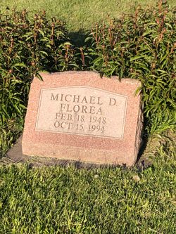
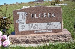
Michael Dale Florea
| Birth | : | 18 Feb 1948 Maryville, Nodaway County, Missouri, USA |
| Death | : | 15 Oct 1994 Phoenix, Maricopa County, Arizona, USA |
| Burial | : | Prairie View Cemetery, Paullina, O'Brien County, USA |
| Coordinate | : | 42.9688988, -95.7022018 |
| Description | : | Michael Florea Michael Dale Florea, 46, died Saturday, Oct. 15, 1994, in Phoenix of brain cancer. He was born Feb. 18, 1948, in Maryville, to Dale and Darlene Howard Florea. Mr. Florea was a 1966 graduate of Maryville R-II High School and attended Northwest Missouri State College. Survivors include his parents of Maryville; three sisters, Linda Grosty of Clarinda, Iowa, Nancy Lewis of Maryville, and Shirley Reed of Burlington Junction; one brother, Bill Florea of Maryville; maternal grandmother, Anna Howard of Maryville; several aunts and uncles; and 11 nieces and nephews. The body will be cremated and local services will be held at a later... Read More |
frequently asked questions (FAQ):
-
Where is Michael Dale Florea's memorial?
Michael Dale Florea's memorial is located at: Prairie View Cemetery, Paullina, O'Brien County, USA.
-
When did Michael Dale Florea death?
Michael Dale Florea death on 15 Oct 1994 in Phoenix, Maricopa County, Arizona, USA
-
Where are the coordinates of the Michael Dale Florea's memorial?
Latitude: 42.9688988
Longitude: -95.7022018
Family Members:
Parent
Flowers:
Nearby Cemetories:
1. Prairie View Cemetery
Paullina, O'Brien County, USA
Coordinate: 42.9688988, -95.7022018
2. West Prairie View Cemetery
Paullina, O'Brien County, USA
Coordinate: 42.9688988, -95.7039032
3. Saint John Cemetery
Germantown, O'Brien County, USA
Coordinate: 42.9566994, -95.7799988
4. Friends Cemetery
Mapleside, O'Brien County, USA
Coordinate: 43.0022000, -95.6225000
5. Liberty Cemetery
Calumet, O'Brien County, USA
Coordinate: 42.9241982, -95.5932999
6. Saint Joseph Catholic Cemetery
Granville, Sioux County, USA
Coordinate: 42.9813995, -95.8716965
7. Pleasant Hill Cemetery
Primghar, O'Brien County, USA
Coordinate: 43.0980988, -95.6374969
8. Saint Anthonys Catholic Calvary Cemetery
Primghar, O'Brien County, USA
Coordinate: 43.0981930, -95.6373780
9. Liberty Cemetery
Meriden, Cherokee County, USA
Coordinate: 42.8368988, -95.6361008
10. Calvary Cemetery
Sutherland, O'Brien County, USA
Coordinate: 42.9686012, -95.4858017
11. Waterman Cemetery
Sutherland, O'Brien County, USA
Coordinate: 42.9664001, -95.4847031
12. Doyle Cemetery
Highland Township, O'Brien County, USA
Coordinate: 43.0619011, -95.5243988
13. Hospers Memorial Cemetery
Hospers, Sioux County, USA
Coordinate: 43.0694008, -95.8846970
14. Marcus-Amherst Cemetery
Marcus, Cherokee County, USA
Coordinate: 42.8161011, -95.8007965
15. Holy Name Cemetery
Marcus, Cherokee County, USA
Coordinate: 42.8163986, -95.8032990
16. Saint Anthonys Cemetery
Hospers, Sioux County, USA
Coordinate: 43.0668983, -95.9036026
17. Cedar Cemetery
Larrabee, Cherokee County, USA
Coordinate: 42.8361015, -95.5346985
18. Covey Church Cemetery
Hartley, O'Brien County, USA
Coordinate: 43.0682000, -95.4875000
19. Meriden Cemetery
Meriden, Cherokee County, USA
Coordinate: 42.7868996, -95.6425018
20. Hospers Cemetery
Hospers, Sioux County, USA
Coordinate: 43.0732994, -95.9197006
21. Center Township Cemetery
O'Brien County, USA
Coordinate: 43.1150000, -95.5355000
22. Steuck Cemetery
Center Township, O'Brien County, USA
Coordinate: 43.1208500, -95.5440000
23. Cherokee County Pioneer Cemetery
Spring Township, Cherokee County, USA
Coordinate: 42.8502998, -95.4906006
24. Fred Feldman Grave
Waterman Township, O'Brien County, USA
Coordinate: 42.9178590, -95.4433340


