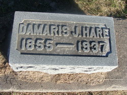
Damaris Jane Kunkel Hare
| Birth | : | 17 Dec 1855 Holt County, Missouri, USA |
| Death | : | 23 Jun 1937 Holton, Jackson County, Kansas, USA |
| Burial | : | Old Bethel Cemetery, Denton, Lawrence County, USA |
| Coordinate | : | 36.1016998, -91.2347031 |
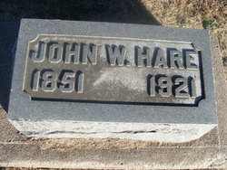
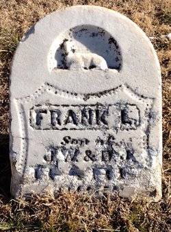
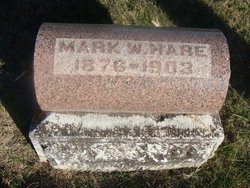
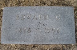
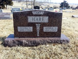
| Description | : | Glasco Sun, June 24, 1937 Mrs. Damaris Kunkel Hare, youngest child of Jacob and Juliana Kunkel was born in Holt County, Mo., on December 17, 1855, and died at the home of her son, Arthur, in Holton, Kansas, on June 23, 1937. Her age was 81 years, 6 months, five days. She is survived by one brother, Levi, of Red Oak, Iowa, by two sons, Arthur of Holton and Edward of Bennington, 10 grandchildren and a number of great-grandchildren. Her husband, John W. Hare, and two sons, Mark and Franklin, preceded her in death. Her marriage in 1875 to John... Read More |
frequently asked questions (FAQ):
-
Where is Damaris Jane Kunkel Hare's memorial?
Damaris Jane Kunkel Hare's memorial is located at: Old Bethel Cemetery, Denton, Lawrence County, USA.
-
When did Damaris Jane Kunkel Hare death?
Damaris Jane Kunkel Hare death on 23 Jun 1937 in Holton, Jackson County, Kansas, USA
-
Where are the coordinates of the Damaris Jane Kunkel Hare's memorial?
Latitude: 36.1016998
Longitude: -91.2347031
Family Members:
Parent
Spouse
Siblings
Children
Flowers:
Nearby Cemetories:
1. Old Bethel Cemetery
Denton, Lawrence County, USA
Coordinate: 36.1016998, -91.2347031
2. New Hope Cemetery
Lawrence County, USA
Coordinate: 36.0835991, -91.2341995
3. McCarroll Family Plot
Lawrence County, USA
Coordinate: 36.1137500, -91.2521300
4. Denton Cemetery
Lawrence County, USA
Coordinate: 36.0968667, -91.2101722
5. Park Cemetery
Lawrence County, USA
Coordinate: 36.1255989, -91.2624969
6. Dent Cemetery
Lawrence County, USA
Coordinate: 36.1369019, -91.2253036
7. Sharp-Herren Cemetery
Denton, Lawrence County, USA
Coordinate: 36.1020000, -91.1790000
8. Pleasant Grove Cemetery
Annieville, Lawrence County, USA
Coordinate: 36.1521020, -91.2626390
9. Holobaugh Cemetery
Lawrence County, USA
Coordinate: 36.1464005, -91.1917038
10. Smithville Cemetery
Smithville, Lawrence County, USA
Coordinate: 36.0785000, -91.3052000
11. Bratcher Cemetery
Smithville, Lawrence County, USA
Coordinate: 36.0914001, -91.3099976
12. Old Lebanon Cemetery
Eaton, Lawrence County, USA
Coordinate: 36.0336720, -91.2261910
13. Lawson Cemetery
Powhatan, Lawrence County, USA
Coordinate: 36.0778008, -91.1461029
14. Hillhouse Cemetery
Smithville, Lawrence County, USA
Coordinate: 36.0564003, -91.3097000
15. Kelley Cemetery
Imboden, Lawrence County, USA
Coordinate: 36.1549988, -91.1613998
16. Townsend Cemetery
Smithville, Lawrence County, USA
Coordinate: 36.0910988, -91.3328018
17. Brown White Farm Cemetery
Smithville, Lawrence County, USA
Coordinate: 36.0657000, -91.3324090
18. McNutt Cemetery
Lawrence County, USA
Coordinate: 36.0208015, -91.1924973
19. Powhatan Cemetery
Powhatan, Lawrence County, USA
Coordinate: 36.0889015, -91.1258011
20. Coffman Cemetery
Smithville, Lawrence County, USA
Coordinate: 36.1278000, -91.3422012
21. Friendship Cemetery
Annieville, Lawrence County, USA
Coordinate: 36.1758260, -91.3022350
22. Nation Cemetery
Lawrence County, USA
Coordinate: 36.1678009, -91.1508026
23. Oak Forest Cemetery
Black Rock, Lawrence County, USA
Coordinate: 36.1108017, -91.1100006
24. Price Cemetery
Lawrence County, USA
Coordinate: 36.0102430, -91.2939560

