


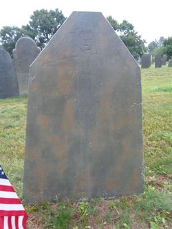
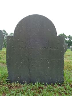
Daniel Howard
| Birth | : | 6 Jan 1750 Bridgewater, Plymouth County, Massachusetts, USA |
| Death | : | 21 Apr 1821 Brockton, Plymouth County, Massachusetts, USA |
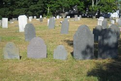
| Burial | : | Raukokore Anglican Church Cemetery, Raukokore, Ōpōtiki District, New Zealand |
| Coordinate | : | -37.6389240, 177.8785240 |
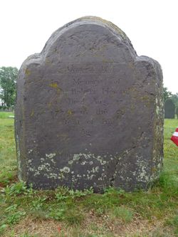
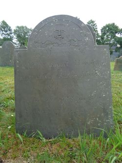
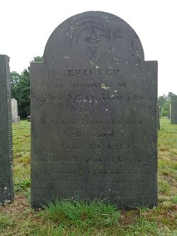
| Inscription | : | In Memory of Daniel Howard Esq: who peacefully closed a life of Exemplary Piety and Publick Usefulness April 21, A.D. 1821 in the 72 year of his age. |
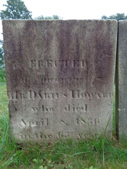
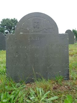
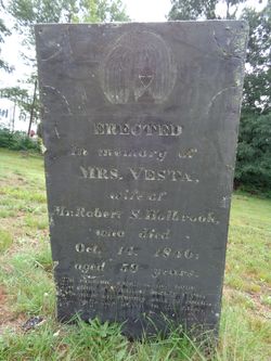
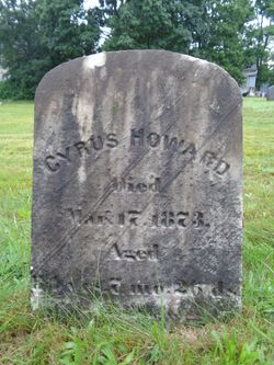
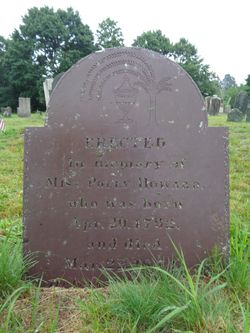
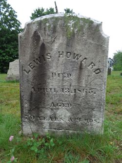
| Description | : | Daniel was town clerk and treasurer for the North Parish of Bridgewater (which became Brockton in 1874), from 1782 to 1785. He married Vesta Howard on June 29, 1773 in Bridgewater, Plymouth Co., Massachusetts. They were the parents of thirteen children. Darius Howard 1773 – 1836 Daniel Howard 1775 –1864 Ambrose Howard 1776 – 1859 Polly Howard 1778 – 1784 Ziphion Howard 1779 – 1849 Vesta Howard 1781 –1840 Damaris Howard 1784 –1859 Cyrus Howard 1785 – 1787 Sidney Howard 1785 – 1787 Cyrus Howard 1788 – 1873 Sidney Howard 1790 – 1853 Polly Howard 1792 – 1793 Lewis Howard 1794 – 1865 |
frequently asked questions (FAQ):
-
Where is Daniel Howard's memorial?
Daniel Howard's memorial is located at: Raukokore Anglican Church Cemetery, Raukokore, Ōpōtiki District, New Zealand.
-
When did Daniel Howard death?
Daniel Howard death on 21 Apr 1821 in Brockton, Plymouth County, Massachusetts, USA
-
Where are the coordinates of the Daniel Howard's memorial?
Latitude: -37.6389240
Longitude: 177.8785240
Family Members:
Parent
Spouse
Siblings

Children

Flowers:


Nearby Cemetories:
1. Raukokore Anglican Church Cemetery
Raukokore, Ōpōtiki District, New Zealand
Coordinate: -37.6389240, 177.8785240
2. Waihau Bay Cemetery
Waihau Bay, Ōpōtiki District, New Zealand
Coordinate: -37.6194100, 177.9149360
3. Howie Family Cemetery
Te Kaha, Ōpōtiki District, New Zealand
Coordinate: -37.7171680, 177.7103060
4. Te Kaha Māori Cemetery
Te Kaha, Ōpōtiki District, New Zealand
Coordinate: -37.7262100, 177.6930600
5. Maraenui Māori Cemetery
Houpoto, Ōpōtiki District, New Zealand
Coordinate: -37.8694900, 177.5849900
6. Rahui Urupā
Hicks Bay, Gisborne District, New Zealand
Coordinate: -37.6009364, 178.3023404
7. Te Koau Urupā
Hicks Bay, Gisborne District, New Zealand
Coordinate: -37.5934290, 178.3222500
8. Tokata Cemetery
Te Araroa, Gisborne District, New Zealand
Coordinate: -37.6213677, 178.3291896
9. Pukehou Memorial Cemetery
Te Araroa, Gisborne District, New Zealand
Coordinate: -37.6218340, 178.3299510
10. Marangairoa Urupā
Te Araroa, Gisborne District, New Zealand
Coordinate: -37.6782490, 178.3561500
11. Te Aowera Marae Cemetery
Waipiro, Gisborne District, New Zealand
Coordinate: -37.9077306, 178.2433691
12. Pukemanuka Cemetery
Gisborne District, New Zealand
Coordinate: -37.7883246, 178.3403532
13. Matahiia Cemetery
Ruatoria, Gisborne District, New Zealand
Coordinate: -37.9243300, 178.2298700
14. Taumataomihi Urupā
Gisborne, Gisborne District, New Zealand
Coordinate: -37.8976200, 178.3002000
15. Mangatarewa Cemetery
Ruatoria, Gisborne District, New Zealand
Coordinate: -37.8321773, 178.3685249
16. Orutua Māori Cemetery
Te Araroa, Gisborne District, New Zealand
Coordinate: -37.6461100, 178.4440600
17. Porourangi Marae Urupā
Ruatoria, Gisborne District, New Zealand
Coordinate: -37.8156640, 178.3993750
18. Ruatoria Cemetery
Ruatoria, Gisborne District, New Zealand
Coordinate: -37.8956070, 178.3574100
19. Hinekopeka Urupā
Port Awanui, Gisborne District, New Zealand
Coordinate: -37.8000340, 178.4427170
20. Okaroro Urupā
Rangitukia, Gisborne District, New Zealand
Coordinate: -37.7716419, 178.4587136
21. Mataharia Station Urupā
Te Araroa, Gisborne District, New Zealand
Coordinate: -37.6485734, 178.4830001
22. Taumata Urupa
Port Awanui, Gisborne District, New Zealand
Coordinate: -37.8003278, 178.4581738
23. St. Matthew's Churchyard
Tuparoa, Gisborne District, New Zealand
Coordinate: -37.9167140, 178.3871320
24. Opape Urupā
Ōpōtiki, Ōpōtiki District, New Zealand
Coordinate: -37.9746540, 177.4244230