Daniel Howard
| Birth | : | 13 Jul 1798 Grafton, Windham County, Vermont, USA |
| Death | : | 24 Oct 1892 Cedar County, Iowa, USA |
| Burial | : | Howard Cemetery, Plato, Cedar County, USA |
| Coordinate | : | 41.7486303, -91.2918299 |
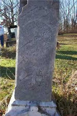
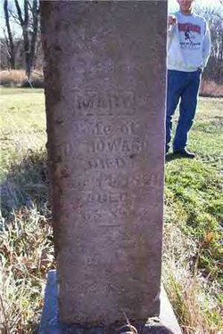
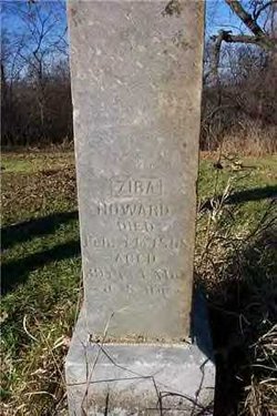
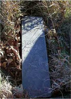
| Description | : | Daniel Howard was supposed to have run away from home at 13 or 14. He died on his farm in Grafton Twp, Cedar, IA where the Howard Cemetery is located. The Howard Cemetery sits at the top of a very steep hill over looking the Cedar River Valley, where you can see for miles. To reach it you must cross a creek. The cemetery is on the original farm of Daniel Howard. The present owner's family (Slach) purchased the farm in 1905 from the Vincent family. It is said that the last buriel was in 1939.... Read More |
frequently asked questions (FAQ):
-
Where is Daniel Howard's memorial?
Daniel Howard's memorial is located at: Howard Cemetery, Plato, Cedar County, USA.
-
When did Daniel Howard death?
Daniel Howard death on 24 Oct 1892 in Cedar County, Iowa, USA
-
Where are the coordinates of the Daniel Howard's memorial?
Latitude: 41.7486303
Longitude: -91.2918299
Family Members:
Parent
Spouse
Siblings
Children
Nearby Cemetories:
1. Howard Cemetery
Plato, Cedar County, USA
Coordinate: 41.7486303, -91.2918299
2. Saint Joseph Cemetery
Cedar Valley, Cedar County, USA
Coordinate: 41.7295000, -91.2667000
3. United Brethren Cemetery
Cedar County, USA
Coordinate: 41.7445000, -91.3285000
4. Shawver Cemetery
Cedar Bluff, Cedar County, USA
Coordinate: 41.7877998, -91.2874985
5. Honey Grove Cemetery
Cedar County, USA
Coordinate: 41.7158012, -91.3266983
6. Evergreen Hill Cemetery
Cedar Bluff, Cedar County, USA
Coordinate: 41.7867012, -91.3305969
7. Woodbridge Cemetery
Buchanan, Cedar County, USA
Coordinate: 41.7644005, -91.2294006
8. Saint Bridgets Cemetery
Solon, Johnson County, USA
Coordinate: 41.7779290, -91.3748950
9. Mason-Wallick Cemetery
Cedar Bluff, Cedar County, USA
Coordinate: 41.8199997, -91.3106003
10. Springdale Cemetery
Springdale, Cedar County, USA
Coordinate: 41.6786003, -91.2581024
11. North Liberty Cemetery
Springdale, Cedar County, USA
Coordinate: 41.6852989, -91.2292023
12. Kizer-Burns Cemetery
Tipton, Cedar County, USA
Coordinate: 41.7559130, -91.1854800
13. Saint Bernadette Catholic Church
West Branch, Cedar County, USA
Coordinate: 41.6755750, -91.3396070
14. West Branch Cemetery
West Branch, Cedar County, USA
Coordinate: 41.6765000, -91.3515000
15. Oasis Cemetery
Oasis, Johnson County, USA
Coordinate: 41.7005997, -91.3858032
16. Mount Zion Church Cemetery
Cedar County, USA
Coordinate: 41.7343000, -91.1790000
17. Hickory Grove Cemetery
Cedar County, USA
Coordinate: 41.6637000, -91.3073000
18. Friends Village Cemetery
West Branch, Cedar County, USA
Coordinate: 41.6732000, -91.3470000
19. Wentzel Cemetery
Mechanicsville, Cedar County, USA
Coordinate: 41.8379000, -91.2890000
20. Chamness Burial Plot
Springdale, Cedar County, USA
Coordinate: 41.6597351, -91.3182108
21. Herbert Hoover National Historic Site
West Branch, Cedar County, USA
Coordinate: 41.6681500, -91.3519900
22. Sand Hill Cemetery
Tipton, Cedar County, USA
Coordinate: 41.7905998, -91.1817017
23. Pee Dee Cemetery
Cedar County, USA
Coordinate: 41.6699982, -91.2142029
24. Goodale Cemetery
Tipton, Cedar County, USA
Coordinate: 41.7219380, -91.1567400


