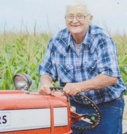
Darrell Dean “Darry” Ruggeberg
| Birth | : | 20 Feb 1943 Lost Nation, Clinton County, Iowa, USA |
| Death | : | 30 Jan 2018 Lime Springs, Howard County, Iowa, USA |
| Burial | : | Chester Hill Cemetery, Chester, Howard County, USA |
| Coordinate | : | 43.4897003, -92.4072037 |
| Description | : | Darrell Dean “Darry” Ruggeberg, 74 of Lime Springs, IA passed away peacefully at home surrounded by family and friends after his year long battle with cancer. Darrell was born February 20, 1943, at home in Lost Nation, IA, to Darrell L. and Nadine (Schnede) Ruggeberg. He graduated from Wheatland High School in 1960. After graduation he farmed in the Wheatland area. He married his high school sweetheart, Marian Kay Hass, on July 30, 1961, in Wheatland, IA, and started a family. They moved to Lime Springs, IA in 1969, where they currently reside. Darrell and... Read More |
frequently asked questions (FAQ):
-
Where is Darrell Dean “Darry” Ruggeberg's memorial?
Darrell Dean “Darry” Ruggeberg's memorial is located at: Chester Hill Cemetery, Chester, Howard County, USA.
-
When did Darrell Dean “Darry” Ruggeberg death?
Darrell Dean “Darry” Ruggeberg death on 30 Jan 2018 in Lime Springs, Howard County, Iowa, USA
-
Where are the coordinates of the Darrell Dean “Darry” Ruggeberg's memorial?
Latitude: 43.4897003
Longitude: -92.4072037
Family Members:
Parent
Siblings
Children
Flowers:
Nearby Cemetories:
1. Chester Hill Cemetery
Chester, Howard County, USA
Coordinate: 43.4897003, -92.4072037
2. Bethlehem Cemetery
Fillmore County, USA
Coordinate: 43.5303001, -92.3486023
3. Bethany Lutheran Cemetery
Le Roy, Mower County, USA
Coordinate: 43.5588989, -92.4794006
4. Le Roy Lutheran Cemetery
Le Roy, Mower County, USA
Coordinate: 43.5217750, -92.5196340
5. Saint Patricks Cemetery
Le Roy, Mower County, USA
Coordinate: 43.5217018, -92.5207977
6. Le Roy Cemetery
Le Roy, Mower County, USA
Coordinate: 43.5214005, -92.5227966
7. Bloomfield Lutheran Church Cemetery
Ostrander, Fillmore County, USA
Coordinate: 43.5932999, -92.4085999
8. Canfield Cemetery
Fillmore County, USA
Coordinate: 43.5305595, -92.2680588
9. Pleasant Hill Cemetery
Lime Springs, Howard County, USA
Coordinate: 43.4502983, -92.2671967
10. Saratoga Township Cemetery
Saratoga, Howard County, USA
Coordinate: 43.3710000, -92.4023000
11. Etna Cemetery
Etna, Fillmore County, USA
Coordinate: 43.6025009, -92.3538971
12. Love Cemetery
York, Fillmore County, USA
Coordinate: 43.5531845, -92.2575226
13. Foreston Cemetery
Howard County, USA
Coordinate: 43.4794006, -92.2331009
14. Ostrander Cemetery
Ostrander, Fillmore County, USA
Coordinate: 43.6167100, -92.4200400
15. Cherry Grove Cemetery
Cherry Grove, Fillmore County, USA
Coordinate: 43.5875015, -92.2880630
16. Wayne Cemetery
McIntire, Mitchell County, USA
Coordinate: 43.4411011, -92.5744019
17. Saetersdal Norwegian Evangelical Lutheran Cemetery
Harmony, Fillmore County, USA
Coordinate: 43.5315018, -92.2290268
18. Old Bloomfield Cemetery
Bloomfield Township, Fillmore County, USA
Coordinate: 43.6380200, -92.4090600
19. Bennington Pioneer Cemetery
Mower County, USA
Coordinate: 43.6013565, -92.5503693
20. Duff Cemetery
Fillmore County, USA
Coordinate: 43.6305618, -92.3183289
21. Bennington Cemetery
Le Roy, Mower County, USA
Coordinate: 43.6258011, -92.5093994
22. Bristol Grove Cemetery
Bristol, Fillmore County, USA
Coordinate: 43.5435867, -92.2045212
23. Riverside Cemetery
Riceville, Mitchell County, USA
Coordinate: 43.3676834, -92.5576324
24. Greenleafton Cemetery
Greenleafton, Fillmore County, USA
Coordinate: 43.5819397, -92.2180634


