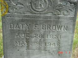
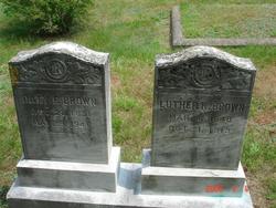
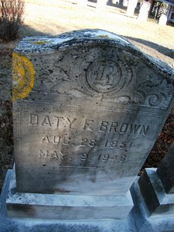
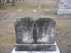
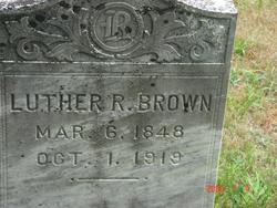
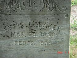
Daty Frances Baker Brown
| Birth | : | 28 Aug 1851 Yarmouth, Barnstable County, Massachusetts, USA |
| Death | : | 9 May 1946 |
| Burial | : | Saint Marys Cemetery, Rochester, Strafford County, USA |
| Coordinate | : | 43.2885160, -70.9666660 |
| Plot | : | Lot 19 |
| Description | : | Holbrook, Jay Mack, MA Vital Records-Yarmouth 1665-1890, Fiche 39, p. 10, line 47, Birth of Data Frances Baker, female, Aug. 28, 1851 in Yarmouth, parents Reuben & Huldah A. Baker, Seaman, father b. Dennis, mother b. Yarmouth. |
frequently asked questions (FAQ):
-
Where is Daty Frances Baker Brown's memorial?
Daty Frances Baker Brown's memorial is located at: Saint Marys Cemetery, Rochester, Strafford County, USA.
-
When did Daty Frances Baker Brown death?
Daty Frances Baker Brown death on 9 May 1946 in
-
Where are the coordinates of the Daty Frances Baker Brown's memorial?
Latitude: 43.2885160
Longitude: -70.9666660
Family Members:
Parent
Spouse
Siblings
Flowers:
Nearby Cemetories:
1. Saint Marys Cemetery
Rochester, Strafford County, USA
Coordinate: 43.2885160, -70.9666660
2. Old Cemetery
Rochester, Strafford County, USA
Coordinate: 43.2997210, -70.9683750
3. Rochester Cemetery
Rochester, Strafford County, USA
Coordinate: 43.3022003, -70.9630966
4. Gonic Village Cemetery
Gonic, Strafford County, USA
Coordinate: 43.2780420, -70.9797880
5. Holy Rosary Cemetery
Rochester, Strafford County, USA
Coordinate: 43.2933250, -70.9856770
6. Jenness cemetery
Rochester, Strafford County, USA
Coordinate: 43.2889088, -70.9450590
7. Brewster Farm Cemetery
Rochester, Strafford County, USA
Coordinate: 43.2958330, -70.9908330
8. French-Hussey Family Burial Ground
Rochester, Strafford County, USA
Coordinate: 43.2979400, -70.9918980
9. Haven Hill Cemetery
Rochester, Strafford County, USA
Coordinate: 43.2841988, -70.9385986
10. Otis Family Cemetery
Gonic, Strafford County, USA
Coordinate: 43.2692012, -70.9901888
11. Ham-Clark Cemetery
Gonic, Strafford County, USA
Coordinate: 43.2721260, -70.9952230
12. Hurd Cemetery
Gonic, Strafford County, USA
Coordinate: 43.2698590, -70.9938210
13. Old Town Cemetery
Rochester, Strafford County, USA
Coordinate: 43.3095200, -70.9913500
14. Ramsbottom Family Cemetery
Rochester, Strafford County, USA
Coordinate: 43.2669440, -70.9411110
15. Garland Cemetery
Gonic, Strafford County, USA
Coordinate: 43.2599400, -70.9801000
16. Clark Cemetery
Rochester, Strafford County, USA
Coordinate: 43.3009850, -71.0074390
17. Foss Cemetery
Rochester, Strafford County, USA
Coordinate: 43.2844800, -71.0113800
18. Furber Cemetery
Rochester, Strafford County, USA
Coordinate: 43.3026000, -71.0077000
19. Mont Calvaire Cemetery
Gonic, Strafford County, USA
Coordinate: 43.2568460, -70.9829700
20. Wingate Homestead Burial Ground
Rochester, Strafford County, USA
Coordinate: 43.3027780, -70.9244440
21. Roberts Burying Ground
Rochester, Strafford County, USA
Coordinate: 43.2969440, -70.9205560
22. Foss Family Cemetery
Rochester, Strafford County, USA
Coordinate: 43.2760360, -71.0156300
23. Daggett Cemetery
Rochester, Strafford County, USA
Coordinate: 43.2499060, -70.9774740
24. Allen Burying Ground
Rochester, Strafford County, USA
Coordinate: 43.2908980, -70.9102260

