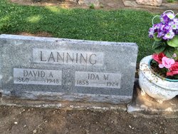
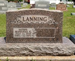
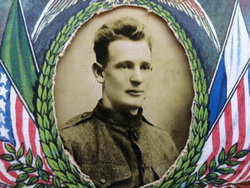
David Alonzo Lanning
| Birth | : | 20 Nov 1860 Oak Forest, Franklin County, Indiana, USA |
| Death | : | 6 Dec 1948 Lesage, Cabell County, West Virginia, USA |
| Burial | : | Maple Grove Cemetery, Brookville, Franklin County, USA |
| Coordinate | : | 39.4216995, -85.0216980 |
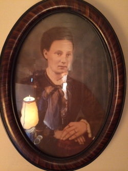
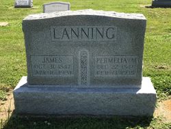
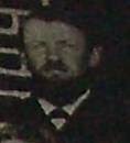
| Description | : | David Alonzo Lanning was the son of John H. Lanning and Leatha Ann O'Neal. He married Ida Mable Annabelle Reed on September 7, 1882 in Oak FOrest, Franklin County, Indiana. He went to West Virginia and died there, his body transported by train back to Indiana for burial (per David Lanning of Rushville, August 2014 conversation). |
frequently asked questions (FAQ):
-
Where is David Alonzo Lanning's memorial?
David Alonzo Lanning's memorial is located at: Maple Grove Cemetery, Brookville, Franklin County, USA.
-
When did David Alonzo Lanning death?
David Alonzo Lanning death on 6 Dec 1948 in Lesage, Cabell County, West Virginia, USA
-
Where are the coordinates of the David Alonzo Lanning's memorial?
Latitude: 39.4216995
Longitude: -85.0216980
Family Members:
Parent
Spouse
Siblings
Children
Flowers:
Nearby Cemetories:
1. Maple Grove Cemetery
Brookville, Franklin County, USA
Coordinate: 39.4216995, -85.0216980
2. Berg-Harding Cemetery
Highland Center, Franklin County, USA
Coordinate: 39.4241667, -85.0113889
3. Old Brookville Cemetery
Brookville, Franklin County, USA
Coordinate: 39.4248505, -85.0097122
4. Vincent Cemetery
Franklin County, USA
Coordinate: 39.4281000, -85.0328000
5. Saint Michael Cemetery
Brookville, Franklin County, USA
Coordinate: 39.4308070, -85.0095360
6. Stringer Cemetery
Brookville, Franklin County, USA
Coordinate: 39.4057270, -85.0126160
7. Infirmary Cemetery
Brookville, Franklin County, USA
Coordinate: 39.4056000, -85.0125000
8. Martin Cemetery
Brookville, Franklin County, USA
Coordinate: 39.4189000, -85.0478000
9. Warne Cemetery
Brookville, Franklin County, USA
Coordinate: 39.4336000, -85.0472000
10. Stoops Cemetery
Brookville, Franklin County, USA
Coordinate: 39.4249100, -85.0518900
11. Bradburn Family Cemetery
Brookville, Franklin County, USA
Coordinate: 39.4138640, -84.9825850
12. Brookville Township Cemetery
Brookville, Franklin County, USA
Coordinate: 39.4347000, -84.9828000
13. Woodworth Cemetery
Brookville, Franklin County, USA
Coordinate: 39.4078000, -84.9811000
14. Elder Cemetery
Brookville, Franklin County, USA
Coordinate: 39.3986250, -84.9848120
15. Saint Philomena Cemetery
Brookville, Franklin County, USA
Coordinate: 39.3914250, -85.0485390
16. Meyncke Cemetery
Brookville, Franklin County, USA
Coordinate: 39.3881660, -85.0016050
17. Wilson Cemetery
Yellow Bank, Franklin County, USA
Coordinate: 39.4303000, -85.0683000
18. Calpha Cemetery
Brookville, Franklin County, USA
Coordinate: 39.4260990, -85.0706760
19. Little Cedar Public Cemetery
Mound Haven, Franklin County, USA
Coordinate: 39.3911066, -84.9868303
20. West Family Cemetery
Brookville, Franklin County, USA
Coordinate: 39.4019300, -84.9700200
21. Utsler Cemetery
Brookville, Franklin County, USA
Coordinate: 39.3806000, -84.9961000
22. Little Cedar Grove Baptist Meeting House Cemetery
Franklin County, USA
Coordinate: 39.3872414, -84.9817886
23. Halstead Cemetery
Brookville, Franklin County, USA
Coordinate: 39.4357010, -85.0788050
24. Collett Cemetery
Yellow Bank, Franklin County, USA
Coordinate: 39.4417940, -85.0763440


