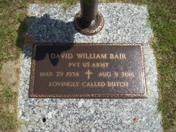
David William Bair
| Birth | : | 29 Mar 1938 Elloree, Orangeburg County, South Carolina, USA |
| Death | : | 9 Aug 2016 Manning, Clarendon County, South Carolina, USA |
| Burial | : | Santee First Baptist Cemetery, Elloree, Orangeburg County, USA |
| Coordinate | : | 33.5553700, -80.6018080 |
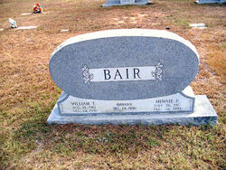
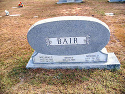
| Description | : | David William Bair, 78, husband of Charlotte Ann Sims Bair, died Tuesday, August 9, 2016, at McLeod Hospital. Born March 29, 1938, in Elloree, he was a son of the late William Taft Bair and the late Minnie Lee Perkins Bair. He was a US Army veteran, a member of the American Legion, Woodman of the World and he was a Mason. He was an active member of Santee Baptist Church. |
frequently asked questions (FAQ):
-
Where is David William Bair's memorial?
David William Bair's memorial is located at: Santee First Baptist Cemetery, Elloree, Orangeburg County, USA.
-
When did David William Bair death?
David William Bair death on 9 Aug 2016 in Manning, Clarendon County, South Carolina, USA
-
Where are the coordinates of the David William Bair's memorial?
Latitude: 33.5553700
Longitude: -80.6018080
Family Members:
Parent
Flowers:
Nearby Cemetories:
1. Santee First Baptist Cemetery
Elloree, Orangeburg County, USA
Coordinate: 33.5553700, -80.6018080
2. Elloree Hillcrest Cemetery
Elloree, Orangeburg County, USA
Coordinate: 33.5608720, -80.6099720
3. Bookhart Cemetery
Elloree, Orangeburg County, USA
Coordinate: 33.5485992, -80.5924988
4. Mount Zion AME Church Cemetery
Creston, Calhoun County, USA
Coordinate: 33.5689940, -80.6151050
5. Trinity Lutheran Church Cemetery
Elloree, Orangeburg County, USA
Coordinate: 33.5603720, -80.5659850
6. Browning Branch Cemetery
Elloree, Orangeburg County, USA
Coordinate: 33.5231820, -80.5632140
7. Union AME Church Cemetery
Calhoun County, USA
Coordinate: 33.5840910, -80.5575110
8. Hungerpiller Family Cemetery
Elloree, Orangeburg County, USA
Coordinate: 33.5049010, -80.6123380
9. Brown Chapel AME Church Cemetery
Calhoun County, USA
Coordinate: 33.5255490, -80.6531950
10. Brown Chapel AME Church Cemetery
Elloree, Orangeburg County, USA
Coordinate: 33.5253550, -80.6530780
11. Jericho Methodist Church Cemetery
Cameron, Calhoun County, USA
Coordinate: 33.5330010, -80.6625040
12. New Faith Community Church Cemetery
Elloree, Orangeburg County, USA
Coordinate: 33.5229150, -80.5477570
13. Magrill Family Cemetery
Calhoun County, USA
Coordinate: 33.5601790, -80.5354270
14. Smith Family Cemetery
Midway, Calhoun County, USA
Coordinate: 33.5129060, -80.6501570
15. Smith-Dantzler Cemetery
Elloree, Orangeburg County, USA
Coordinate: 33.4941130, -80.6052520
16. Haynes Chapel AME Church Cemetery
Cameron, Calhoun County, USA
Coordinate: 33.6130110, -80.5751970
17. Granger Baptist Church Cemetery
Elloree, Orangeburg County, USA
Coordinate: 33.4909840, -80.6030410
18. Gresham Cemetery
Orangeburg County, USA
Coordinate: 33.4906006, -80.6031036
19. Jerusalem Cemetery
Elloree, Orangeburg County, USA
Coordinate: 33.5102340, -80.5447570
20. McGrew Cemetery
Elloree, Orangeburg County, USA
Coordinate: 33.4859880, -80.6027150
21. Bodrick Cemetery
Lone Star, Calhoun County, USA
Coordinate: 33.6245880, -80.5891440
22. Cedar Grove Baptist Church Cemetery
Lone Star, Calhoun County, USA
Coordinate: 33.6259320, -80.5947950
23. Shady Grove Methodist Church Cemetery
Cameron, Calhoun County, USA
Coordinate: 33.5896560, -80.6767060
24. Irick Cemetery
Lone Star, Calhoun County, USA
Coordinate: 33.6283580, -80.5924100


