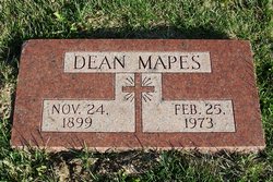
Dean Mapes
| Birth | : | 24 Nov 1899 Nebraska, USA |
| Death | : | 25 Feb 1973 Omaha, Douglas County, Nebraska, USA |
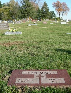
| Burial | : | Pleasant Ridge Cemetery, Plattsmouth, Cass County, USA |
| Coordinate | : | 40.9735985, -95.8827972 |
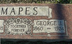
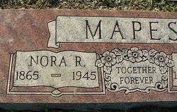
| Description | : | Dean Mapes Nov. 24, 1899 - Feb. 25, 1973 Information from ancestry.com 1900 United States Federal Census Name: Cary Mapes. Race: White. Gender: Male. Age: 6/12 Birth Date: Nov 1899 Place: Nebraska Home in 1900: Rock Bluffs, Cass, Nebraska Relation to Head of House: Son Father's Name: George Mapes Father's Birthplace: Ohio Mother's Name: Nora Mapes Mother's Birthplace: Ohio Household Members: Name Age George Mapes 39 (Father) Nora Mapes 36 (Lenora Rainey Mapes Mother) Walter Mapes 16 (brother)& Charley Mapes 13 (brother) Troy Mapes 10 (Brother)& Jessie Mapes 8 (sister) Cary Mapes 6/12 (believed to be Dean) 1930... Read More |
frequently asked questions (FAQ):
-
Where is Dean Mapes's memorial?
Dean Mapes's memorial is located at: Pleasant Ridge Cemetery, Plattsmouth, Cass County, USA.
-
When did Dean Mapes death?
Dean Mapes death on 25 Feb 1973 in Omaha, Douglas County, Nebraska, USA
-
Where are the coordinates of the Dean Mapes's memorial?
Latitude: 40.9735985
Longitude: -95.8827972
Family Members:
Parent
Siblings
Flowers:
Nearby Cemetories:
1. Pleasant Ridge Cemetery
Plattsmouth, Cass County, USA
Coordinate: 40.9735985, -95.8827972
2. Doom Family Cemetery
Cass County, USA
Coordinate: 40.9550000, -95.8575000
3. Billings Cemetery
Plattsmouth, Cass County, USA
Coordinate: 41.0025000, -95.8897000
4. Youngs Cemetery
Murray, Cass County, USA
Coordinate: 40.9406013, -95.9039001
5. Oak Hill Cemetery
Plattsmouth, Cass County, USA
Coordinate: 41.0106010, -95.9124985
6. Clemmons Cemetery
Murray, Cass County, USA
Coordinate: 40.9300003, -95.8961029
7. Holy Sepulchre Cemetery
Plattsmouth, Cass County, USA
Coordinate: 41.0122660, -95.9128240
8. Rock Bluff Cemetery
Plattsmouth, Cass County, USA
Coordinate: 40.9150009, -95.8469009
9. Van Eaton Cemetery
Pacific Junction, Mills County, USA
Coordinate: 40.9388800, -95.7919400
10. Lewiston Cemetery
Union, Cass County, USA
Coordinate: 40.8856087, -95.8936539
11. Eight Mile Grove Cemetery
Cass County, USA
Coordinate: 40.9509239, -95.9979324
12. Kenosha Cemetery
Cass County, USA
Coordinate: 40.8750000, -95.8427963
13. LaPlatte Cemetery
La Platte, Sarpy County, USA
Coordinate: 41.0694008, -95.9336014
14. Martin Chapel Cemetery
Pacific City, Mills County, USA
Coordinate: 41.0611000, -95.8013992
15. Walnut Hill Cemetery
Mills County, USA
Coordinate: 40.9232900, -95.7517100
16. Godsey Cemetery
Mills County, USA
Coordinate: 41.0705986, -95.8075027
17. Waubonsie Cemetery
Mills County, USA
Coordinate: 40.9451370, -95.7310791
18. Gowens-Turner Cemetery
Glenwood, Mills County, USA
Coordinate: 41.0715510, -95.7952420
19. Otterbein Cemetery
Cass County, USA
Coordinate: 40.8856010, -95.9963989
20. Glenwood Resource Center Cemetery
Glenwood, Mills County, USA
Coordinate: 41.0361720, -95.7338590
21. Buck Cemetery
Cass County, USA
Coordinate: 40.8499985, -95.9403000
22. Mackey Cemetery
Glenwood, Mills County, USA
Coordinate: 40.9017070, -95.7376100
23. Glenwood Cemetery
Glenwood, Mills County, USA
Coordinate: 41.0599670, -95.7480240
24. Glenwood Catholic Cemetery
Glenwood, Mills County, USA
Coordinate: 41.0600000, -95.7453000


