
| Memorials | : | 70 |
| Location | : | Glenwood, Mills County, USA |
| Coordinate | : | 41.0361720, -95.7338590 |
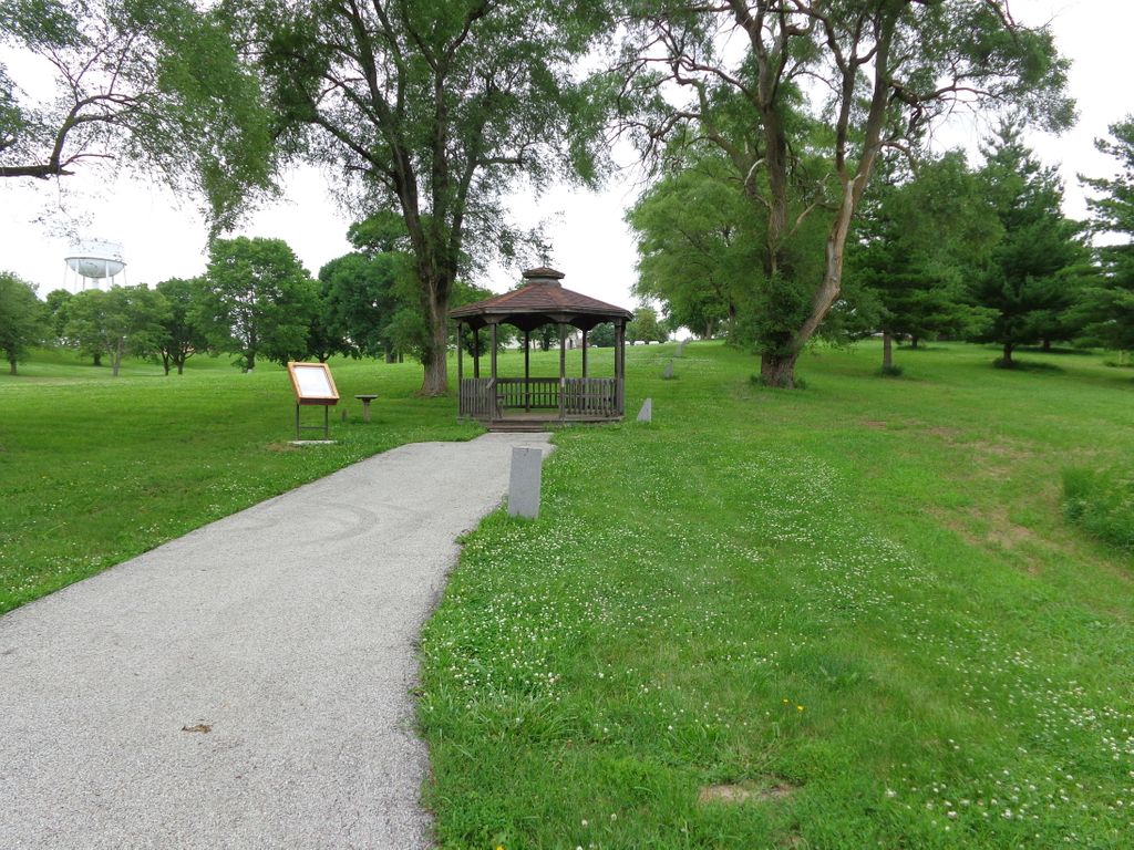
| Description | : | Originally established in 1866 as a Civil War Orphan’s Home, reportedly including evangelist Billy Sunday as one of its residents. In the 1870’s it became the first Iowa Institution for Feeble-Minded Children. In 1935 it became the Glenwood State-Hospital School. It is now known as the Glenwood Resource Center. The cemetery is accessed from the middle of the Resource Center by a single lane road to the south end, to where a gazebo and display case are located. A plot diagram in the display case reflects last names and plot locations. The cemetery markers have gone through... Read More |
frequently asked questions (FAQ):
-
Where is Glenwood Resource Center Cemetery?
Glenwood Resource Center Cemetery is located at Glenwood, Mills County ,Iowa ,USA.
-
Glenwood Resource Center Cemetery cemetery's updated grave count on graveviews.com?
70 memorials
-
Where are the coordinates of the Glenwood Resource Center Cemetery?
Latitude: 41.0361720
Longitude: -95.7338590
Nearby Cemetories:
1. Glenwood Catholic Cemetery
Glenwood, Mills County, USA
Coordinate: 41.0600000, -95.7453000
2. Glenwood Cemetery
Glenwood, Mills County, USA
Coordinate: 41.0599670, -95.7480240
3. Bomar Family Cemetery
Mills County, USA
Coordinate: 41.0369400, -95.6941700
4. Mills County Farm Cemetery
Glenwood, Mills County, USA
Coordinate: 41.0417930, -95.6756530
5. Martin Chapel Cemetery
Pacific City, Mills County, USA
Coordinate: 41.0611000, -95.8013992
6. Gowens-Turner Cemetery
Glenwood, Mills County, USA
Coordinate: 41.0715510, -95.7952420
7. West Liberty Cemetery
Glenwood, Mills County, USA
Coordinate: 41.0956001, -95.7536011
8. Godsey Cemetery
Mills County, USA
Coordinate: 41.0705986, -95.8075027
9. Hillsdale Cemetery
Glenwood, Mills County, USA
Coordinate: 41.0097008, -95.6427994
10. Waubonsie Cemetery
Mills County, USA
Coordinate: 40.9451370, -95.7310791
11. Saar's Field Cemetery
Mills County, USA
Coordinate: 41.1255500, -95.7725000
12. Estes Cemetery
Tabor, Mills County, USA
Coordinate: 40.9425011, -95.7080994
13. Silver City Cemetery
Silver City, Mills County, USA
Coordinate: 41.1042442, -95.6380005
14. Wall Cemetery
Mineola, Mills County, USA
Coordinate: 41.1157990, -95.8153000
15. Fairview Cemetery
Tabor, Mills County, USA
Coordinate: 40.9453011, -95.6716995
16. East Liberty Cemetery
Malvern, Mills County, USA
Coordinate: 41.0592346, -95.6005020
17. Saint Boniface Catholic Cemetery
Mills County, USA
Coordinate: 41.1419000, -95.7467100
18. Van Eaton Cemetery
Pacific Junction, Mills County, USA
Coordinate: 40.9388800, -95.7919400
19. Mineola Cemetery
Mineola, Mills County, USA
Coordinate: 41.1391130, -95.6941800
20. Walnut Hill Cemetery
Mills County, USA
Coordinate: 40.9232900, -95.7517100
21. Pottawattamie Chief Waubonsie Burial Site
Mills County, USA
Coordinate: 40.9236100, -95.7086100
22. Salem Lutheran Church Cemetery
Glenwood, Mills County, USA
Coordinate: 41.1556015, -95.7617035
23. Billings Cemetery
Plattsmouth, Cass County, USA
Coordinate: 41.0025000, -95.8897000
24. Doom Family Cemetery
Cass County, USA
Coordinate: 40.9550000, -95.8575000