
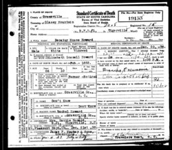
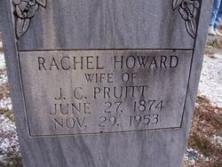
Decatur Moses Howard
| Birth | : | Feb 1852 Glassy, Greenville County, South Carolina, USA |
| Death | : | 20 Dec 1938 Tigerville, Greenville County, South Carolina, USA |
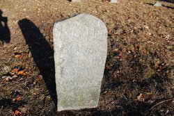
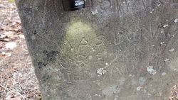
| Burial | : | Hillcrest Cemetery, Gallup, McKinley County, USA |
| Coordinate | : | 35.5214005, -108.7525024 |
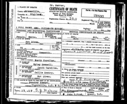
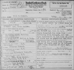
| Description | : | SOURCE: Greenville News, Page 6 DATE: Wednesday, December 21, 1938 DECATUR M. HOWARD Decatur M. Howard, life-long resident of Glassy Mountain township of Greenville County, died at the home of his granddaughter, Mrs. Hattie Howard, near Tigerville, shortly after 1 o'clock yesterday afternoon following two weeks of illness. Mr. Howard was 86 years of age and during his active years had been engaged in farming. He was a member of Mount Pleasant Baptist Church. His wife, Mrs. Elizabeth Gosnell Howard died 11 years ago on December 20. Mr. Howard... Read More |
frequently asked questions (FAQ):
-
Where is Decatur Moses Howard's memorial?
Decatur Moses Howard's memorial is located at: Hillcrest Cemetery, Gallup, McKinley County, USA.
-
When did Decatur Moses Howard death?
Decatur Moses Howard death on 20 Dec 1938 in Tigerville, Greenville County, South Carolina, USA
-
Where are the coordinates of the Decatur Moses Howard's memorial?
Latitude: 35.5214005
Longitude: -108.7525024
Family Members:
Parent
Spouse
Siblings
Children
Flowers:


Nearby Cemetories:
1. Hillcrest Cemetery
Gallup, McKinley County, USA
Coordinate: 35.5214005, -108.7525024
2. Cathedral of the Sacred Heart Crypt
Gallup, McKinley County, USA
Coordinate: 35.5258450, -108.7357330
3. Gallup State Veterans Cemetery
Gallup, McKinley County, USA
Coordinate: 35.5358950, -108.7086870
4. Gallup City Cemetery
Gallup, McKinley County, USA
Coordinate: 35.5016320, -108.8400220
5. Sunset Memorial Park
Gallup, McKinley County, USA
Coordinate: 35.5028770, -108.8443640
6. Rehoboth Mission Cemetery
Rehoboth, McKinley County, USA
Coordinate: 35.5286640, -108.6540990
7. Pinehaven Cemetery
Pinehaven, McKinley County, USA
Coordinate: 35.3518982, -108.7268982
8. Torreon Cemetery
McKinley County, USA
Coordinate: 35.3722000, -108.5250015
9. McGaffey Cemetery
McGaffey, McKinley County, USA
Coordinate: 35.3703003, -108.5224991
10. Pine Tree Cemetery
Vanderwagen, McKinley County, USA
Coordinate: 35.2658410, -108.7540080
11. Pinedale Cemetery
Pinedale, McKinley County, USA
Coordinate: 35.6113860, -108.4498390
12. Family Cemeteries
Apache County, USA
Coordinate: 35.3595472, -109.0677722
13. Bowman Memorial Park
Apache County, USA
Coordinate: 35.4192009, -109.1072006
14. Saint Michaels Cemetery
Saint Michaels, Apache County, USA
Coordinate: 35.6431900, -109.0986900
15. Navajo Veterans Cemetery
Fort Defiance, Apache County, USA
Coordinate: 35.7226600, -109.0553390
16. Lone Pine Cemetery
Mexican Springs, McKinley County, USA
Coordinate: 35.8258018, -108.8771973
17. Good Shepherd Mission Cemetery
Fort Defiance, Apache County, USA
Coordinate: 35.7429100, -109.0705680
18. Tohatchi Cemetery
Tohatchi, McKinley County, USA
Coordinate: 35.8626080, -108.7582670
19. Mormon Colony Cemetery
Cibola County, USA
Coordinate: 35.1730995, -108.4661026
20. Standing Rock Cemetery
Standing Rock, McKinley County, USA
Coordinate: 35.8014560, -108.3614590
21. New Houck Veteran and Community Cemetery
Houck, Apache County, USA
Coordinate: 35.2791732, -109.1883917
22. Ramah Cemetery
Ramah, McKinley County, USA
Coordinate: 35.1258011, -108.4950027
23. Houck Community Cemetery
Houck, Apache County, USA
Coordinate: 35.2851790, -109.2333750
24. Thoreau Cemetery
Thoreau, McKinley County, USA
Coordinate: 35.4082450, -108.2066630