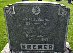
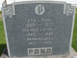
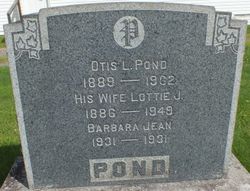
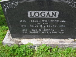
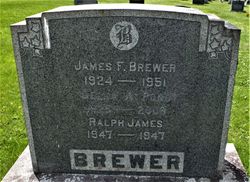
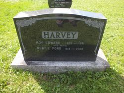
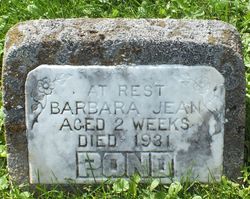
Della Alice Pond Brewer
| Birth | : | 1 Oct 1925 Woodstock, Carleton County, New Brunswick, Canada |
| Death | : | 9 Dec 2008 Woodstock, Carleton County, New Brunswick, Canada |
| Burial | : | Saint Peter's Presbyterian Cemetery, Stanley, York County, Canada |
| Coordinate | : | 46.2737100, -66.7431400 |
| Description | : | With profound sadness the family wishes to announce the death of Della A. Donovan (nee Pond) at Carleton Manor, Woodstock, NB on Tuesday, December 9, 2008. Born in Woodlands in 1925, she was the daughter of the late Otis and Lottie Pond. A former resident of Stanley and Fredericton, she leaves her daughter, Bonnie (Brewer) and her husband, Tom Sproull of Woodstock, NB; her son, Arthur Logan and his wife, Heather (Holt) of Stanley, NB; Dee is survived by her cherished grandchildren, Sonja (Sproull) Wright (Michael) of Florenceville, NB, John Sproull (Andrea Gormley) and James Sproull (Cindy MacBride) both of... Read More |
frequently asked questions (FAQ):
-
Where is Della Alice Pond Brewer's memorial?
Della Alice Pond Brewer's memorial is located at: Saint Peter's Presbyterian Cemetery, Stanley, York County, Canada.
-
When did Della Alice Pond Brewer death?
Della Alice Pond Brewer death on 9 Dec 2008 in Woodstock, Carleton County, New Brunswick, Canada
-
Where are the coordinates of the Della Alice Pond Brewer's memorial?
Latitude: 46.2737100
Longitude: -66.7431400
Family Members:
Parent
Spouse
Siblings
Flowers:
Nearby Cemetories:
1. Saint Peter's Presbyterian Cemetery
Stanley, York County, Canada
Coordinate: 46.2737100, -66.7431400
2. Old Catholic Cemetery
Stanley, York County, Canada
Coordinate: 46.2810800, -66.7410000
3. St. Patrick’s Roman Catholic Cemetery
Stanley, York County, Canada
Coordinate: 46.2883540, -66.7340490
4. Hillcrest United Church Cemetery
Stanley, York County, Canada
Coordinate: 46.2954581, -66.7315725
5. Cross Creek Baptist Cemetery
Cross Creek, York County, Canada
Coordinate: 46.2965570, -66.7302099
6. Sterling United Church Cemetery
Tay Creek, York County, Canada
Coordinate: 46.2464250, -66.8202667
7. St. James Anglican Church Cemetery
Tay Creek, York County, Canada
Coordinate: 46.2458250, -66.8206984
8. Williamsburg Community Cemetery
Williamsburg, York County, Canada
Coordinate: 46.3383868, -66.7883562
9. St. Joseph’s Roman Catholic Church Cemetery
Tay Creek, York County, Canada
Coordinate: 46.2082498, -66.8063516
10. Woodland Community Cemetery
Woodlands, York County, Canada
Coordinate: 46.1804680, -66.7667470
11. Nashwaak Bridge Community Cemetery
Nashwaak Bridge, York County, Canada
Coordinate: 46.2400100, -66.6050900
12. 42nd Highland Memorial Cemetery
Nashwaak Bridge, York County, Canada
Coordinate: 46.2124510, -66.6136600
13. Cardigan United Church Cemetery
Cardigan, York County, Canada
Coordinate: 46.1579400, -66.7887300
14. Nashwaak Valley Pentecostal Church Cemetery
Taymouth, York County, Canada
Coordinate: 46.1919390, -66.6087720
15. Taymouth Donald Ross original Property
Taymouth, York County, Canada
Coordinate: 46.1828700, -66.6173500
16. Taymouth Bell Property Cemetery
Taymouth, York County, Canada
Coordinate: 46.1814600, -66.6194200
17. Taymouth Community Cemetery
Taymouth, York County, Canada
Coordinate: 46.1796480, -66.6123310
18. Cardigan Welsh Heritage Cemetery
Cardigan, York County, Canada
Coordinate: 46.1462400, -66.7841800
19. Taymouth Urquhart Property
Taymouth, York County, Canada
Coordinate: 46.1822600, -66.6078500
20. McGivney Community Cemetery
McGivney, York County, Canada
Coordinate: 46.3599900, -66.5568900
21. Zionville Cemetery
Zionville, York County, Canada
Coordinate: 46.2030300, -66.5371900
22. Birdton United Church Cemetery
Birdton, York County, Canada
Coordinate: 46.1117740, -66.8209860
23. Saint Peter's Anglican Church Cemetery
Nashwaak, York County, Canada
Coordinate: 46.1229968, -66.6101600
24. Dorn Ridge Cemetery
Dorn Ridge, York County, Canada
Coordinate: 46.1386000, -66.9276000

