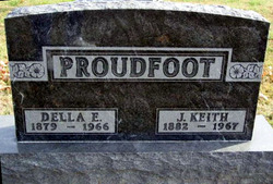
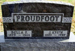
Delphy Elizabeth “Della” Hart Proudfoot
| Birth | : | 19 Jun 1879 Liberty, Clarke County, Iowa, USA |
| Death | : | 1 Jul 1966 |
| Burial | : | Apple Tree Creek Cemetery, Apple Tree Creek, Bundaberg Region, Australia |
| Coordinate | : | -25.2254030, 152.2386650 |
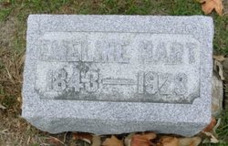
| Description | : | Della was a cousin. She was the daughter of Samuel HART & Emeline C. MILER. She was the wife of Jacob Keith PROUDFOOT, married in 1910, in Clarke Co., IA. Their son was Paul Eugene PROUDFOOT. Della was a school teacher. |
frequently asked questions (FAQ):
-
Where is Delphy Elizabeth “Della” Hart Proudfoot's memorial?
Delphy Elizabeth “Della” Hart Proudfoot's memorial is located at: Apple Tree Creek Cemetery, Apple Tree Creek, Bundaberg Region, Australia.
-
When did Delphy Elizabeth “Della” Hart Proudfoot death?
Delphy Elizabeth “Della” Hart Proudfoot death on 1 Jul 1966 in
-
Where are the coordinates of the Delphy Elizabeth “Della” Hart Proudfoot's memorial?
Latitude: -25.2254030
Longitude: 152.2386650
Family Members:
Parent
Spouse
Siblings
Children
Flowers:
Nearby Cemetories:
1. Apple Tree Creek Cemetery
Apple Tree Creek, Bundaberg Region, Australia
Coordinate: -25.2254030, 152.2386650
2. Childers Lawn Cemetery
Childers, Bundaberg Region, Australia
Coordinate: -25.2241618, 152.2642764
3. Agnes Vale Station Cemetery
Childers, Bundaberg Region, Australia
Coordinate: -25.2720660, 152.2496070
4. Cordalba Cemetery
Cordalba, Bundaberg Region, Australia
Coordinate: -25.1562560, 152.2146830
5. Booyal Cemetery
Booyal, Bundaberg Region, Australia
Coordinate: -25.1758160, 152.0520170
6. Philips Private Cemetery
Pine Creek, Bundaberg Region, Australia
Coordinate: -25.0532680, 152.1633390
7. Walla Station Cemetery
Gin Gin, Bundaberg Region, Australia
Coordinate: -25.1250040, 151.9782540
8. Howard Remembrance Park
Howard, Fraser Coast Region, Australia
Coordinate: -25.3054360, 152.5470520
9. South Kolan Cemetery
South Kolan, Bundaberg Region, Australia
Coordinate: -24.9390920, 152.1427140
10. Bundaberg Crematorium and Memorial Park
Bundaberg, Bundaberg Region, Australia
Coordinate: -24.9131630, 152.2998890
11. Degilbo Cemetery
Degilbo, North Burnett Region, Australia
Coordinate: -25.4774440, 151.9982160
12. Bundaberg Catholic Cemetery
Bundaberg, Bundaberg Region, Australia
Coordinate: -24.8953620, 152.3426630
13. Gin Gin Cemetery
Gin Gin, Bundaberg Region, Australia
Coordinate: -24.9966870, 151.9487120
14. Bundaberg General Cemetery
Bundaberg, Bundaberg Region, Australia
Coordinate: -24.8844800, 152.3233800
15. Chowey Cemetery
Chowey, North Burnett Region, Australia
Coordinate: -25.4513533, 151.9287490
16. Original Bundaberg Cemetery (Defunct)
Bundaberg, Bundaberg Region, Australia
Coordinate: -24.8685900, 152.3465300
17. Springfield Gardens Crematorium
Calavos, Bundaberg Region, Australia
Coordinate: -24.8975850, 152.4578050
18. St Mary's Anglican Churchyard
Brooweena, Fraser Coast Region, Australia
Coordinate: -25.6155810, 152.2342900
19. Barlows Farm Cemetery
Takura, Fraser Coast Region, Australia
Coordinate: -25.3330030, 152.7191200
20. Maryborough Crematorium
Maryborough, Fraser Coast Region, Australia
Coordinate: -25.5116294, 152.6716756
21. Maryborough Lawn Cemetery
Maryborough, Fraser Coast Region, Australia
Coordinate: -25.5126410, 152.6731850
22. Maryborough Cemetery
Maryborough, Fraser Coast Region, Australia
Coordinate: -25.5165460, 152.6735930
23. Avondale Independent Cemetery
Rockhampton Region, Australia
Coordinate: -24.7368700, 152.1627900
24. Maryborough Pioneer Cemetery
Maryborough, Fraser Coast Region, Australia
Coordinate: -25.5232830, 152.6746380

