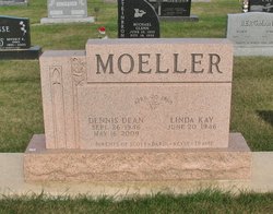
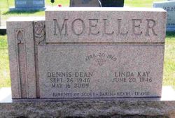
Dennis Dean Moeller
| Birth | : | 26 Sep 1946 Waterloo, Black Hawk County, Iowa, USA |
| Death | : | 16 May 2009 Klinger, Bremer County, Iowa, USA |
| Burial | : | Saint Matthew's Anglican Cemetery, New Norfolk, Derwent Valley Council, Australia |
| Coordinate | : | -42.7806289, 147.0664250 |
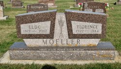
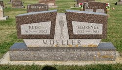
| Description | : | Dennis Dean Moeller, 62 of Klinger, rural Readlyn, Iowa, died on Saturday, May 16, 2009 at his home. Dennis was born on September 26, 1946, in Waterloo, Iowa, the son of Eldo and Florence (Koepke) Moeller. He was baptized and confirmed at Immanuel Lutheran Church, Klinger. He attended kindergarten through eighth grade at Immanuel Lutheran School and graduated from Wapsie Valley High School in 1964. After high school he joined his father on the farm and together they developed one of the top dairy herds in Bremer County during the 1970's and 1980's. Dennis was united in marriage to Linda Becker... Read More |
frequently asked questions (FAQ):
-
Where is Dennis Dean Moeller's memorial?
Dennis Dean Moeller's memorial is located at: Saint Matthew's Anglican Cemetery, New Norfolk, Derwent Valley Council, Australia.
-
When did Dennis Dean Moeller death?
Dennis Dean Moeller death on 16 May 2009 in Klinger, Bremer County, Iowa, USA
-
Where are the coordinates of the Dennis Dean Moeller's memorial?
Latitude: -42.7806289
Longitude: 147.0664250
Family Members:
Parent
Flowers:
Nearby Cemetories:
1. Saint Matthew's Anglican Cemetery
New Norfolk, Derwent Valley Council, Australia
Coordinate: -42.7806289, 147.0664250
2. St. Matthew’s Anglican Columbarium Wall
New Norfolk, Derwent Valley Council, Australia
Coordinate: -42.7792220, 147.0673080
3. New Norfolk Old Cemetery
New Norfolk, Derwent Valley Council, Australia
Coordinate: -42.7719330, 147.0579860
4. Lawitta Church Cemetery
Magra, Derwent Valley Council, Australia
Coordinate: -42.7661690, 147.0331060
5. Malbina General Cemetery
Malbina, Derwent Valley Council, Australia
Coordinate: -42.7866610, 147.1184830
6. Plenty Anglican Church Cemetery
Plenty, Derwent Valley Council, Australia
Coordinate: -42.7382900, 146.9605860
7. Jackman Graveyard
Collinsvale, Glenorchy City, Australia
Coordinate: -42.8406720, 147.1639470
8. Collinsvale Uniting Church Cemetery
Collinsvale, Glenorchy City, Australia
Coordinate: -42.8410560, 147.1991720
9. St. Mary's Anglican Cemetery
Bridgewater, Brighton Council, Australia
Coordinate: -42.7374010, 147.2282310
10. Hestercombe Uniting Church Cemetery
Austins Ferry, Glenorchy City, Australia
Coordinate: -42.7695190, 147.2448030
11. St. Augustine's Anglican Cemetery
Broadmarsh, Southern Midlands Council, Australia
Coordinate: -42.6380880, 147.1158740
12. Red Hills Cemetery
Bushy Park, Derwent Valley Council, Australia
Coordinate: -42.7091350, 146.8893740
13. St. Mary's Church of England Cemetery
Gretna, Central Highlands Council, Australia
Coordinate: -42.6669200, 146.9333810
14. Broadmarsh Congregational Cemetery
Broadmarsh, Southern Midlands Council, Australia
Coordinate: -42.6344620, 147.1129760
15. St. Paul's Anglican Church Cemetery
Glenorchy, Glenorchy City, Australia
Coordinate: -42.8275410, 147.2665830
16. Glenorchy Chapel Burial Ground
Glenorchy, Glenorchy City, Australia
Coordinate: -42.8317820, 147.2704320
17. St George's Church of England Cemetery
Gagebrook, Brighton Council, Australia
Coordinate: -42.7499706, 147.2793948
18. St Matthews Church Cemetery
Glenorchy, Glenorchy City, Australia
Coordinate: -42.8329730, 147.2743670
19. Pontville Saint Matthews Roman Catholic Cemetery
Brighton, Brighton Council, Australia
Coordinate: -42.6900390, 147.2629800
20. St. Mark's Anglican Cemetery
Pontville, Southern Midlands Council, Australia
Coordinate: -42.6807150, 147.2663860
21. St John’s Anglican Church Cemetery
New Town, Hobart City, Australia
Coordinate: -42.8550230, 147.2969180
22. New Town Congregational Cemetery
New Town, Hobart City, Australia
Coordinate: -42.8545680, 147.3026230
23. East Risdon Cemetery
Risdon, Clarence City, Australia
Coordinate: -42.8211910, 147.3184970
24. St. Michael's Anglican Cemetery
Bagdad, Southern Midlands Council, Australia
Coordinate: -42.6263790, 147.2226500


