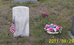
Donald C. “Bing” Burns
| Birth | : | 4 Mar 1914 Minneapolis, Hennepin County, Minnesota, USA |
| Death | : | 30 May 1980 Montana, USA |
| Burial | : | Nashua Cemetery, Nashua, Valley County, USA |
| Coordinate | : | 48.1425018, -106.3700027 |
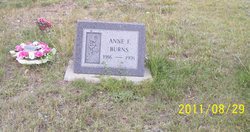
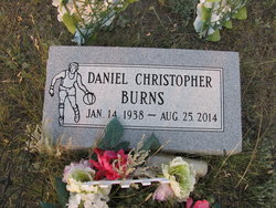
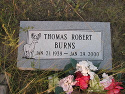
| Description | : | Resident of Fort Peck for a long span of years, Mr. Burns worked for the Corps of Engineers. Funeral services held at St. Raphael's Catholic Church in Glasgow, on June 1, 1980 with the Rev. William M. Cawley officiating. Parents: Christ Burns and Gena Hondo Burns Married to Anne F. Ihnat, August 15, 1936. The couple had four children: sons Thomas, Daniel, and Donald Burns, and daughter Maryann Burns O'Connor. |
frequently asked questions (FAQ):
-
Where is Donald C. “Bing” Burns's memorial?
Donald C. “Bing” Burns's memorial is located at: Nashua Cemetery, Nashua, Valley County, USA.
-
When did Donald C. “Bing” Burns death?
Donald C. “Bing” Burns death on 30 May 1980 in Montana, USA
-
Where are the coordinates of the Donald C. “Bing” Burns's memorial?
Latitude: 48.1425018
Longitude: -106.3700027
Family Members:
Spouse
Children
Flowers:
Nearby Cemetories:
1. Nashua Cemetery
Nashua, Valley County, USA
Coordinate: 48.1425018, -106.3700027
2. Memorial Gardens
Whately, Valley County, USA
Coordinate: 48.1646100, -106.4983100
3. Galpin Cemetery
Valley County, USA
Coordinate: 48.0732994, -106.4692001
4. Fort Peck Dam Disaster Memorial
Valley County, USA
Coordinate: 48.0083000, -106.4003000
5. Fort Peck Cemetery
Valley County, USA
Coordinate: 48.0069008, -106.4599991
6. Highland Cemetery
Glasgow, Valley County, USA
Coordinate: 48.2010994, -106.6205978
7. Sunset Rest Cemetery
Frazer, Valley County, USA
Coordinate: 48.0741997, -106.0369034
8. Saint Joseph Cemetery
Frazer, Valley County, USA
Coordinate: 48.0560989, -106.0413971
9. Oswego Presbyterian Cemetery
Oswego, Valley County, USA
Coordinate: 48.0428140, -105.8675410
10. Oswego Catholic Cemetery
Oswego, Valley County, USA
Coordinate: 48.0480230, -105.8586070
11. Lustre Mennonite Brethren Cemetery
Lustre, Valley County, USA
Coordinate: 48.3931670, -105.9796380
12. Bethel Lustre Mennonite Cemetery
Lustre, Valley County, USA
Coordinate: 48.4085000, -105.9995000
13. Prairie Elk Colony Cemetery
McCone County, USA
Coordinate: 48.0159000, -105.7970000
14. Evangelical Mennonite Brethren Church Cemetery
Lustre, Valley County, USA
Coordinate: 48.4500000, -105.9245000
15. Prairie Elk Cemetery
Wolf Point, Roosevelt County, USA
Coordinate: 47.9040851, -105.8199363
16. Chicken Hill Cemetery
Roosevelt County, USA
Coordinate: 48.0685997, -105.7193985
17. Larslan Cemetery
Valley County, USA
Coordinate: 48.5639000, -106.1744003
18. King Memorial Cemetery
Wolf Point, Roosevelt County, USA
Coordinate: 48.0950012, -105.6524963
19. Greenwood Cemetery
Wolf Point, Roosevelt County, USA
Coordinate: 48.1035995, -105.6500015
20. Bethel Wolf Point Mennonite Church Cemetery
Wolf Point, Roosevelt County, USA
Coordinate: 48.3498000, -105.6980000
21. Volt Cemetery
Volt, Roosevelt County, USA
Coordinate: 48.3775000, -105.7160500
22. Courchene Cemetery
Wolf Point, Roosevelt County, USA
Coordinate: 48.0993996, -105.5927963
23. Union Baylor Cemetery
Baylor, Valley County, USA
Coordinate: 48.6645510, -106.4443020
24. Hillview Cemetery
Hinsdale, Valley County, USA
Coordinate: 48.3828011, -107.0847015


