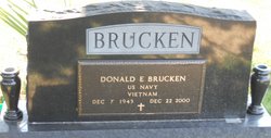
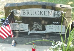
Donald E. “Donnie” Brucken
| Birth | : | 7 Dec 1943 Holton, Jackson County, Kansas, USA |
| Death | : | 22 Dec 2000 Holton, Jackson County, Kansas, USA |
| Burial | : | David Shaw Home Cemetery #1, Shiloh, Sumter County, USA |
| Coordinate | : | 33.9316910, -80.0611390 |
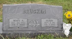
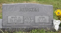
| Description | : | Donald E. "Donnie" Brucken, 57, Holton, died Friday, Dec. 22, 2000, at his home. Mr. Brucken was a farmer and carpenter in the Holton area until 1993. He was a Navy veteran of the Vietnam War and served aboard the USS Lofberg destroyer, stationed out of San Diego. He was born Dec. 7, 1943, in Holton, the son of Henry and Mary A. Hermesch Brucken. He graduated from Holton High School in 1962. He moved from Holton to Edmonds, Wash., in 1993 and moved back to Holton this year. Mr. Brucken was a member of St. Dominic Catholic Church in Holton, the Jackson... Read More |
frequently asked questions (FAQ):
-
Where is Donald E. “Donnie” Brucken's memorial?
Donald E. “Donnie” Brucken's memorial is located at: David Shaw Home Cemetery #1, Shiloh, Sumter County, USA.
-
When did Donald E. “Donnie” Brucken death?
Donald E. “Donnie” Brucken death on 22 Dec 2000 in Holton, Jackson County, Kansas, USA
-
Where are the coordinates of the Donald E. “Donnie” Brucken's memorial?
Latitude: 33.9316910
Longitude: -80.0611390
Family Members:
Parent
Spouse
Flowers:
Nearby Cemetories:
1. David Shaw Home Cemetery #1
Shiloh, Sumter County, USA
Coordinate: 33.9316910, -80.0611390
2. Edwards Cemetery
Shiloh, Sumter County, USA
Coordinate: 33.9275510, -80.0499570
3. Shiloh United Methodist Church Cemetery
Shiloh, Sumter County, USA
Coordinate: 33.9399986, -80.0402985
4. Olive Grove Church Cemetery
Clarendon County, USA
Coordinate: 33.9104040, -80.0482430
5. Goodman Cemetery
Shiloh, Sumter County, USA
Coordinate: 33.9542130, -80.0418000
6. Asbury Cemetery
Sumter County, USA
Coordinate: 33.9561005, -80.0406036
7. Trinity United Methodist Church Cemetery
Shiloh, Sumter County, USA
Coordinate: 33.9741850, -80.0660610
8. W.L. Coker Family Cemetery
Turbeville, Clarendon County, USA
Coordinate: 33.8945530, -80.0246780
9. Pine Grove United Methodist Church Cemetery
Turbeville, Clarendon County, USA
Coordinate: 33.8947890, -80.0141950
10. Turbeville Southern Methodist Church Cemetery
Turbeville, Clarendon County, USA
Coordinate: 33.8944450, -80.0142490
11. Turbeville First Baptist Church Cemetery
Turbeville, Clarendon County, USA
Coordinate: 33.8933570, -80.0149730
12. Wheeler Cemetery
Turbeville, Clarendon County, USA
Coordinate: 33.8821720, -80.0901840
13. Pleasant Grove Baptist Church Cemetery
Pleasant Grove, Sumter County, USA
Coordinate: 33.9896460, -80.0471610
14. Friendship Cemetery
Pleasant Grove, Sumter County, USA
Coordinate: 33.9898605, -80.0464630
15. Hickory Grove Baptist Church
Clarendon County, USA
Coordinate: 33.8797640, -80.0169150
16. Horse Branch Free Will Baptist Cemetery
Turbeville, Clarendon County, USA
Coordinate: 33.8907260, -79.9996940
17. Faith Bible Church Cemetery
Shiloh, Sumter County, USA
Coordinate: 33.9853400, -80.0049100
18. Goodwill Presbyterian Church Cemetery
Mayesville, Sumter County, USA
Coordinate: 33.9152250, -80.1473110
19. Union Hill Baptist Church Cemetery
Turbeville, Clarendon County, USA
Coordinate: 33.9035810, -79.9789650
20. Moore Cemetery
Shiloh, Sumter County, USA
Coordinate: 33.9517440, -79.9721670
21. Turbeville First Baptist Church Memorial Garden
Turbeville, Clarendon County, USA
Coordinate: 33.8558540, -80.0452330
22. Gamble Cemetery
Clarendon County, USA
Coordinate: 33.8542710, -80.0595440
23. Ebenezer Cemetery
Clarendon County, USA
Coordinate: 33.8539009, -80.0597000
24. New Covenant Pentecostal Holiness Church Cemetery
Turbeville, Clarendon County, USA
Coordinate: 33.9099510, -79.9706020


