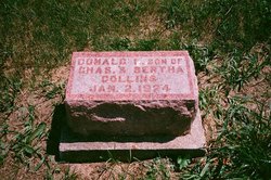
Donald I Collins
| Birth | : | 2 Jan 1924 Andrew County, Missouri, USA |
| Death | : | 2 Jan 1924 Andrew County, Missouri, USA |
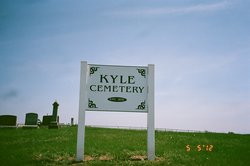
| Burial | : | Kyle Cemetery, Graham, Nodaway County, USA |
| Coordinate | : | 40.1636009, -95.0307999 |
frequently asked questions (FAQ):
-
Where is Donald I Collins's memorial?
Donald I Collins's memorial is located at: Kyle Cemetery, Graham, Nodaway County, USA.
-
When did Donald I Collins death?
Donald I Collins death on 2 Jan 1924 in Andrew County, Missouri, USA
-
Where are the coordinates of the Donald I Collins's memorial?
Latitude: 40.1636009
Longitude: -95.0307999
Family Members:
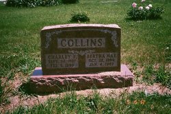
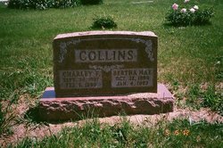
Parent
Siblings
Flowers:
Nearby Cemetories:
1. Kyle Cemetery
Graham, Nodaway County, USA
Coordinate: 40.1636009, -95.0307999
2. Shamberger Cemetery
Graham, Nodaway County, USA
Coordinate: 40.1652985, -94.9925003
3. Prairie Home Cemetery
Graham, Nodaway County, USA
Coordinate: 40.2036018, -95.0488968
4. Schooler Cemetery
Maitland, Holt County, USA
Coordinate: 40.1666985, -95.0903015
5. Linville Cemetery
Graham, Nodaway County, USA
Coordinate: 40.2160988, -95.0261002
6. Maitland Cemetery
Maitland, Holt County, USA
Coordinate: 40.2019196, -95.0847015
7. Bethany Christian Church Cemetery
Graham, Nodaway County, USA
Coordinate: 40.1585388, -94.9461365
8. Centenary Cemetery
Graham, Nodaway County, USA
Coordinate: 40.1293907, -94.9546204
9. Groves Cemetery
Graham, Nodaway County, USA
Coordinate: 40.2369003, -95.0500031
10. Antioch Christian Church Cemetery
Savannah, Andrew County, USA
Coordinate: 40.0932700, -94.9938600
11. Fairview Cemetery
Maitland, Holt County, USA
Coordinate: 40.0943985, -95.0781021
12. Dysart Cemetery
Andrew County, USA
Coordinate: 40.0934900, -94.9738700
13. Woodcock Cemetery
Bolckow, Andrew County, USA
Coordinate: 40.0815460, -94.9834260
14. Swan Chapel Cemetery
Graham, Nodaway County, USA
Coordinate: 40.2449417, -94.9421692
15. Cowan Cemetery
New Point, Holt County, USA
Coordinate: 40.0593987, -95.0875015
16. Hillcrest Cemetery
Skidmore, Nodaway County, USA
Coordinate: 40.2689018, -95.0860977
17. Center District Cemetery
Mound City, Holt County, USA
Coordinate: 40.1743202, -95.1822891
18. Pleasant Grove Cemetery
Pumpkin Center, Nodaway County, USA
Coordinate: 40.2188110, -94.8918610
19. McGuire Cemetery
Holt County, USA
Coordinate: 40.0430984, -95.0425034
20. Litts Cemetery
Whitecloud, Nodaway County, USA
Coordinate: 40.1377983, -94.8756027
21. South Bethel Cemetery
Mound City, Holt County, USA
Coordinate: 40.0946999, -95.1628036
22. Gravel Wall Cemetery
Andrew County, USA
Coordinate: 40.0672210, -94.9260280
23. Baker Cemetery
Barnard, Nodaway County, USA
Coordinate: 40.1660800, -94.8636600
24. Salem Cemetery
Pumpkin Center, Nodaway County, USA
Coordinate: 40.2076721, -94.8683167


