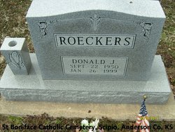
Donald Joseph Roeckers
| Birth | : | 22 Sep 1950 Ottawa, Franklin County, Kansas, USA |
| Death | : | 26 Jan 1999 Richmond, Franklin County, Kansas, USA |
| Burial | : | Fernwood Cemetery, Mill Valley, Marin County, USA |
| Coordinate | : | 37.8767014, -122.5231018 |
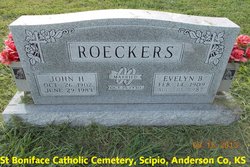
| Description | : | RICHMOND -- Donald Joseph Roeckers, 48, Richmond, died Tuesday, Jan. 26, 1999, at his home. Mr. Roeckers was a custodian at Central Heights High School for more than 20 years and had been involved in numerous community projects, including the street markers and Free Fair in Richmond. He served in the Air Force from 1971 to 1975. He was born Sept. 22, 1950, at Ottawa, the son of John H. and Evelyn Brummel Roeckers. He graduated from Central Heights High School, and he attended Emporia State University. Mr. Roeckers was a life member of St. Therese Catholic Church in Richmond, where he... Read More |
frequently asked questions (FAQ):
-
Where is Donald Joseph Roeckers's memorial?
Donald Joseph Roeckers's memorial is located at: Fernwood Cemetery, Mill Valley, Marin County, USA.
-
When did Donald Joseph Roeckers death?
Donald Joseph Roeckers death on 26 Jan 1999 in Richmond, Franklin County, Kansas, USA
-
Where are the coordinates of the Donald Joseph Roeckers's memorial?
Latitude: 37.8767014
Longitude: -122.5231018
Family Members:
Parent
Siblings
Flowers:
Nearby Cemetories:
1. Fernwood Cemetery
Mill Valley, Marin County, USA
Coordinate: 37.8767014, -122.5231018
2. Druid Heights Burial Site
Mill Valley, Marin County, USA
Coordinate: 37.8892100, -122.5647100
3. St. Stephen's Episcopal Church Memorial Garden
Belvedere, Marin County, USA
Coordinate: 37.8767515, -122.4712901
4. Sailors Cemetery
Sausalito, Marin County, USA
Coordinate: 37.8442390, -122.4774770
5. San Quentin Prison Cemetery
San Rafael, Marin County, USA
Coordinate: 37.9436480, -122.4883760
6. Angel Island Cemetery (defunct)
Tiburon, Marin County, USA
Coordinate: 37.8621830, -122.4325920
7. Presidio of San Francisco Pet Cemetery
San Francisco, San Francisco County, USA
Coordinate: 37.8025490, -122.4671960
8. San Francisco National Cemetery
San Francisco, San Francisco County, USA
Coordinate: 37.8011208, -122.4617462
9. Golden Gate Cemetery (Defunct)
San Francisco, San Francisco County, USA
Coordinate: 37.7851990, -122.5013850
10. Caledonian Cemetery (Defunct)
San Francisco, San Francisco County, USA
Coordinate: 37.7857070, -122.4958030
11. World War II West Coast Memorial
San Francisco, San Francisco County, USA
Coordinate: 37.7941742, -122.4653168
12. French Benevolent Cemetery (Defunct)
San Francisco, San Francisco County, USA
Coordinate: 37.7849610, -122.4947080
13. Beth Olam Cemetery (Defunct)
San Francisco, San Francisco County, USA
Coordinate: 37.7840450, -122.4987420
14. German Benevolent Cemetery (Defunct)
San Francisco, San Francisco County, USA
Coordinate: 37.7828920, -122.4945580
15. Grand Army of the Republic Cemetery (Defunct)
San Francisco, San Francisco County, USA
Coordinate: 37.7819420, -122.4994290
16. Montgomery Memorial Chapel Crypt
San Anselmo, Marin County, USA
Coordinate: 37.9687940, -122.5638630
17. Mission San Rafael Arcangel Cemetery
San Rafael, Marin County, USA
Coordinate: 37.9744330, -122.5280570
18. First Presbyterian Church Memorial Garden
San Anselmo, Marin County, USA
Coordinate: 37.9703310, -122.5667860
19. Holy Virgin Cathedral Sepulchre
San Francisco, San Francisco County, USA
Coordinate: 37.7804360, -122.4862370
20. Chinese Cemetery
San Francisco, San Francisco County, USA
Coordinate: 37.7854530, -122.4589380
21. Saint Mary's Columbarium
San Francisco, San Francisco County, USA
Coordinate: 37.7965330, -122.4376000
22. Laurel Hill Cemetery (Defunct)
San Francisco, San Francisco County, USA
Coordinate: 37.7841300, -122.4508670
23. San Francisco Columbarium
San Francisco, San Francisco County, USA
Coordinate: 37.7806587, -122.4570694
24. Odd Fellows Cemetery (Defunct)
San Francisco, San Francisco County, USA
Coordinate: 37.7791100, -122.4564240


