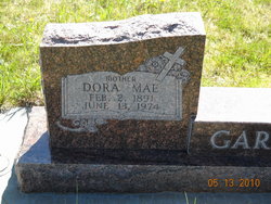
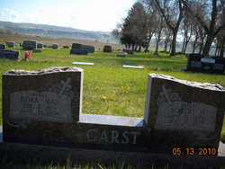
Dora Mae Campbell Garst
| Birth | : | 2 Feb 1891 Bowmantown, Washington County, Tennessee, USA |
| Death | : | 13 Jun 1974 Edgar, Carbon County, Montana, USA |
| Burial | : | Rockvale Cemetery, Rockvale, Carbon County, USA |
| Coordinate | : | 45.4888770, -108.8626350 |
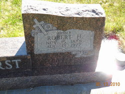
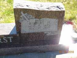
| Description | : | Mrs. Dora Mae Garst, 83, of Edgar, wife of Robert H. Garst died Thursday night in Deaconess Hospital. She had been in failing health about a year and a hospital patient the past two weeks. The Garsts came to Montana in 1916 lo homestead 10 miles east of Edgar and lived there until 1958, when they moved into Edgar. They were married Jan. 1, 1916, in Jonesboro Tenn. Mrs. Garst was a member of the Edgar Methodist Church, and the Women's Society of Christian Service. She was born Feb. 2, 1891, in Jonesboro, a daughter of Mr.... Read More |
frequently asked questions (FAQ):
-
Where is Dora Mae Campbell Garst's memorial?
Dora Mae Campbell Garst's memorial is located at: Rockvale Cemetery, Rockvale, Carbon County, USA.
-
When did Dora Mae Campbell Garst death?
Dora Mae Campbell Garst death on 13 Jun 1974 in Edgar, Carbon County, Montana, USA
-
Where are the coordinates of the Dora Mae Campbell Garst's memorial?
Latitude: 45.4888770
Longitude: -108.8626350
Family Members:
Parent
Spouse
Siblings
Children
Flowers:
Nearby Cemetories:
1. Rockvale Cemetery
Rockvale, Carbon County, USA
Coordinate: 45.4888770, -108.8626350
2. Joliet Cemetery
Joliet, Carbon County, USA
Coordinate: 45.4799995, -108.9985962
3. Gebo Cemetery
Fromberg, Carbon County, USA
Coordinate: 45.4030000, -108.9242000
4. Carbonado Cemetery
Joliet, Carbon County, USA
Coordinate: 45.4585991, -109.0139008
5. Park City Cemetery
Park City, Stillwater County, USA
Coordinate: 45.6247120, -108.9165690
6. Beltz Cemetery
Carbon County, USA
Coordinate: 45.4049988, -109.0706024
7. Pioneer Cemetery
Stillwater County, USA
Coordinate: 45.6575012, -108.8944016
8. Teeples Cemetery
Bridger, Carbon County, USA
Coordinate: 45.3248600, -108.7785880
9. Bridger Cemetery
Bridger, Carbon County, USA
Coordinate: 45.2825012, -108.9244003
10. Saint Anthony Catholic Cemetery
Laurel, Yellowstone County, USA
Coordinate: 45.6939650, -108.7685320
11. Laurel Cemetery
Laurel, Yellowstone County, USA
Coordinate: 45.6944008, -108.7692032
12. Yellowstone National Cemetery
Laurel, Yellowstone County, USA
Coordinate: 45.6962050, -108.7726520
13. Big Day Cemetery
Pryor, Big Horn County, USA
Coordinate: 45.4169006, -108.5653000
14. Plenty Coups State Park Cemetery
Pryor, Big Horn County, USA
Coordinate: 45.4287870, -108.5491920
15. Mountain View Cemetery
Bridger, Carbon County, USA
Coordinate: 45.2588997, -108.8910980
16. Roberts Cemetery
Roberts, Carbon County, USA
Coordinate: 45.3605995, -109.1536026
17. Sings Good-Stewart Family Cemetery
Pryor, Big Horn County, USA
Coordinate: 45.4076540, -108.5289690
18. Pryor Cemetery
Pryor, Big Horn County, USA
Coordinate: 45.4193993, -108.5111008
19. Cooke Cemetery
Billings, Yellowstone County, USA
Coordinate: 45.7035500, -108.6184500
20. Silver Tip Ranch Cemetery
Bridger, Carbon County, USA
Coordinate: 45.1889340, -108.9850340
21. Mountain View Cemetery
Columbus, Stillwater County, USA
Coordinate: 45.6417007, -109.2727966
22. Holy Cross Cemetery
Billings, Yellowstone County, USA
Coordinate: 45.7400017, -108.5552979
23. Terrace Gardens Cemetery
Billings, Yellowstone County, USA
Coordinate: 45.7733900, -108.6009160
24. Clear Creek Cemetery
Roberts, Carbon County, USA
Coordinate: 45.2416992, -109.1931000

