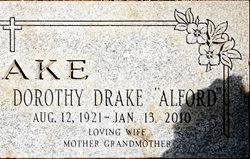
Dorothy Mae Hale Alford
| Birth | : | 12 Aug 1921 White River, Mellette County, South Dakota, USA |
| Death | : | 13 Jan 2010 Gerber, Tehama County, California, USA |
| Burial | : | Salem-Friedhof Cemetery, Bushton, Rice County, USA |
| Coordinate | : | 38.4655991, -98.4056015 |
| Plot | : | Lot 378 Space 2 |
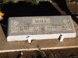
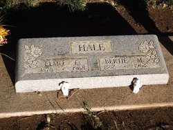
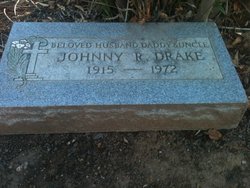
| Description | : | Dorothy Mae Drake Alford, 88, of Gerber passed away peacefully with her family by her side on January 13, 2010. She was buried January 16th at the Tehama Cemetery. Mrs. Alford was born in August 12, 1921 to Elmo and Bertie Hale in White River, South Dakota. She was the youngest and last survivor of nine children. Dorothy married John Drake September 7th, 1940 in Reno, Nevada; together they had one child, Barbara. After John's death in 1972 Dorothy met and married Stanley Alford. Stan and Dorothy enjoyed 35 years together until Grandpa Stan passed away in 2008. Dorothy was... Read More |
frequently asked questions (FAQ):
-
Where is Dorothy Mae Hale Alford's memorial?
Dorothy Mae Hale Alford's memorial is located at: Salem-Friedhof Cemetery, Bushton, Rice County, USA.
-
When did Dorothy Mae Hale Alford death?
Dorothy Mae Hale Alford death on 13 Jan 2010 in Gerber, Tehama County, California, USA
-
Where are the coordinates of the Dorothy Mae Hale Alford's memorial?
Latitude: 38.4655991
Longitude: -98.4056015
Family Members:
Parent
Spouse
Siblings
Children
Flowers:
Nearby Cemetories:
1. Salem-Friedhof Cemetery
Bushton, Rice County, USA
Coordinate: 38.4655991, -98.4056015
2. Holy Name Catholic Cemetery
Bushton, Rice County, USA
Coordinate: 38.4929400, -98.4432900
3. Bushton-Farmer Township Cemetery
Bushton, Rice County, USA
Coordinate: 38.5078011, -98.3886032
4. Wesley Chapel Cemetery
Lyons, Rice County, USA
Coordinate: 38.4494200, -98.3308300
5. Montgomery Cemetery
Barton County, USA
Coordinate: 38.4933014, -98.4805984
6. Cain City Cemetery
Ellsworth County, USA
Coordinate: 38.5337080, -98.4433460
7. Immanuel Cemetery
Rice County, USA
Coordinate: 38.3699989, -98.4421997
8. Emmanuel Lutheran Cemetery
Chase, Rice County, USA
Coordinate: 38.3702350, -98.4433800
9. Lorraine Cemetery
Lorraine, Ellsworth County, USA
Coordinate: 38.5508200, -98.3309800
10. Baptist Cemetery
Lorraine, Ellsworth County, USA
Coordinate: 38.5657997, -98.3313980
11. Saint Peter Lutheran Cemetery
Holyrood, Ellsworth County, USA
Coordinate: 38.5814460, -98.3879430
12. Springdale Cemetery
Chase, Rice County, USA
Coordinate: 38.3630981, -98.3305969
13. Saint Pauls United Church of Christ Cemetery
Holyrood, Ellsworth County, USA
Coordinate: 38.5840180, -98.4063880
14. Pleasant View Cemetery
Claflin, Barton County, USA
Coordinate: 38.5297012, -98.5372009
15. Saint Marys Cemetery
Chase, Rice County, USA
Coordinate: 38.3492012, -98.3507996
16. Ebenezer Church Cemetery
Rice County, USA
Coordinate: 38.3908900, -98.2759000
17. Frederick Cemetery
Frederick, Rice County, USA
Coordinate: 38.5077350, -98.2484450
18. Saints Peter and Paul Cemetery
Ellinwood, Barton County, USA
Coordinate: 38.4344320, -98.5703900
19. Bloomingdale Cemetery
Claflin, Barton County, USA
Coordinate: 38.5511017, -98.5541992
20. Shumway Cemetery
Lyons, Rice County, USA
Coordinate: 38.3911018, -98.2356033
21. Henry Family Cemetery
Ellsworth County, USA
Coordinate: 38.6232270, -98.3389780
22. Lakin Comanche Cemetery
Ellinwood, Barton County, USA
Coordinate: 38.3486000, -98.5736000
23. Hilltop Cemetery
Raymond, Rice County, USA
Coordinate: 38.2886009, -98.4231033
24. Rice County Poor Farm Cemetery
Rice County, USA
Coordinate: 38.3449410, -98.2387280

