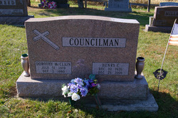
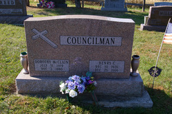
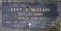
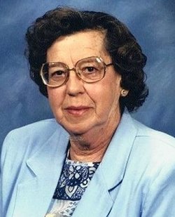
Dorothy McClain Councilman
| Birth | : | 31 Jul 1919 |
| Death | : | 2 Dec 1990 Lima, Allen County, Ohio, USA |
| Burial | : | Sand Spring Cemetery, Friendsville, Garrett County, USA |
| Coordinate | : | 39.6711006, -79.4597015 |
| Plot | : | Section H, Row 2 |
frequently asked questions (FAQ):
-
Where is Dorothy McClain Councilman's memorial?
Dorothy McClain Councilman's memorial is located at: Sand Spring Cemetery, Friendsville, Garrett County, USA.
-
When did Dorothy McClain Councilman death?
Dorothy McClain Councilman death on 2 Dec 1990 in Lima, Allen County, Ohio, USA
-
Where are the coordinates of the Dorothy McClain Councilman's memorial?
Latitude: 39.6711006
Longitude: -79.4597015
Family Members:
Parent
Spouse
Siblings
Flowers:
Nearby Cemetories:
1. Sand Spring Cemetery
Friendsville, Garrett County, USA
Coordinate: 39.6711006, -79.4597015
2. Humberson Cemetery
Friendsville, Garrett County, USA
Coordinate: 39.6768200, -79.4342100
3. VanSickle Cemetery
Hazelton, Preston County, USA
Coordinate: 39.6800840, -79.4850690
4. Blooming Rose Church Cemetery
Friendsville, Garrett County, USA
Coordinate: 39.6558900, -79.4399500
5. Webb Chapel Cemetery
Hazelton, Preston County, USA
Coordinate: 39.6648210, -79.4915600
6. Cuppett-Falkner Cemetery
Hazelton, Preston County, USA
Coordinate: 39.6493900, -79.4879280
7. Andrew Friend Cemetery
Friendsville, Garrett County, USA
Coordinate: 39.6631700, -79.4197000
8. Emberson Cemetery
Friendsville, Garrett County, USA
Coordinate: 39.6716995, -79.4150009
9. Asher Glade Cemetery
Friendsville, Garrett County, USA
Coordinate: 39.7047005, -79.4443970
10. Friend Family Graveyard
Friendsville, Garrett County, USA
Coordinate: 39.6622000, -79.4124200
11. Keeler Glade Cemetery
Garrett County, USA
Coordinate: 39.6308000, -79.4768000
12. Steele Cemetery
Friendsville, Garrett County, USA
Coordinate: 39.6650009, -79.4005966
13. Savage Cemetery
Hazelton, Preston County, USA
Coordinate: 39.6323470, -79.5003360
14. Markleysburg Cemetery
Markleysburg, Fayette County, USA
Coordinate: 39.7253000, -79.4469600
15. Frazee Ridge Cemetery
Garrett County, USA
Coordinate: 39.7114600, -79.4099200
16. Mitchell Cemetery
Glade Farms, Preston County, USA
Coordinate: 39.6925470, -79.5294020
17. Great Crossings Cemetery
Garrett County, USA
Coordinate: 39.7127991, -79.4067001
18. Myers Frazee Cemetery
Henry Clay Township, Fayette County, USA
Coordinate: 39.7299800, -79.4517700
19. Thomas Cemetery
Markleysburg, Fayette County, USA
Coordinate: 39.7322006, -79.4574966
20. Cuppett - Teets Cemetery
Glade Farms, Preston County, USA
Coordinate: 39.7101700, -79.5225000
21. Glover Cemetery
Markleysburg, Fayette County, USA
Coordinate: 39.7330589, -79.4530563
22. Jeffreys Cemetery
Hazelton, Preston County, USA
Coordinate: 39.6446160, -79.5351210
23. Andrew Umble Cemetery
Markleysburg, Fayette County, USA
Coordinate: 39.7385200, -79.4536100
24. Sisler Cemetery
Mountain Dale, Preston County, USA
Coordinate: 39.6081009, -79.4938965

