
| Birth | : | 1 Nov 1936 Council Grove, Morris County, Kansas, USA |
| Death | : | 25 Aug 2020 Council Grove, Morris County, Kansas, USA |
| Burial | : | Greenwood Cemetery, Council Grove, Morris County, USA |
| Coordinate | : | 38.6581900, -96.5010900 |
| Plot | : | S4 |
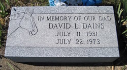
| Inscription | : | Parents of Calvin - Bruce - Shari - Brenda |
| Description | : | Pat Johnson November 1, 1936 ~ August 25, 2020 (age 83) The Council Grove Daily Republican/August 27, 2020/pg 1/col 1 Dorothy "Pat" Johnson died August 26th at her home. She was born November 1, 1936 to Lester and Bertha (Clark) Dains in Council Grove, Kansas. She married Ellis Blount in 1953 and had two sons, Calvin and Bruce. They later divorced. She married Keith Gentry in October, 1959; they had two daughters, Shari and Brenda. Keith passed away June 1, 1989. She married Maurice "Sonny" Johnson in November, 1991. He passed away in 2015. |
frequently asked questions (FAQ):
-
Where is Dorothy “Pat” Dains Gentry's memorial?
Dorothy “Pat” Dains Gentry's memorial is located at: Greenwood Cemetery, Council Grove, Morris County, USA.
-
When did Dorothy “Pat” Dains Gentry death?
Dorothy “Pat” Dains Gentry death on 25 Aug 2020 in Council Grove, Morris County, Kansas, USA
-
Where are the coordinates of the Dorothy “Pat” Dains Gentry's memorial?
Latitude: 38.6581900
Longitude: -96.5010900
Family Members:
Parent

Spouse
Siblings
Flowers:


Nearby Cemetories:
1. Greenwood Cemetery
Council Grove, Morris County, USA
Coordinate: 38.6581900, -96.5010900
2. Calvary Cemetery
Council Grove, Morris County, USA
Coordinate: 38.6567001, -96.5111008
3. Sunnyslope Memorial Gardens
Council Grove, Morris County, USA
Coordinate: 38.6796700, -96.4644400
4. Four Mile Cemetery
Council Grove, Morris County, USA
Coordinate: 38.6086200, -96.5097000
5. Little John Cemetery
Council Grove, Morris County, USA
Coordinate: 38.6568300, -96.4175100
6. Hebrank Cemetery
Council Grove, Morris County, USA
Coordinate: 38.7172000, -96.4260100
7. Raglan Cemetery
Dunlap, Morris County, USA
Coordinate: 38.6370100, -96.3942700
8. Pleasant View Cemetery
Council Grove, Morris County, USA
Coordinate: 38.5948000, -96.5880700
9. Kelso Cemetery
Parkerville, Morris County, USA
Coordinate: 38.7496986, -96.5714035
10. Downing Cemetery
Kelso, Morris County, USA
Coordinate: 38.7467650, -96.5851850
11. Comiskey Cemetery
Morris County, USA
Coordinate: 38.6521988, -96.3535995
12. Gilbert Family Cemetery
Bushong, Lyon County, USA
Coordinate: 38.6895800, -96.3458500
13. Garfield Cemetery
Morris County, USA
Coordinate: 38.7817001, -96.4591980
14. Highland Cemetery
Wilsey, Morris County, USA
Coordinate: 38.6678009, -96.6716995
15. Dunlap Colored Cemetery
Dunlap, Morris County, USA
Coordinate: 38.5875015, -96.3538971
16. Dunlap Cemetery
Dunlap, Morris County, USA
Coordinate: 38.5792007, -96.3538971
17. Wilsey Cemetery
Wilsey, Morris County, USA
Coordinate: 38.6381569, -96.6880646
18. Ramsey-Black Cemetery
Parkerville, Morris County, USA
Coordinate: 38.7606010, -96.6449966
19. Beman Cemetery
Morris County, USA
Coordinate: 38.8072014, -96.4266968
20. Sommer Cemetery
Morris County, USA
Coordinate: 38.7595700, -96.6720800
21. Parker-Highland Cemetery
Parkerville, Morris County, USA
Coordinate: 38.7675018, -96.6682968
22. Agnes City Cemetery
Bushong, Lyon County, USA
Coordinate: 38.6880989, -96.2799988
23. Sunnyside Cemetery
Bushong, Lyon County, USA
Coordinate: 38.6083900, -96.2853700
24. Swartz Cemetery
Dwight, Morris County, USA
Coordinate: 38.8274994, -96.5622025