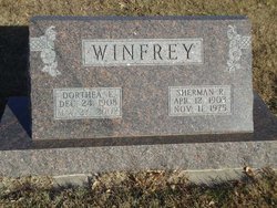
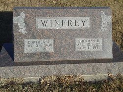
Dorthea E. Miller Winfrey
| Birth | : | 24 Dec 1908 Lincoln County, Nebraska, USA |
| Death | : | 27 May 2002 Saint Paul, Howard County, Nebraska, USA |
| Burial | : | Elmwood Cemetery, Saint Paul, Howard County, USA |
| Coordinate | : | 41.2002983, -98.4677963 |
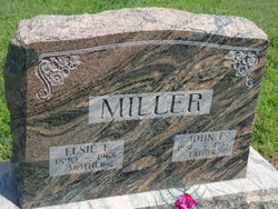
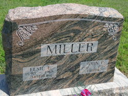
| Description | : | Daughter of John & Elsie (Hahnau) Miller. Married to Sherman R. Winfrey on 8-19-1926 at Council Bluffs, IA. |
frequently asked questions (FAQ):
-
Where is Dorthea E. Miller Winfrey's memorial?
Dorthea E. Miller Winfrey's memorial is located at: Elmwood Cemetery, Saint Paul, Howard County, USA.
-
When did Dorthea E. Miller Winfrey death?
Dorthea E. Miller Winfrey death on 27 May 2002 in Saint Paul, Howard County, Nebraska, USA
-
Where are the coordinates of the Dorthea E. Miller Winfrey's memorial?
Latitude: 41.2002983
Longitude: -98.4677963
Family Members:
Parent
Spouse
Siblings
Children
Flowers:
Nearby Cemetories:
1. Elmwood Cemetery
Saint Paul, Howard County, USA
Coordinate: 41.2002983, -98.4677963
2. Warsaw Cemetery
Saint Paul, Howard County, USA
Coordinate: 41.1844400, -98.5575000
3. Canada Hill Methodist Episcopal Cemetery
Howard County, USA
Coordinate: 41.1843987, -98.5575027
4. Saint Wenceslaus Cemetery
Howard County, USA
Coordinate: 41.2056007, -98.5702972
5. Hamm Cemetery
Howard County, USA
Coordinate: 41.2933006, -98.4672012
6. Fairdale Cemetery
Howard County, USA
Coordinate: 41.2891998, -98.5152969
7. Elba Cemetery
Elba, Howard County, USA
Coordinate: 41.2764015, -98.5643997
8. Oak Ridge Cemetery
Dannebrog, Howard County, USA
Coordinate: 41.1138992, -98.5485992
9. Bohemian National Graveyard
Howard County, USA
Coordinate: 41.2492070, -98.5927620
10. Scotch Cemetery
Farwell, Howard County, USA
Coordinate: 41.1917000, -98.6130981
11. Czechoslovakia Cemetery
Farwell, Howard County, USA
Coordinate: 41.2132988, -98.6224976
12. Saint Josephs Cemetery
Elba, Howard County, USA
Coordinate: 41.2930984, -98.5746994
13. South Logan Cemetery
Howard County, USA
Coordinate: 41.3222100, -98.4352600
14. North Cemetery
Howard County, USA
Coordinate: 41.3222008, -98.4347000
15. Danish Lutheran Cemetery
Farwell, Howard County, USA
Coordinate: 41.2134660, -98.6336020
16. Nysted Cemetery
Nysted, Howard County, USA
Coordinate: 41.1307983, -98.6136017
17. Saint Anthony Catholic Cemetery
Farwell, Howard County, USA
Coordinate: 41.1845400, -98.6414700
18. Saint Libory Catholic Cemetery
Saint Libory, Howard County, USA
Coordinate: 41.0828700, -98.3569700
19. Spring Creek Cemetery
Cushing, Howard County, USA
Coordinate: 41.3314200, -98.3833300
20. Rose Hill Cemetery
Palmer, Merrick County, USA
Coordinate: 41.2256012, -98.2692032
21. Haggart Cemetery
Saint Libory, Howard County, USA
Coordinate: 41.0698500, -98.3547500
22. Kelso Cemetery
Howard County, USA
Coordinate: 41.1627998, -98.6707993
23. Fairdale Sunrise Cemetery
Elba, Howard County, USA
Coordinate: 41.3580000, -98.4887000
24. Swedish Pioneer Cemetery
Howard County, USA
Coordinate: 41.0910988, -98.6324997

