Dr Peter Brown
| Birth | : | 1756 Rowan County, North Carolina, USA |
| Death | : | 31 Oct 1812 Rowan County, North Carolina, USA |
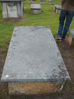
| Burial | : | Battiest Cemetery, Battiest, McCurtain County, USA |
| Coordinate | : | 34.3887405, -94.9259109 |
| Plot | : | # 78 |
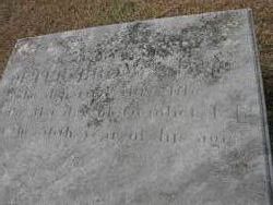
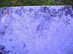
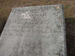
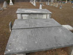
| Inscription | : | In memory of PETER BROWN Esqr who departed 31st of October 1812 in the 56 year of his age. |
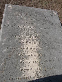
| Description | : | Son of Michael (Braun) Brown and Margareta Catherina Shamback Brown, They are buried at Braun Family Cemetery, Rowan County, North Carolina March 11, 1777, Rowan County, North Carolina, married Susannah Bruner, born 1760 - died, 11-11-1816 Parents of 9 children: 1. Mary Brown, born 1778, married Barney Bowers 2. Margaret Brown, born 1780 3. Susan Brown, born 1783, married _____ Thompson 4. Elizabeth Brown, born 1786, died in 1857 5. Peter Brown, Jr. born 1788 6. Sarah "Sally" M. Brown, born 1792, died July 10, 1832, married Horace B. Satterwhite 7. Michael Brown, born 1793, married _____ Long 8. Anabarbary Brown 9.... Read More |
frequently asked questions (FAQ):
-
Where is Dr Peter Brown's memorial?
Dr Peter Brown's memorial is located at: Battiest Cemetery, Battiest, McCurtain County, USA.
-
When did Dr Peter Brown death?
Dr Peter Brown death on 31 Oct 1812 in Rowan County, North Carolina, USA
-
Where are the coordinates of the Dr Peter Brown's memorial?
Latitude: 34.3887405
Longitude: -94.9259109
Family Members:
Parent
Spouse
Siblings
Children
Nearby Cemetories:
1. Battiest Cemetery
Battiest, McCurtain County, USA
Coordinate: 34.3887405, -94.9259109
2. Old Parsons Cemetery
Battiest, McCurtain County, USA
Coordinate: 34.4013901, -94.9015808
3. Parsons Family Cemetery
Battiest, McCurtain County, USA
Coordinate: 34.3823395, -94.9575806
4. Bethel Hill Cemetery
Bethel, McCurtain County, USA
Coordinate: 34.3566160, -94.8938080
5. Bethel Cemetery
Bethel, McCurtain County, USA
Coordinate: 34.3663406, -94.8458633
6. Kulli-Chito Presbyterian Church Cemetery
Bethel, McCurtain County, USA
Coordinate: 34.3805542, -94.8361130
7. County Line Cemetery
Pushmataha County, USA
Coordinate: 34.3889008, -95.0472031
8. Sherwood Cemetery
Sherwood, McCurtain County, USA
Coordinate: 34.3318100, -94.7816530
9. Rock Creek Cemetery
Honobia, Le Flore County, USA
Coordinate: 34.5378600, -94.9367800
10. Ludlow Cemetery
Le Flore County, USA
Coordinate: 34.5331001, -94.8664017
11. Fewell Cemetery
Pushmataha County, USA
Coordinate: 34.5208015, -95.0382996
12. Nolia Cemetery
Nashoba, Pushmataha County, USA
Coordinate: 34.4688988, -95.1600037
13. Octavia Cemetery
Octavia, Le Flore County, USA
Coordinate: 34.5155983, -94.7149963
14. John Isic Cardner Grave
Pushmataha County, USA
Coordinate: 34.2649940, -95.1472820
15. Curb Isbel Grave
Pushmataha County, USA
Coordinate: 34.3509440, -95.2027500
16. Dickson Solomon Grave
Pushmataha County, USA
Coordinate: 34.3341611, -95.1993330
17. Nanih Chito Cemetery
McCurtain County, USA
Coordinate: 34.4215200, -94.6472310
18. Wilson Chapel Cemetery
McCurtain County, USA
Coordinate: 34.2002983, -95.1003036
19. Old Smithville Cemetery
Smithville, McCurtain County, USA
Coordinate: 34.4654320, -94.6410390
20. Smithville Cemetery
Smithville, McCurtain County, USA
Coordinate: 34.4651500, -94.6387500
21. Old Ringold Cemetery
McCurtain County, USA
Coordinate: 34.2150002, -95.1502991
22. Buffalo Cemetery
Watson, McCurtain County, USA
Coordinate: 34.3959900, -94.6139200
23. Myers Cemetery
Pushmataha County, USA
Coordinate: 34.6511002, -95.0077972
24. Nashoba Indian Cemetery
Pushmataha County, USA
Coordinate: 34.4849900, -95.2352700

