| Birth | : | 26 Aug 1951 Muscatine, Muscatine County, Iowa, USA |
| Death | : | 26 Aug 1951 Muscatine, Muscatine County, Iowa, USA |
| Burial | : | Oak Hill Cemetery, Lebanon, Boone County, USA |
| Coordinate | : | 40.0482160, -86.4545760 |
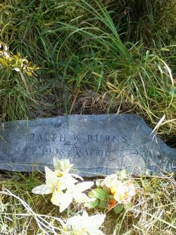
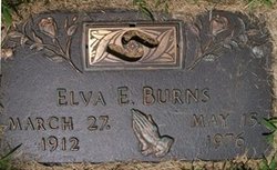
| Description | : | Obituary for Burns, Earl Burns, Merle Graveside services were held at the Memorial Cemetery at 11. A.M. today for Merle and Earl Burns, twin sons of Ralph and Elva Cunningham Burns, 112 Walnut Street, who died at birth at 1:45 Sunday at Hershey Hosptial. The Rev. Merle Hull of the Walnut Street Baptist Church was in charge, with the Geo. M. Wittach funeral home directing arrangements. Survivors are the parents, two brothers; Ralph Burns Jr. and Michael Burns; Two sisters Rosemary and Patsy Burns at home; three half sisters, Mrs. Ben Butler, Mrs. Robert Moore, Jr. , Miss Martha McCracken, both of Muscatine, Iowa; Grandparents,... Read More |
frequently asked questions (FAQ):
-
Where is Earl Burns's memorial?
Earl Burns's memorial is located at: Oak Hill Cemetery, Lebanon, Boone County, USA.
-
When did Earl Burns death?
Earl Burns death on 26 Aug 1951 in Muscatine, Muscatine County, Iowa, USA
-
Where are the coordinates of the Earl Burns's memorial?
Latitude: 40.0482160
Longitude: -86.4545760
Family Members:
Parent
Siblings
Flowers:
Nearby Cemetories:
1. Oak Hill Cemetery
Lebanon, Boone County, USA
Coordinate: 40.0482160, -86.4545760
2. Saint Joseph Cemetery
Lebanon, Boone County, USA
Coordinate: 40.0474701, -86.4558105
3. Cedar Hill Cemetery
Lebanon, Boone County, USA
Coordinate: 40.0514870, -86.4655304
4. County Farm Cemetery
Lebanon, Boone County, USA
Coordinate: 40.0329971, -86.4507065
5. Center Cemetery
Lebanon, Boone County, USA
Coordinate: 40.0393840, -86.4193290
6. Browns Wonder Cemetery
Lebanon, Boone County, USA
Coordinate: 40.0830994, -86.4302979
7. Robison Cemetery
Lebanon, Boone County, USA
Coordinate: 40.0066986, -86.4692001
8. Dowden Cemetery
Lebanon, Boone County, USA
Coordinate: 40.0269012, -86.3983002
9. Beck Cemetery
Lebanon, Boone County, USA
Coordinate: 40.0855370, -86.5155330
10. Mount Union Cemetery
Milledgeville, Boone County, USA
Coordinate: 39.9864006, -86.4811020
11. Bethel Cemetery
Pike, Boone County, USA
Coordinate: 40.1130447, -86.4806519
12. Brockway Cemetery
Max, Boone County, USA
Coordinate: 40.0013351, -86.5316238
13. Hopewell Cemetery
Lebanon, Boone County, USA
Coordinate: 40.1265488, -86.4552231
14. Smith Cemetery
Boone County, USA
Coordinate: 39.9749985, -86.4075012
15. Milledgeville Cemetery
Milledgeville, Boone County, USA
Coordinate: 39.9738731, -86.4994583
16. Pleasant View Cemetery
Dover, Boone County, USA
Coordinate: 40.0536003, -86.5682983
17. Shepard Graves
Boone County, USA
Coordinate: 40.1372337, -86.4321976
18. Elizaville Cemetery
Elizaville, Boone County, USA
Coordinate: 40.1236260, -86.3755310
19. Old Mount Zion Cemetery
Max, Boone County, USA
Coordinate: 40.0245018, -86.5796127
20. Cason Cemetery
Hazelrigg, Boone County, USA
Coordinate: 40.1051979, -86.5611572
21. Mounts Runn Baptist Cemetery
Whitestown, Boone County, USA
Coordinate: 40.0368996, -86.3230972
22. Taylor Cemetery
Hazelrigg, Boone County, USA
Coordinate: 40.0835304, -86.5823212
23. Bethel Hill Cemetery
Lebanon, Boone County, USA
Coordinate: 40.1343994, -86.5441971
24. Salem Cemetery
Elizaville, Boone County, USA
Coordinate: 40.1486206, -86.3943634


