
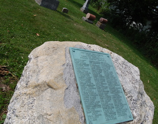
| Memorials | : | 16 |
| Location | : | Whitestown, Boone County, USA |
| Coordinate | : | 40.0368996, -86.3230972 |
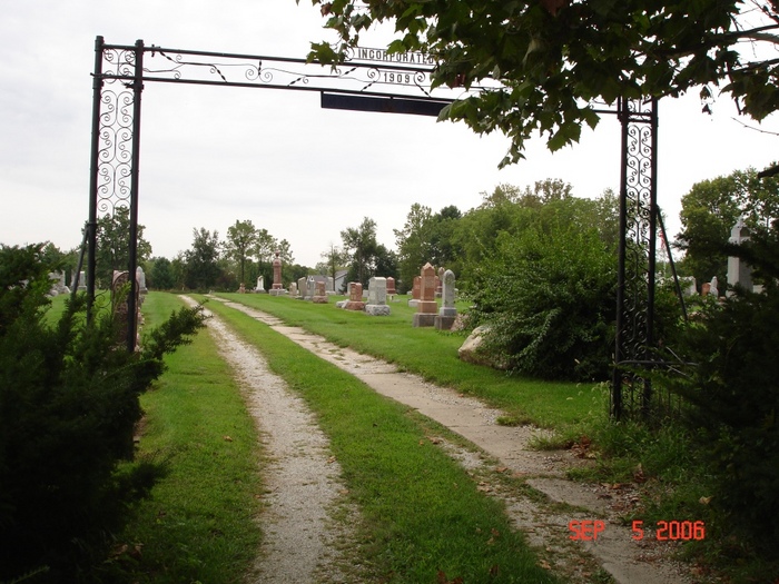
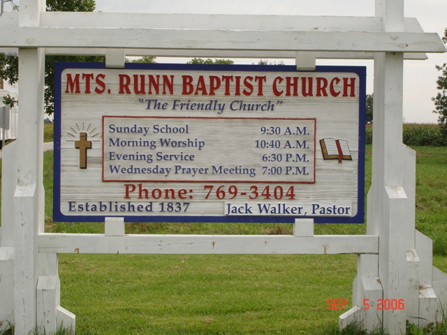
| Description | : | The cemetery is located in Union Township (W half of the NE quadrant of Section 5 Township 18N Range 2E) on the west side of S County Road 775 E about 0.25 miles south of its intersection with W Base Line Road (Indiana State Highway 32). Indiana Cemetery Locations, Volume 3, published by the Indiana Genealogical Society (April 2007), gives the primary cemetery name as Mounts Run. The cemetery is listed in the Cemetery and Burial Grounds Registry of the Indiana Department of Natural Resources (DNR) and in the State Historical Architectural and Archaeological Research Database (SHAARD) with... Read More |
frequently asked questions (FAQ):
-
Where is Mounts Runn Baptist Cemetery?
Mounts Runn Baptist Cemetery is located at S County Road 775 E Whitestown, Boone County ,Indiana , 46077USA.
-
Mounts Runn Baptist Cemetery cemetery's updated grave count on graveviews.com?
14 memorials
-
Where are the coordinates of the Mounts Runn Baptist Cemetery?
Latitude: 40.0368996
Longitude: -86.3230972
Nearby Cemetories:
1. Rosston Cemetery
Rosston, Boone County, USA
Coordinate: 40.0447998, -86.2866974
2. Wheatley Cemetery
Boone County, USA
Coordinate: 40.0632640, -86.2957030
3. Lutheran Cemetery
Whitestown, Boone County, USA
Coordinate: 40.0073433, -86.2995148
4. Sedwick Family Cemetery #1
Rosston, Boone County, USA
Coordinate: 40.0489000, -86.2800000
5. Segwick Family Cemetery #2
Rosston, Boone County, USA
Coordinate: 40.0597000, -86.2839000
6. Johns Cemetery
Boone County, USA
Coordinate: 40.0520400, -86.2737500
7. Lane Cemetery
Northfield, Boone County, USA
Coordinate: 40.0061798, -86.2796707
8. Hutton Memorial Cemetery
Northfield, Boone County, USA
Coordinate: 39.9986000, -86.2849503
9. McCord Cemetery
Whitestown, Boone County, USA
Coordinate: 39.9843200, -86.3319600
10. Wright-Bethel Cemetery
Waugh, Boone County, USA
Coordinate: 40.0847015, -86.2900009
11. Dowden Cemetery
Lebanon, Boone County, USA
Coordinate: 40.0269012, -86.3983002
12. Richardson Cemetery
Boone County, USA
Coordinate: 40.0714684, -86.2612457
13. Parr-Jones Cemetery
Marion Township, Boone County, USA
Coordinate: 40.0818600, -86.2689150
14. Eagle Creek Regular Baptist Cemetery
Eagle Village, Boone County, USA
Coordinate: 39.9799538, -86.2736588
15. Schooler Cemetery
Eagle Township, Boone County, USA
Coordinate: 39.9678000, -86.3461000
16. Cox Cemetery
Zionsville, Boone County, USA
Coordinate: 39.9836006, -86.2596970
17. Pitzer Cemetery
Zionsville, Boone County, USA
Coordinate: 39.9636002, -86.3206024
18. Sugar Grove Cemetery
Hamilton County, USA
Coordinate: 40.0155983, -86.2313995
19. Center Cemetery
Lebanon, Boone County, USA
Coordinate: 40.0393840, -86.4193290
20. Jones Cemetery
Boone County, USA
Coordinate: 39.9639015, -86.3458023
21. Eagle Creek Cemetery
Westfield, Hamilton County, USA
Coordinate: 40.0130730, -86.2263870
22. Saint Francis of the Fields Episcopal Columbarium
Zionsville, Boone County, USA
Coordinate: 39.9643200, -86.2816300
23. Clarkston Cemetery
Zionsville, Boone County, USA
Coordinate: 39.9693985, -86.2508011
24. Smith Cemetery
Boone County, USA
Coordinate: 39.9749985, -86.4075012