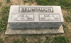
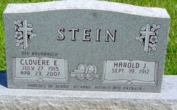
Earl Evert Brumbaugh
| Birth | : | 24 Mar 1897 Warsaw, Hancock County, Illinois, USA |
| Death | : | 12 Jul 1992 Kirksville, Adair County, Missouri, USA |
| Burial | : | Mount Zion Cemetery, Fonda, Pocahontas County, USA |
| Coordinate | : | 42.5821991, -94.8300018 |
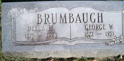
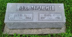
| Description | : | Earl Brumbaugh Earl Evert Brumbaugh, son of George and Della Mae (Cooper) Brumbaugh, was born March 24, 1897 in Warsaw, Ill., and died Sunday July 12, 1992, in a Kirksville, Mo., nursing home at the age of 95 years, three months, and 23 days. He married Effie Leila Miller on May 6, 1950. She preceded him in death on February 7, 1984. Also preceding him in death were his parents; four brothers, Dewey Brumbaugh, Albert Brumbaugh, Wayne Brumbaugh, and Sherman Brumbaugh in infancy.; and four sisters, Opal Roberts, Elizabeth Bailey, Georgia Brumbaugh, and Ethel Brumbaugh in infancy. Surviving are three brothers,... Read More |
frequently asked questions (FAQ):
-
Where is Earl Evert Brumbaugh's memorial?
Earl Evert Brumbaugh's memorial is located at: Mount Zion Cemetery, Fonda, Pocahontas County, USA.
-
When did Earl Evert Brumbaugh death?
Earl Evert Brumbaugh death on 12 Jul 1992 in Kirksville, Adair County, Missouri, USA
-
Where are the coordinates of the Earl Evert Brumbaugh's memorial?
Latitude: 42.5821991
Longitude: -94.8300018
Family Members:
Parent
Spouse
Siblings
Flowers:
Nearby Cemetories:
1. Mount Zion Cemetery
Fonda, Pocahontas County, USA
Coordinate: 42.5821991, -94.8300018
2. Cedar Township Cemetery
Fonda, Pocahontas County, USA
Coordinate: 42.5810000, -94.8375000
3. Saint Columbkilles Cemetery
Varina, Pocahontas County, USA
Coordinate: 42.6467018, -94.8443985
4. Varina Cemetery
Newell Township, Buena Vista County, USA
Coordinate: 42.6539993, -94.9339981
5. Saint Marys Catholic Cemetery
Pomeroy, Calhoun County, USA
Coordinate: 42.5558014, -94.6889038
6. Dover Township Cemetery
Varina, Pocahontas County, USA
Coordinate: 42.6896100, -94.8524200
7. Elfsborg Lutheran Cemetery
Palmer, Pocahontas County, USA
Coordinate: 42.6169014, -94.6875000
8. Saint John Cemetery
Williams Township, Calhoun County, USA
Coordinate: 42.4747009, -94.8672028
9. Union Cemetery
Pomeroy, Calhoun County, USA
Coordinate: 42.5539017, -94.6789017
10. Evangelical Covenant Cemetery
Pomeroy, Calhoun County, USA
Coordinate: 42.6165720, -94.6803640
11. Swedish Mission Bethany Cemetery
Pocahontas County, USA
Coordinate: 42.6138992, -94.6774979
12. Grant Township Cemetery
Pocahontas, Pocahontas County, USA
Coordinate: 42.6571999, -94.6996994
13. Crown Hill Cemetery
Jolley, Calhoun County, USA
Coordinate: 42.4808006, -94.7360992
14. Newell Cemetery
Newell, Buena Vista County, USA
Coordinate: 42.6123800, -94.9994800
15. Cedar Cemetery
Sac City, Sac County, USA
Coordinate: 42.4430000, -94.9110000
16. Newell Catholic Prairie Cemetery
Newell, Buena Vista County, USA
Coordinate: 42.6144000, -95.0328000
17. Garfield Cemetery
Calhoun County, USA
Coordinate: 42.4275017, -94.7902985
18. Saint Josephs Cemetery
Palmer, Pocahontas County, USA
Coordinate: 42.6342010, -94.6188965
19. Donna Lynn Salis-Christensen Burial Plot
Newell, Buena Vista County, USA
Coordinate: 42.5882134, -95.0544960
20. Memorial Park Cemetery
Calhoun County, USA
Coordinate: 42.5189018, -94.6194000
21. Twin Lakes Cemetery
Jolley, Calhoun County, USA
Coordinate: 42.4427986, -94.6889038
22. Swedish Cemetery
Manson, Calhoun County, USA
Coordinate: 42.5426295, -94.5992013
23. Palmer Cemetery
Palmer, Pocahontas County, USA
Coordinate: 42.6166992, -94.5894012
24. Saint Paul Lutheran Cemetery
Palmer, Pocahontas County, USA
Coordinate: 42.6176000, -94.5893500

