

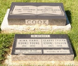
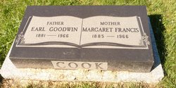
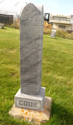
Earl Goodwin Cook
| Birth | : | 9 Nov 1881 Ontario, Canada |
| Death | : | 20 Apr 1966 Fort Macleod, Claresholm Census Division, Alberta, Canada |
| Burial | : | Fairview Cemetery, Pincher Creek, Claresholm Census Division, Canada |
| Coordinate | : | 49.4935700, -113.9231800 |
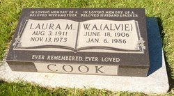
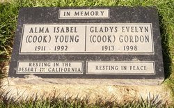
| Description | : | successful farmer, horseman & businessman - elected to the Alberta Legislature in 1921 and continued to represent the United Farmers of Alberta there until 1930 - Board of Governors of the University of Alberta Children - W. Alvie operated a road construction company - Leslie Ethelbert (Bert) pilot with RCAF died in 1942 - James P died early in life. - Alma married Ernie Young resided in Los Angeles - Gladys married James Gordon. |
frequently asked questions (FAQ):
-
Where is Earl Goodwin Cook's memorial?
Earl Goodwin Cook's memorial is located at: Fairview Cemetery, Pincher Creek, Claresholm Census Division, Canada.
-
When did Earl Goodwin Cook death?
Earl Goodwin Cook death on 20 Apr 1966 in Fort Macleod, Claresholm Census Division, Alberta, Canada
-
Where are the coordinates of the Earl Goodwin Cook's memorial?
Latitude: 49.4935700
Longitude: -113.9231800
Family Members:
Parent
Spouse
Siblings

Children
Flowers:


Nearby Cemetories:
1. Fairview Cemetery
Pincher Creek, Claresholm Census Division, Canada
Coordinate: 49.4935700, -113.9231800
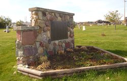
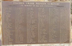
2. Pioneer Cemetery
Pincher Creek, Claresholm Census Division, Canada
Coordinate: 49.4944000, -113.9404000
3. Pincher Creek Mennonite Brethren Cemetery
Pincher Creek, Claresholm Census Division, Canada
Coordinate: 49.4699090, -113.8627370
4. Pincher Creek Colony
Pincher Creek, Claresholm Census Division, Canada
Coordinate: 49.5047220, -113.9947220
5. Trinity Lutheran Cemetery
Pincher Creek, Claresholm Census Division, Canada
Coordinate: 49.4070670, -113.9263560
6. Brocket Colony Cemetery
Pincher Creek, Claresholm Census Division, Canada
Coordinate: 49.4655200, -113.7694100
7. Brocket Cemetery
Brocket, Claresholm Census Division, Canada
Coordinate: 49.5457100, -113.7667700
8. Cowley Cemetery
Cowley, Claresholm Census Division, Canada
Coordinate: 49.5906800, -114.0943900
9. United Doukhobors of Alberta Cemetery
Lundbreck, Claresholm Census Division, Canada
Coordinate: 49.5768410, -114.1484240
10. Fishburn United Church Cemetery
Pincher Creek, Claresholm Census Division, Canada
Coordinate: 49.3783700, -113.7011300
11. Springridge Mennonite Church Cemetery
Springridge, Claresholm Census Division, Canada
Coordinate: 49.4529305, -113.6340179
12. Saint Henry's Roman Catholic Church Cemetery
Twin Butte, Claresholm Census Division, Canada
Coordinate: 49.3189900, -113.7728900
13. Spring Point Hutterite Cemetery
Pincher Creek, Claresholm Census Division, Canada
Coordinate: 49.6843639, -113.8070451
14. Livingstone Hutterite Colony Cemetery
Lundbreck, Claresholm Census Division, Canada
Coordinate: 49.6498659, -114.1594770
15. Hartley Cemetery
Hartleyville, Claresholm Census Division, Canada
Coordinate: 49.3777000, -113.6227000
16. Livingstone Cemetery
Cowley, Claresholm Census Division, Canada
Coordinate: 49.6839800, -114.1144500
17. Bratton Family Cemetery
Spring Point, Claresholm Census Division, Canada
Coordinate: 49.7150200, -113.8017500
18. Hill Spring Cemetery
Hill Spring, Claresholm Census Division, Canada
Coordinate: 49.3128700, -113.6436100
19. Thompson Hutterite Cemetery
Glenwood, Claresholm Census Division, Canada
Coordinate: 49.4269974, -113.5401975
20. Hill Spring Pioneer Cemetery
Hill Spring, Claresholm Census Division, Canada
Coordinate: 49.3035000, -113.6249000
21. Waterton Hutterite Cemetery
Hill Spring, Claresholm Census Division, Canada
Coordinate: 49.2661602, -113.6918691
22. Passburg Cemetery
Crowsnest Pass, Canmore Census Division, Canada
Coordinate: 49.5631230, -114.3387240
23. Ewelme Hutterite Cemetery
Glenwood, Claresholm Census Division, Canada
Coordinate: 49.4510436, -113.4906843
24. Glenwood Cemetery
Glenwood, Claresholm Census Division, Canada
Coordinate: 49.3859800, -113.5003500