


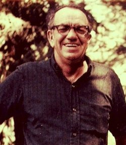
Earl Lavester Shiflett
| Birth | : | 20 Oct 1905 Wenatchee, Chelan County, Washington, USA |
| Death | : | 21 Oct 1957 Chelan, Chelan County, Washington, USA |
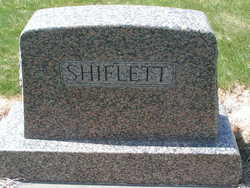
| Burial | : | Cayucos-Morro Bay District Cemetery, Cayucos, San Luis Obispo County, USA |
| Coordinate | : | 35.4371986, -120.8850021 |
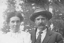
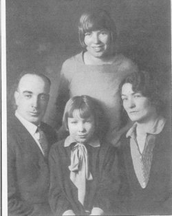
| Description | : | Earl L Shiflett, 52, Okanogan, and former long-time Wenatchee resident, died in Chelan Hospital Monday following a sudden illness. Mr. Shiflett was en route to Wenatchee when stricken. Born in Wenatchee, October 21, 1905, Mr. Shiflett spent his early life on Wenatchee Heights. He was married to Mildred Stringfield April 2, 1929, in California. Mr. and Mrs. Shiflett made their home here until moving to Okanogan in 1941. Mr. Shiflett was a member of Omak Lodge No. 1742 B. P. O. E., of Wenatchee Local Teamsters Union. Surviving are; his wife Mildred Shiflett at home; two sons, Earl Shiflett Jr. and Ray... Read More |
frequently asked questions (FAQ):
-
Where is Earl Lavester Shiflett's memorial?
Earl Lavester Shiflett's memorial is located at: Cayucos-Morro Bay District Cemetery, Cayucos, San Luis Obispo County, USA.
-
When did Earl Lavester Shiflett death?
Earl Lavester Shiflett death on 21 Oct 1957 in Chelan, Chelan County, Washington, USA
-
Where are the coordinates of the Earl Lavester Shiflett's memorial?
Latitude: 35.4371986
Longitude: -120.8850021
Family Members:
Parent

Spouse

Siblings


Children


Flowers:


Nearby Cemetories:
1. St. Peter’s By-the-Sea Episcopal Church Memo
Morro Bay, San Luis Obispo County, USA
Coordinate: 35.3628700, -120.8467400
2. Canet Cemetery
San Luis Obispo County, USA
Coordinate: 35.3522840, -120.7901660
3. Adelaida Cemetery
Adelaida, San Luis Obispo County, USA
Coordinate: 35.5632085, -120.8956170
4. Los Osos Valley Memorial Park
Los Osos, San Luis Obispo County, USA
Coordinate: 35.3053017, -120.8011017
5. Willow Creek Mennonite Cemetery
Wilson Corner, San Luis Obispo County, USA
Coordinate: 35.5890410, -120.8215860
6. Chapel of the Roses Cemetery
Atascadero, San Luis Obispo County, USA
Coordinate: 35.5027340, -120.6881430
7. Atascadero Pine Mountain Cemetery
Atascadero, San Luis Obispo County, USA
Coordinate: 35.4960835, -120.6565582
8. Saint Pauls Episcopal Church Memorial Garden
Cambria, San Luis Obispo County, USA
Coordinate: 35.5575200, -121.0757200
9. Templeton Cemetery
Templeton, San Luis Obispo County, USA
Coordinate: 35.5714455, -120.7022095
10. Dove Cemetery
San Luis Obispo County, USA
Coordinate: 35.4482231, -120.6344299
11. Santa Rosa Cemetery
Cambria, San Luis Obispo County, USA
Coordinate: 35.5662900, -121.0809300
12. Cambria Cemetery
Cambria, San Luis Obispo County, USA
Coordinate: 35.5746994, -121.0922012
13. Adelaida Cemetery
San Luis Obispo County, USA
Coordinate: 35.6563988, -120.8728027
14. Porte Family Cemetery
San Simeon, San Luis Obispo County, USA
Coordinate: 35.6376400, -121.0379800
15. Mission San Luis Obispo Cemetery
San Luis Obispo, San Luis Obispo County, USA
Coordinate: 35.2806600, -120.6645200
16. Old Mission Cemetery
San Luis Obispo, San Luis Obispo County, USA
Coordinate: 35.2670660, -120.6692150
17. San Luis Cemetery
San Luis Obispo, San Luis Obispo County, USA
Coordinate: 35.2644192, -120.6712830
18. Santa Margarita Cemetery
Santa Margarita, San Luis Obispo County, USA
Coordinate: 35.3913994, -120.5880966
19. Saint James Episcopal Church Inurnment Garden
Paso Robles, San Luis Obispo County, USA
Coordinate: 35.6283460, -120.6929780
20. Paso Robles District Cemetery
Paso Robles, San Luis Obispo County, USA
Coordinate: 35.6424700, -120.7035000
21. San Marcos Mennonite Cemetery
San Luis Obispo County, USA
Coordinate: 35.6874570, -120.7995160
22. Creston Cemetery
Creston, San Luis Obispo County, USA
Coordinate: 35.5328640, -120.5121450
23. Estrella Adobe Cemetery
Paso Robles, San Luis Obispo County, USA
Coordinate: 35.6975080, -120.6399460
24. San Miguel District Cemetery
San Miguel, San Luis Obispo County, USA
Coordinate: 35.7392006, -120.7013550